Ride Report
March 2019
 |
| Sunrise on the Tucson Mountains |
To qualify for the 2019 edition of the Paris-Brest-Paris 1200, a rider must complete a full Super Randonnuer series of sanctioned brevets in 2019. The
200,
300, and
400 are in the bag (click each distance for ride reports) and the 600 is all that is left to complete!
The official Patagonia 600 km is March 30-31; but this year, yours truly, will be supporting the actual event, so this ride report covers the 'Pre-ride.' The Pre-ride is sanctioned under
RUSA rules to allow the organizer and/or volunteers to ride the course, for credit, up to 15 days in advance of the event. This allows the Regional Brevet Administrator (Mike Sturgill) to ride and enjoy the actual event. Mike Sturgill, Roger Peskett, Tom Baker, and Brian McGuire, pre-rode and supported the earlier events, so its our turn. Brian McGuire will join us for the Sunday portion of the ride and will also be supporting the event. Here is our story:
Day 1 - 400km
 |
| There is actually a bike in there! |
Its 90 miles from home to the event start in Marana (just outside Tucson) and to save a little gas we packed the bike in the Mini and motored down to Marana at O'dark-Thirty Saturday morning. Quickly assembling the machine in the Day's Inn parking lot (room reserved for the over night), and grabbing a Frappuccino and reciept at the Chevron station on Cortaro road at 0555 we are off!
 |
| Moon is still up with the sunrise |
Quite chilly at the start (Garmin reports 36 degrees F) but with the sun coming up and the gentle climb towards Gates Pass, its a nice way to ease into the ride and warm-up. The turn onto Sweetwater came up quickly and soon we find ourselves at the top of the pass. Very little traffic in either direction!
 |
| Gates Pass |
 |
| Much of the descent in the cold shadow of the mountains |
Picking up speed, its cold and the road is rough from frost heaves in the pavement. Soon we leave the cold shadow and have a gentle climb on Kinney road to leave the park. Turning onto AZ86 we put Tuscon in the rear-view mirror and head toward the first Control in Three Points. The road is smooth with an ample shoulder and the first 6-7 miles are recently resurfaced and smooth. It is another 7-miles of good shoulder to the Three Points Store.
Grabbing some supplies and a receipt its a left turn onto AZ286 headed toward Sasabe and Arivaca. You can put away the cue-sheet, its 33 miles to the next turn!
 |
| Far left Baboquivari Peak, right Kitt Peak and Observatory |
You won't need the cue sheet until Baboquivari is much closer on your right, that cues the next turn. Traffic is light and while there is no shoulder, the road is straight and the few motorists gave plenty of space. Probably 3 out of 4 vehicles belong to the Department of Homeland Security Border Patrol!
 |
| Leaving the first Border Patrol Checkpoint |
The ride will pass through several Border Patrol Checkpoints, the first one is heading
toward Mexico, no need to stop here!
 |
| Entering the Buenos Aires Refuge |
60 miles and 4.5 hours from the start, brings us to the Buenos Aires National Wildlife Refuge. Closer to Baboquivari, but still another 12 miles to go before the turn to Arivaca! This was a good spot to strip some layers and slather on the sun screen!
 |
| Babo is getting closer! |
The joy from finally making the turn, quickly disappears. The rains have been tough on Arizona roads this winter. And this section of road was a very rough patch-on-patch-on-patch surface. No traffic in sight so its all over the road trying to find a smooth line. At least most of the holes were filled!
Soon the town comes into view and we stop at the control at Arivaca Mercantile. Finding a spot in the shade we enjoy some canned soup, chips, and a Pepsi! Leaving town there is a bit of climbing, but the road is much improved.
HOWEVER, while smooth, this road also suffered damage and there were many un-repaired potholes to be on the look out for. There was a nice tailwind, and with the general downhill and steep rollers on the way toward Amado, full attention is necessary as hitting one of those at speed (25-30 mph) would be catastrophic!
 |
| Another Checkpoint just outside Amado AZ |
 |
| No time for Lunch today |
 |
| Too early for dinner? |
We enter Amado and marvel at the architectural roadside masterpieces. Time for a right turn onto the I-19 frontage road for the run to Rio Rico and the next control.
 |
| This section of road is metric (whatever that means)! |
The route follows I-19 mostly on the frontage road. There are two sections where the route is on the freeway shoulder, but the pavement is smooth and relatively debris-free.
Traffic is light heading toward Mexico. On the other side of the road,
there is a huge back-up at another Border Patrol checkpoint. The next
control is any open business at Exit 17. We roll into the Chevron, get some
supplies and a receipt and take a short break in the shade!
 |
| Bike path on Pendleton Drive |
Back on the road, a new route through Rio Rico takes us to Pendleton Drive. Its under construction, apparently due to the addition of a bike path. After noticing the path at about mile 127, we cross the dirt and join the path, but at 127.7, it abruptly ended (without warning) due to a washout. We pick it up again at 127.8 but it only goes to 128.6. In hindsight, it would have been better to just stay on the roadway until the path is complete/repaired!
We leave Pendleton Drive for 13.6 miles along S. River Road. It meanders
along through farmland, and with a slight tailwind and gentle rollers,
its a very nice route to AZ 82.
 |
| AZ 82 just outside Patagonia |
Its climbing time again, but with the breeze at our back we are heading east toward Patagonia and the next control in Sonoita. The road is wide and smooth with a narrow rough shoulder.
 |
| Next time stop here! |
Rolling though Patagonia we are tempted to stop at the Wagon Wheel. But with another 12 miles to the control in Sonoita, and wanting to make the big descent before sunset and it gets cold we press on.
 |
| Arizona Wine Country just outside Sonoita |
We roll in Sonoita at 1800 (6pm). There is a new rest stop with a water fountain so we stop to see if it works; it doesn't! No worries we stop at the Dollar General store (open until 10pm) for supplies and a receipt.
The sun sets behind the mountains, and quite suddenly the temperature drops from 65 to 50 degrees during the 20 minute stop. So in the waning sunlight we push out for 10 miles of climbing before the payoff and 12 mile descent to the outskirts of Tucson.
The first few miles of the descent are steep and ADOT has put rumble strips in the pavement. Not a big deal during the day, but at night they appear suddenly and the vibration jars the headlight mount so the beam is pointing toward the sky! We hit the second set in the dark before we can stop and fix the light and continue, with an adrenaline boost for good measure.
A left turn puts us on Sahuarita Road with the lights of Tucson in the distance. The road is in fair shape but its 18 miles to Sahuarita and the lights never seem to get any closer! Finally a left onto Nogales Highway and 4 miles to the next control is in Green Valley
With temperatures continuing to drop, we make a quick stop at the Circle K and get back on the road for the climb up Duval Mine road. Not much traffic up here at 9:30 on a Saturday night. We turn onto Mission Road just as the lights of the mine come into view. A little more climbing to Helmet Peak and its the sweet and gentle descent on good roads all the way to Tucson!
With temperatures contining to drop in the desert (low 40's) we look forward to getting into town where its warmer! Warm, but at a price. At Congress road, and the first several miles of Silverbell the road conditions were very rough. Not a happy place with 240 miles in the saddle. They do get progressively better and the temperature drops again and we make our way the overnight control in Marana.
 |
| Nearly 2000 calories for our midnight snack! |
We check into the room at 0038 Sunday morning, stow the bike and run down to the car to hit the McDonalds Drive Thru. Its open 24 hours on Saturday and right next door, but the dining room is closed. So its to the drive thru. They were only accepting cash, but luckily we have enough to procure breakfast and head back to the room.
Shower, eat, repack the bike, watch some SportsCenter, and hit the sack at 0145 with a planned wake-up of 0615.
Day 2 - 200km
Waking up just before the alarm went off, grab an Ensure and some fruit bars as we get ready. Brian texts at 0645 that he is in the lobby and ready to go. I run down and grab a coffee with my bags, check-out, load the car, and return to the room to get the bike.
After a false start with the Garmin (it re-booted) we rolled out for the 200km loop to Oracle. The sun is up and comfortably cool as we start the 41 miles of gentle climbing to Oracle.
 |
| Biosphere 2 on AZ77 |
The roads are good until Oracle Junction, then the shoulder narrows and the road deteriorates. Not the best for a rear-end with 400km in the books on the previous day!
The route takes us past Oracle and we double back on American Avenue. We stop at the control (Circle K) and reload and get our receipts.
 |
| Rejoining AZ77, Picacho Peak in the distance (44 miles away) |
 |
| Brian McGuire |
We spot Picacho Peak in the distance. The next control is at the foot of the peak, 44 miles away! We continue down the way we came but turn right at AZ79. The climbing starts again, and we pull off to lose some layers. The climb ends at a electrical substation in the distance (about 6 miles away) so its heads down and start climbing. Not much shoulder here, and with somewhat heavy traffic, we both dialed it up a bit to get this section done.
We turn onto Park Link Road. Its wide, smooth, and with very little traffic. Its 18 miles of twisting slightly downhill riding through beautiful desert. Brian flats about halfway down and insists that we go on and meet at the control.
 |
| Will this road ever end, Picacho Peak, still in the distance! |
Reaching the I-10 Frontage road, we turn right for the last 5 miles to the control in Picacho. There is a Dairy Queen there, but we spot a Subway and decide to stop there because the service is generally slow at the DQ and the parking lot was packed. While the sandwich was good, the Subway was also packed! Brian finds us and we finish lunch and head out on the frontage road for the last segment to Painted Rock and Marana.
One more stretch of rough road on Sandario road and we make it to Picture Rocks and the last control. Purchasing a cold water, and tucking the receipt in the brevet card we press on for the last climb of the day.
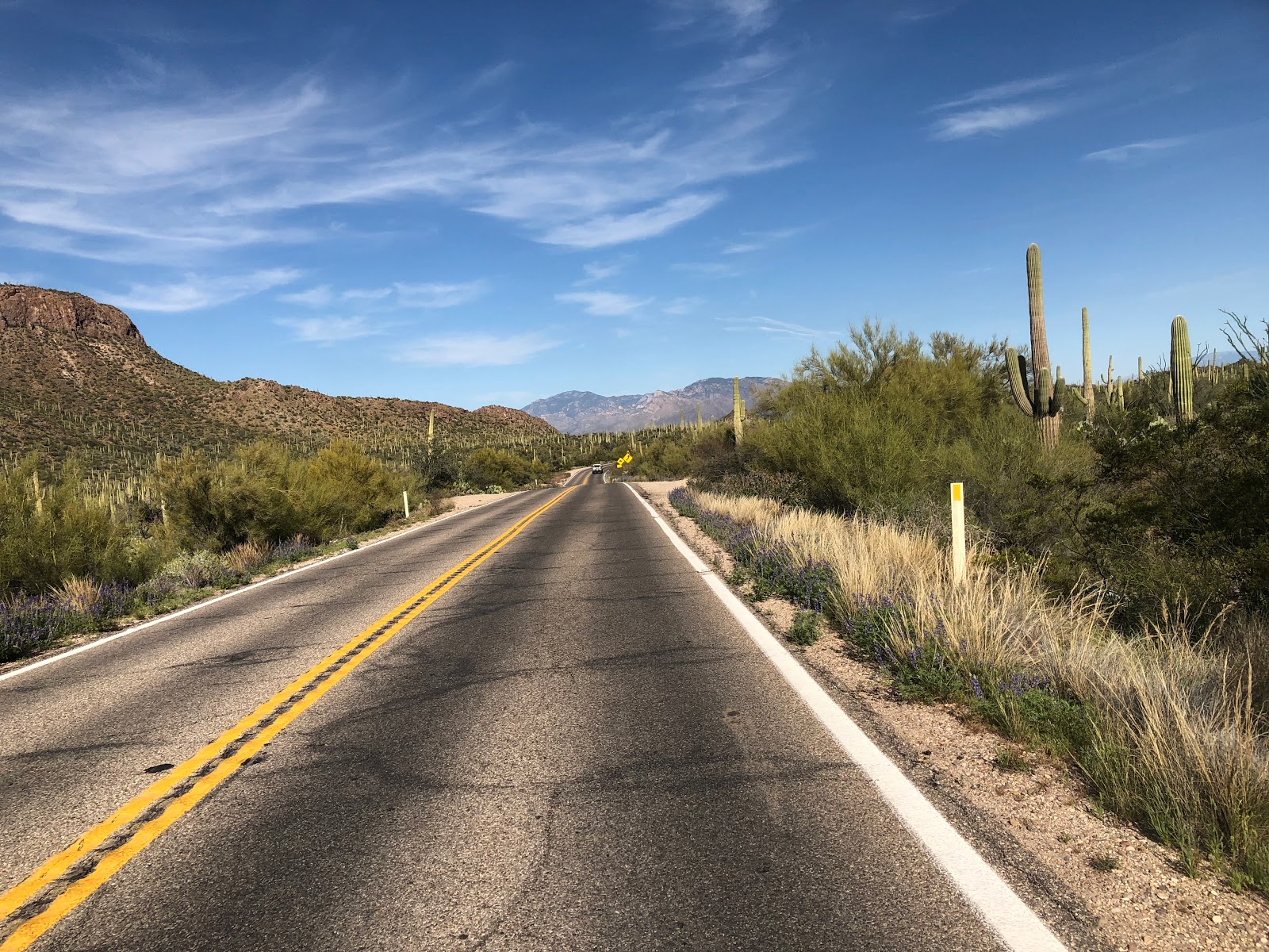
 |
| Re-entering the Saguaro National Park |
One last spectacular run through the Saguaro National Park! Traffic was moderate, and there are some steep and fun rollers on the descent! Leaving the park, its only a few miles to the Marana and the finish.
We pull into the Chevron at 1622 and enjoy a Popsicle to toast the end of this very enjoyable 600km Brevet! Thanks to Brian McGuire for joining us.
Will we see you at the Patagonia 600, there is still time to
register here! (midnight 27 March).
Click here for GPS data
Steve Atkins
 |
| Soaking in a salt bath on the recovery day with an audience! |