February 2021
Pre-Ride Report
 |
| Sunrise on Cave Creek Road |
This report is for the pre-ride of the main event to be held this Saturday, Feburary 6, 2021. Mike Sturgill will be the trail boss and I joined him for his pre-ride to check out the course.
 |
| Morning traffic on Cave Creek Road |
We pushed out from Mike's house (just around the corner from the King Coffee Roastery) at 0700 and headed into the morning rush hour traffic on Cave Creek Road. We were treated to an awesome sunrise! Traffic thinned as we continued north, and turning onto Sonoran Desert Drive, we had the road mostly to ourselves.
Several hot air balloons were launching and were quite the sight in the morning dawn. This area of the valley is not yet developed and is a great place to ride. We connect to the Carefree Highway (Gordon Lightfoot wrote a song about it!) and continue westward. Just before the I-17, and the last chance for food/water for the next 40 miles, the road becomes extremely rough for a hundred meters or so. We joked that if anything was going to come loose on the bikes, it would be now. Luckily nothing did!
We are good on water and so continue on AZ-74 past Lake Pleasant and onto the 25 mile run to the US60. Passing Lake Pleasant, we wondered what river fed into it. I guessed (incorrectly) the Hassayampa River (it runs through Wickenburg). Near the end of the ride Mike will guess again, and confirm after the ride that the Agua Fria river feeds Lake Pleasant.
 |
| Mike leading the way on AZ 74 |
 |
| Passing through Historic Wickenburg |
 |
| Vuture Mine Road |
 |
| Vulture City Ghost Town |
 |
| Nearing the end on the 20 mile run on Vulture Mine Road |
Its a long gentle descent on Vulture Mine Road, winds were light as we were able to hold speeds of 20-23 mph most of the way. The road jogs right on Indian School road toward Tonopah, before heading south again.
 |
| Nearing Wintersburg; Palo Verde Nuclear Station in the distance |
 |
| Wintersburg Mercantile |
 |
| Taking a break in the shade |
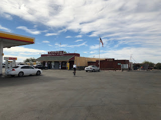
We roll into the Wintersburg Mercantile at 104 miles into the ride. We grab sandwiches and take a short lunch break in the shade.
 |
| Fields in Palo Verde |
Back on the road its past the many coops that house the Hickman Egg Farms. The wind was right on the nose, which was OK, since those coops emit a really foul stench!
Connecting with Old US 80, we are back in wide open farm country. Cattle feed lots and dairies alternate with alfalfa fields providing many aromatic contrasts! We turn north and cross I-10 again and begin the steady climb toward Surprise on the Sun Valley Parkway.
The first third of the 20 miles is on fresh pavement with a wide shoulder. Neither of us commented on our good fortune, for fear of jinxing it! Later it reverted to older pavement with some frost heaves, but not too bad. With four lanes and light traffic it was just fine.
As Vulture Peak again came into view, the route finally turns east and we stop at the Canyon Springs Store. We both needed a sugar and caffeine break and found just the ticket inside! Add some chips and we were ready for the last 40 miles of the route.
 |
| Oh yeah, this will dew! |
More excellent pavement on the descent into Sun City, then its a tour de Retirement Community as we travel through the various iterations of Sun City. Tidy yards, golf courses, and tricked out golf carts dominate the landscape as we continue eastward into Phoenix.
 |
| On the Agua Fria Bridge on Happy Valley Parkway |
Its again rush hour, but the roads are good with bike lanes, just the normal need to watch folks turning right without checking the bike lane as we make our way through town. We spot a few hot air balloons in the distance as we cross the Agua Fria Bridge on Happy Valley Parkway. Mike wonders if its the Agua Fria that feeds Lake Pleasant. After the ride, he confirmed it in an e-mail:
I just learned something about our valley
rivers. It's the Agua Fria that sources Lake Pleasant. It
continues to flow south and dumps into the Gila down by PIR. I
also saw that the Salt dumps into the Gila right where we cross it
when we ride by PIR on AtB 400k. The Gila, then, flows all the way
to the Colorado in Yuma. The Salt River is formed by the
confluence of the White & Black Rivers in the White Mountains.
The Verde also flows into the Salt down by the Bush Hwy. The Verde
River starts all the way up in Prescott Valley near Paulden.
Sycamore Creek flows into the Verde just north of Clarkdale.
Major lakes formed by our rivers:
- Lake Pleasant: Agua Fria
- Roosevelt, Apache, Canyon & Saguaro Lakes: Salt River
- Horseshoe & Bartlett Lakes: Gila River
Back to the ride...We roll into Mike's neighborhood just as the sun set to put this one in the books at just over 11 hours. Good day on the bike with great company, thanks Mike!
Steve Atkins

