Thursday, September 30, 2021

2021 Southern Transcon Day 23: Greenville AL

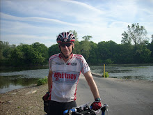
Reflections on the Alabama River
Another 7:00 am start. When I took the bike to the trailer at 6:15 am before breakfast it was raining steadily. Breakfast was moved inside because of the rain. By the time we finished breakfast and it was time to load and depart, the rain was now barely a drizzle.

Wet roads in Livingston
The rain had stopped, but the humidity was still 100% and the roads were soaked. Passing cars and trucks kicked up huge clouds of mist as they passed. We decided not to wear the rain jackets since it was in the low 70's. But with the moisture in the air, and from the road traffic, we were soaked to the skin in minutes.

Tombigbee Waterway
Traffic was unusually heavy, with lots of logging traffic during the morning 'rush hour' as we left town. As normal, once we were about 20 miles out of town, the traffic became lighter. However, there were still many logging trucks going in all directions!

Path to hay fields and timber stands
Ranches (horse and cattle) shared the landscape with many sections of forest in various stages of growth.

Jefferson first SAG
The first SAG was in Jefferson at the community center. This cool general store was right next to the center. Check out the guy in the canoe!

Cotton is back
We had not seen large cotton fields since we left the Delta country in Mississippi, today there were many acres planted. Bases on the partially brown leaves, it looks like the defoliant has been applied and harvest time will be soon.

Red truck SAG at Thomaston Park
The Red truck SAG was in a city park in Thomaston. It was set back and we almost missed the turn when we were distracted by a Cheetos delivery truck at the Dollar General store across the way!

Let's head to the SAG
Another 20 miles would take us to the lunch SAG on the banks of the Alabama River. It looks more like a huge lake because it is dammed just a mile or so down stream.

SAG on the banks of the Alabama River
The SAG was in a state park on the banks of the river, and we had a covered picnic tables to enjoy our hamburgers on ! Its a long day at127 miles; so we dined, filled our bottles, our pockets with snacks, and dashed back out on the road.

It was pouring here!
Its 32 miles to the next SAG so we settle into a steady pace. We can see the storm cells building around us. At first it looks like we may dodge between two of them. But we take a turn to the north, and then from behind we start to feel the sprinkles. 

Soon its pouring rain. Its not cold, but its coming down so hard its hard to see through the glasses. Jeff  decides to pull off and put on his rain jacket. I slowed down and noticed the rain running down my back into the shorts and thought, yeah, its time to put on the jacket.

Jeff takes a call
We continue on for a while then Jeff calls out that his fiance, Lori has called him three times in a row so we stop so he can call her back. It turns out that Jeff stopped so suddenly to put on his jacket that his Garmin sent out an emergency alert to Lori! Its hard to tell from the photo, but it was really coming down in sheets here! He convinced her everything was fine, but it was really raining so we had to go.

Timber operations by the highway
The heavy rain lasted about 30 minutes. It had stopped raining when we passed this timber operation. Unfortunately, my camera/phone was foggy from all the moisture!

Pine Apple AL

Pine Apple SAG and decorations

The last SAG was in Pine Apple. A cute small town where Veronica had set up the SAG under an abandoned storefront with an awning. We still had 32 miles to go, so again we refilled and got out of there quickly.

Back in cotton country

Chicken houses near Greenville
More cotton, cattle, and now chicken houses dotted the landscape as we headed into Greenville! The last 10 miles had plenty of rollers to remind our legs that we had been in the saddle for 9 hours today. We finally rolled in at about 4:30pm. 127 miles and 3400 feet of climbing in 9.5 hours!
Another 128 miles closer!

Tim was in the parking lot to greet us and we went a nearby Mexican restaurant for dinner. He is in great spirits and we are very happy to have him back. Tomorrow he will ease back into the tour and ride a few sections with SAG van bumps and see how it goes. 

Most the gear is almost dry, so its time to call it a night. See you in the parking lot at 7!

Click here for GPS data


Wednesday, September 29, 2021

2021 Southern Transcon Day 22: Livingston AL


Rolling pasture near Herbert MS

Confirmed 100% Humidity!
We rolled out at 7:30am in a balmy Mississippi fog this morning, the roads were damp from the humidity and light fog hung in the air! We backtracked toward the Natchez Trace then headed out of town on a country road.

Route 14 outside Kosciusko MS
No shoulder, but with light traffic, we rolled out of town and back into the countryside.


Swamp crossing at 14 miles

Miles of country roads
We rode many miles today on rolling country roads. Mostly small farms and ranches separated by stands of forest in various stages of harvest. As in the photo above nearly all the yards around the farm houses had neatly cut grass, all the way to the edge of the highway!

Neshoba County Courthouse in Philadelphia MS
After the first SAG near Edinburg we rolled through Laurel Hill and then Philadelphia. Philadelphia is large enough for the highway to separate into two 2-lane one-way streets through downtown. There were two short but very steep climbs, but soon we were downtown and stopped at the County Courthouse.

SAG at abandoned service station
Next stop was the SAG near Hebert. In an abandoned service station, with a closed restaurant. No need to set up a pop-up tent here, the service island cover is still intact! We made it a quick stop and pressed on.

Wildflowers in clear cut section
There is quite a bit of logging going on in this area. Many sections were clear cut, with others containing early wild flower growth, saplings and small pines, then larger ones that appear ready to harvest. There were only a few log trucks, but plenty of log debris on the road to watch out for.

Lunch was in the Dekalb city park
We had a nice lunch in the Dekalb city park. There was a 'health walk' with helpful signs like this along the path. This one was near where we set up lunch. We skipped the walk and got back on the bikes with about 37 miles still to go!

Porterville Post Officec
The last SAG was in Porterville MS in an area around a train crossing. Several abandoned buildings and the town's working post office were in the area. Well working if you are there M-F from 7:30 - 11:30am!

Wes and Jeff
Wes and Jeff cruising through another clear-cut section on the way to the state line.

Old Briggs Chapel

New Briggs Chapel

Just before the state line, we noted the Old Briggs Chapel and its more contemporary and spacious replacement as we headed for the next state on our journey.

Alabama State Line

No 'Welcome to Alabama' sign, but this Country road marker is on the state line and indicates that our country road changed its name from MS Route 39, to Sumter County Alabama Road 12.

Alabama shaded country road

Another 12 miles of nice Alabama roads took us to a truck stop just outside of Livingston AL with a Comfort Inn. We had a few sprinkles just as we rolled in. We stopped for an ice cream at the convenience store before checking in and starting the after-ride routine.  

Not wanting to risk dinner at the Taste of India in the truck stop, we opted for our first chain food at the Burger King. We donned our rain gear and hoped that the rain will finish tonight and be done by morning. 

We start 30 minutes earlier tomorrow. It will be a long day, 130 miles with 4,000 feet of climbing, rain or shine!

Click here for GPS data


Tuesday, September 28, 2021

2021 Southern Transcon Day 21: Kosciusko MS


Hillside Wildlife Preserve
 

There was a chance of rain today as we left Indianola, and we had cloud cover most of the day. It didn't rain, but by the time we got to the lunch sag, we were all soaking wet and had dishpan hands from the 90+% humidity! But first we need to get rolling!

We didn't stop

We rolled out at 7:30 and just a mile down the road we passed the BB King Museum. Not on the agenda for today, we headed out of town on Route 49. Its a 4 lane highway with no shoulder, but traffic was light leaving town, and what little traffic there was gave us plenty of space.

Delta Country farms to the horizon!

Jeff and Wes take a pull

We started easy and slowly dialed up the pace, soon we caught Wes and got organized into a pace line. We worked together into the headwind for about 20 miles.


Yazoo River

More Delta country for 20 miles after the SAG

Mark B. and Alessandra joined the pace line after the SAG and we worked together until the road tilted up and into Hillside Wildlife Preserve

Vine covered forest in the Hillside Wildlife Preserve

Back in the forest

Three miles of climbing brought us to the SAG at 50 miles. At this point in the ride the humidity was so bad that wet fingers could not operate the touchscreen on the Garmin or the iPhone! It wasn't raining, but everything was soaked!

50 mile SAG at church and cemetery

The 50 mile SAG was at the Oak Grove Church. It had beautiful grounds, and other than the gardener tending to the  grounds, we had the parking lot to ourselves. Standard procedure at every SAG is to wash your hands at the soapy water station before entering. Today, I took extra paper towels to try and mop up the sweat on my glasses and face!

More rollers for the rest of the ride

Ebenezer Big Store

We continued along more miles of rollers passing through the town of Ebenezer. We noted this was the Big store, and wondered where the small one was!

Tuna (or catfish?) salad for lunch

We continued on to Goodman and stopped for the lunch SAG at the city park. The lunch trailer was set up near the basketball court and we set up our chairs on the court. Each of us, soaking wet from the humidity were wringing out gloves and caps as our kits stuck to us like it had been raining.

Road to Kosciusko

We had two hours to cover the last 25 miles and end of the day in Kosciusko at 3pm. We dialed back the pace and covered the distance in about an hour and a half.

Natchez Trace Parkway
We arrived in Kosciusko about 2:30. The Natchez Trace Parkway passes through here. We rolled to the entrance to get a photo. Its not on our route for tomorrow.
Ice Cream at Chez Sidewalk

We arrived 30 minutes early so we checked to see if a Dairy Queen, Sonic, or McDonald's was nearby. No luck, but there was a convenience store across the street, so we rolled over to check it out. Score! M&M Ice Cream Sandwiches and Gatorade for now, and chocolate milk for later. We savored the frosty snacks on a shady curb in the parking lot brevet style. We rolled back to the hotel after our treat to start the end of day routine just before 3! Great food at Rodeo Family Mexican to call it a day!

Good news, we got word today that Tim will be rejoining the group in a couple of days in Greenville Alabama! 

Click here for GPS data

Monday, September 27, 2021

2021 Southern Transcon Day 20: Indianola MS


Dusty dawn on Route 35

Load 'em up
We gathered in the parking lot at 7:15 am to pump tires and check out the equipment. At the stroke of 7:30, the bags were loaded and we are on our way. There was lots of traffic in downtown Monticello, and even more once we left town. It seemed like all the logging trucks we missed yesterday were on the road this morning!
Still in the forest
After a few sharp rollers in town, the terrain started to flatten out as we made out way through more miles of forest and small farms. We had some cross wind, but with the flatter roads, we started to pick up the pace.
First SAG in Dermott

Wes and Luis joined the train and we dialed up the pace to the first SAG at 25 miles. We arrived at the SAG in 1.5 hours. We reloaded and quickly got back on the road.

Jeff and Luis in the flat lands
The roads were flat and mostly in good shape and our train reached the second SAG at 48 miles in under 3 hours.
Lake Chicot

Lake Chicot
Suddenly the farm land gives way to Lake Chicot. From the State Park website: At 20 miles long, Lake Chicot is the largest natural lake in Arkansas and the largest oxbow lake in North America. Its beautiful waters are a favorite with anglers throughout the year. Located near the Mississippi River, the park is situated in one of the largest flyways in the country making it a perfect place for birdwatching.

Several debris burns along Causeway Road

Lake on one side, nice homes on the other

Causeway Road runs along the lake for 11 miles. The pavement was very rough in places, with patch on patch on patch. We commented that the homeowners probably like it that way to keep the speeders under control!

Jeff, Alessandra, Luis, Wes on Causeway Road

The Greenville Bridge

The Greenville Bridge is a cable-stayed bridge over the Mississippi River, in the United States, carrying US 82 and US 278 between Refuge, Mississippi, and Shives, Arkansas.When it opened in 2010, it was the fourth-longest cable-stayed bridge in North America. Interesting that it was built by Massman Construction, that in 1940 also built the original Humphreys Bridge it replaced!

The mighty Mississippi River

PBP selfie?

Welcome to Mississippi


Lots of cotton growing here

Miles and miles of farm land

Another great lunch

Lunch was at 75 miles into the ride and featured turkey brats, yams, deviled eggs, potato salad and some pickles! We made it a quick stop and got back into farm country.

Nice shaded farm house

Final SAG near 'metal shed'

We rolled through miles of freshly tilled fields. With no protection, we were really feeling the cross winds. Happily the route turned north 1.5 miles after the SAG, and the wind was on our tail for the last 15 miles.

Residential route to the hotel in Indianola

We dialed back the pace about 5 miles out of town to start the recovery process, and to make sure we didn't arrive too early (before 3 pm). The last several miles used some residential streets, and we rolled into the parking lot at 2:58!

Another day, another state!

Pizza party in the parking lot, and this day is in the books!

 Click here for GPS data

Click here for PacTour photos