 |
| At the End of the World |
September 11, 2011
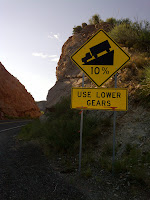
This morning I decided to head out to Superior to do a little hill work and test out the XTR setup on the road bike. Between Superior and Kearny there is a particularly steep hill, known as the End of the World, on SR 177. I decided to drive to the top of the hill, park the Suburban in the safety pull out area, ride down to the town of Kelvin (about 9 miles), turn around, and head back to the top and repeat.
 |
| Dawn on the US 60 |
 |
| Looking north toward the Superstitions |
The road descends at 10%+ grades past the Asarco Ray Mine to the town of Kelvin. There had been heavy rain this morning before I arrived, but was clear, cool (about 72 degrees), and all that remained were puddles on the side of the road. On this Sunday morning, there was no activity in the mine.
On the second loop I continued down the Kelvin-Florence Highway about another mile or so to the Gila River. It was flowing but was quite muddy.
 |
| Memorial by the Gila |
After a few minutes of watching the muddy river flow under the bridge, I pointed my faithful companion uphill and rode to the End of the World a second time!
 |
| Single lane bridge over the Gila River |
This mornings data: 36 miles and 3510 feet of elevation gain. At just under 100 feet of gain per mile this ride does not quite match the 113 feet per mile of gain on the Whitney Classic, but certainly has some nice steep grades that are as steep, if not as long as the climbs on the Whitney.
In just under two weeks and Joe Tansill and I will be on our way to Lone Pine and my 12th Whitney Classic. If you would like to join my support team click here to make a donation (indicate Atkins WC in the comment box).
Thanks!
 |
| At the safety pullout after the ride |
 |
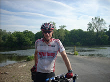
| Very happy with the XTR Setup! |

1 comment:
You should have rode to the end of the pavement on the other side of the bridge to test your gears as it goes up to 15-16% for a bit as I recall. It's not very long but is definitely steep.
Post a Comment