Friday, October 30, 2026

2026 Lower Salt 200 Pre-ride Report

Pre-ride report

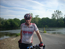
Look who showed up at the start; yours truly, Mike Sturgill, and Brian McGuire! After soloing the 600 pre-ride I was looking forward to some company. 
Unfortunately, Mike had wheel problems and made it about 5 miles before heading back to the start. He was planning on changing the route and gave us directions to take a different approach to avoid morning traffic on Scottsdale Road. Here we are on Pima Road heading up to Pinnacle Pass. Note the Mesquite bush growing into the bike lane.
Those Mesquite plants may look lush and harmless, but this close-up shows the huge thorns hidden in those soft leaves so steer clear!
Leaving the Salt River Indian Community and heading into the Tonto National forest.
On the Beeline Highway with the Four Peaks Wilderness in the distance.
Between Saguaro Lake and the Salt River, the road narrows for a short, steep, and twisty climb. Brian took these photos as I reached and cleared the top.
The speed limit drops and the cars gave us plenty of room. On the steep descent I had to use my brakes so I wouldn’t pass the slower traffic!
We took a 30 minute lunch break at the Control at the Shell Station/Filibertos at mile 71. It was nice to sit down at a table and enjoy a nice chicken burro with bean and cheese! Save time by ordering your food as soon as you go in. Then fill your bottles and shop while they prepare your meal so you can head straight out after lunch!
After lunch on Power Road there is a new multi-use path that goes from Thomas road for about a mile, much smoother than the bike lane on the road so we used it.
Heading east toward Saguaro lake is one of the most beautiful portions of the ride.
Here is Brian on the steep section climbing out of the Salt River Area toward Saguaro Lake and the Beeline Highway.
We stopped in Fountain Hills to repair Brian’s front tire, by the time we finished the rear also went flat. A couple of staples in the front and two tire wires in the rear. Brian carried three spares for this ride! The Beeline Highway has a nice wide shoulder where all sorts of debris can accumulate. It’s slightly downhill on the return and you can really fly, but there are all sorts of flat inducing objects hidden there. Top off your sealant and/or bring extra tubes!
A minor construction project in Fountain Hills at Palisades and Eagle Ridge Dr. Again the sign said no right turn, but we rode through easily.
Here is the bike path entrance off of Eagle Ridge. It’s a fun steep descent with a few switchbacks. It empties you at a gated community, that says private, but bikes can pass through the offset gates with no problem.
Another bike path entrance, this one at Sweetwater and 89th Street.
The route makes a left turn on Hayden Road to go .1 miles to the light. It was busy so we decided to turn left onto the sidewalk and use the light to cross.

We rolled into the start/finish control in about 9 hours and 42 minutes after we started. It was great to have company for this ride and we hoped Mike got his wheel issue sorted out!

Head over to AZ Randos.com to join the fun that is Arizona Brevet Week 2026!


Steve Atkins

Wednesday, October 28, 2026

2026 North Valley 400km Brevet Pre-Ride Report

October 27, 2026

Pre-ride Report

Arizona Brevet Week is coming up in a couple of weeks and here is my pre-ride report for the North Valley 400!
I stopped here to take a photo of the sand in the corner, as a possible hazard, then proceeded to made a wrong turn. I didn't think the route headed east so I stopped at a street light about a half a mile up the road to check the cue sheet. I realized I loaded the wrong route into my Garmin (the Desert Loop 400 NV) instead of the correct one (North Valley 400k). They both start out the same but diverge here. Luckily it only cost me about a mile to turn around and rejoin the route!

Actually there was lots of sand throughout the course due to the heavy rains we had (are continuing to have) this fall. Bring raingear and use caution in the bike lanes, especially after dark, where much of the sand remains!
Nice sunrise nearing Anthem at the beginning of the route.
The cue sheet is clear, but I didn't think that tiny opening in the fence was the one we were supposed to ride through! So I turned right and made my second route error of the day! Since there was no other openings I figured that must have been it! It was!
Ride through this opening into the gravel and bear right for a very short dirt section to stay on the route.
Happy Valley Road has a several mile long construction project staring at 39th Ave. 
 Reduced to one lane with no lane lines, but the lane was wide enough to ride comfortably.
Follow the cue sheet exactly and you won't miss the entrance to the bike path. I didn't see it behind the City of Peoria monument!
I rode 25mm tires on my old brevet machine and wished I had wider ones to smooth out the 'thump-thumps' on the New River Bike Trail. Still much nicer that riding on the street, and with 10+ miles of urban riding with no traffic interruptions, yes please!
Another construction project, this one on Lake Pleasant Parkway starting at Loop 303. 
I could ride inside the barriers most of the way, but had to share the lane near the end. Traffic was light and not a problem.
For once, light winds on New River Road.
In Cave Creek, this looked like a classic Route 66 Diner, but it has closed and moved up the street to a larger tourist emporium. I was short of time and didn't stop at either!
Example of more sand covering the shoulder/bike lane. This one on McDowell Mountain Road. Bush Highway and Usery Pass Roads had even more (for me it was dark when I rode through) so stay alert!
The Verde River full, and the desert was very lush for this time of year!
Sunset on Bush Highway with the Superstition Mountain Wilderness in the distance.

I took a dinner stop at the control at the Control - Shell Mini Mart at mile 186.8. It’s a good place to stop, there is a Filibertos Mexican restaurant inside with fast counter service and seating. The next two convenience stores (mile 213 and mile 226) were both closed when I rolled through after 10pm. If you need water before the finish, at mile 215 turn right on Shea Boulevard, there is a 24 hour Circle K about 1/4 mile on the west (left) side of the street, then double back to rejoin the route.
Construction at McDowell and Longmore Roads.
The signage said no right turn onto Longmore, which is on the route.
I rode through, it was only a couple hundred meters, and past these barricades the road reopened. It was nearly midnight when I rolled through.
On the Pima Bike Lane most of the intersections are under construction and signs note 'sidewalk closed' I rolled through them with no issues, then hit this last one at Chaparral Road. I rolled through carefully.
This sign indicated the construction zone was complete. Other than the hole to the left, there were no real obstructions. But be careful at the intersections, the curb indentations are hard to see crossing the streets. Most of the intersections on this section of Pima road are under construction, and the traffic paint had not been applied.

Mike selected a nice direct route to the finish and I rolled in just before 1am, nearly 20 hours to get this one done!

Still time to sign up at AZRandos.com, come join us.

Steve Atkins