Showing posts with label 600 km brevet; randonnuering. Show all posts

Monday, March 16, 2020

2020 Kitt Peak 300km Preride

Ride Report
March 2020
Another week, another great ride through the SNP!
In order to support the upcoming Kitt Peak brevets (600, 400, 300, 200),  I set out to preride the Kitt Peak 300 course. RUSA rules allow for a preride for event workers in the weeks before to check out the course, navigation tools, and controls before the main event. The ride is self-supported, but I was able to convince Tucson resident and randonnuer Tom Altemus to join me for this adventure.

With Tom Altemus at the start
Balloons over Tucson

We rolled out of the LaQuinta at dawn and were treated to a great view of several hot air balloons taking advantage of the cool and calm conditions just after sunrise. The route heads west to Silverbell Road then south toward the Tucson Mountain Park. Silverbell, once a narrow bumpy route, has been improved over the years and is now freshly paved and is a great section to warm up and get the legs moving.

We reach the turnoff at Sweetwater and make our way over a section of rollers through a beautiful residential area tucked in the foothills of the mountains. Turning right onto Gates Pass Road, we enter the park for the short climb to Gates Pass.
Tom at the top of Gates Pass
Traffic is light and we clear the pass in no time and start the descent. On the way up, Tom mentioned that he had heard the road surface on the descent was rough. It seems each time I pass through here the frost heaves get a little worse. They seem better taken at speed and we roll out of the park heading south on Kinney Road.
On AZ 86
Turning west on AZ86, we pick up a slight tailwind and are cruising easily at 20+ mph on the descent to Robles Junction/Three Point. The road here is in fantastic shape, with a full paved shoulder and marked bike paths through the intersections as we head out of town.
Kitt Peak from Robles Jct/Three Points
Is it Robles Junction, or Three Points? No matter, its a quick 15 miles on AZ 86. The old convenience store building was replaced last summer and now includes indoor restrooms. A big plus, but the covered patio out front is gone. The table is still there, but the cashier hoped they would add a patio cover later, and maybe even some covered parking. Not a official control, it is the last chance for water before the control at the Kitt Peak Visitor Center, so we stop to reload.
Kitt Peak in the distance
Back on AZ 86 the road surface is still excellent as we approach the peak. While the road tilts up slightly, the nice tailwind pushes us along, and we cover the next 16 miles in under an hour.
Kitt Peak Turnoff
The cue sheet and GPS track were spot on all day, and with hardly any other roads in sight, the turnoff for the climb to Kitt Peak would have been hard to miss!
'Doh, COVID-19 strikes again!
We make the turn and in just 500 meters or so, we find the road closed to the public. Later we would learn that the visitor center and road is closed to the public due to COVID -19.
Construction zone on AZ 86
We head back to AZ 86 and continue our journey westward toward Sells Arizona. We are covering new ground for both of us, and other than a 3 mile construction zone about 7 miles from Sells (traffic was light in the construction zone, and the few cars/trucks that passed gave us plenty of space), the road is perfect with a smooth shoulder. The only thing better; the great mountain views and blossoming wildflowers!

We did notice that our favorable tailwind had become a bit of a headwind in the last few miles to Sells. We were fine with that, since once we hit the control we would double back and head out the way we came, with another tailwind!
War memorial in Sells
Sells is a small town on the Tohono O'odham Nation, and at the edge of town, our route takes us off the AZ86 to Main street through a residential section, schools, and a park before arriving at the shopping plaza. Its a Basha's Grocery store, so we head in to get some lunch and supplies.
Our lunch companion
We sit down in the shade outside the store, and a dog walks up and looks like he wants to join us for lunch. He was very polite and patient and just plopped down next to us. Then he offers this proposition; "If you share some of your ham sandwich, I'll tell my friends not to chase you on your way out of town."
Deal is done!
Sounds like a good deal to us, so we seal the deal. He kept his word, and there were no chase induced dog wind sprints on the way out of town!

With a tailwind, and slight down hill, the 35 miles flash by and we are soon back at Robles Junction/Three Points. In addition to the normal reload, I pick up some WD40 for my sticky rear derailleur that had been giving me shifting problems all day! It seemed to help and we made our way back toward Tucson Mountain Park. We stopped at the Kinney Road Circle K control to get a receipt and headed back into the park. 
Tom at the Saguaro National Park
The road was rough with some uphill rollers past Old Tucson Studios and the Tucson Desert Museum, before entering the Saguaro National Park. The road here is butter smooth, and the scenery is fantastic! Its also generally downhill from here all the way to the next control in Marana. Its a Circle K that has been used as a control in many brevets in this region. This is the first time I have been here with less than 15 miles to go before the finish! A quick stop for a receipt and bottle refill and we are back on the road.

Again the winds continued to shift so that after enduring some cross and headwinds for a short time, we were treated with another tailwind to the finish!
At the ride finish
It was a great day on the bike, and even better to be able to share it with Tom Altemus. We packed the bikes in our respective vehicles, said our good-byes, and called this a day.
At the 'real' finish
Oh yeah, need to pick up a finish receipt and some post ride nourishment! Could this day get any better?

Editors Note: Unfortunately with Kitt Peak closed because of concerns about COVID-19, the Kitt Peak brevets were cancelled from the Brevet Calendar.

Hopefully it will be rescheduled later in this year!

Steve Atkins

Click here for photo album


Tuesday, March 26, 2019

2019 Patagonia 600km Brevet

Ride Report
March 2019
Sunrise on the Tucson Mountains
To qualify for the 2019 edition of the Paris-Brest-Paris 1200, a rider must complete a full Super Randonnuer series of sanctioned brevets in 2019. The 200, 300, and 400 are in the bag (click each distance for ride reports) and the 600 is all that is left to complete!

The official Patagonia 600 km is March 30-31; but this year, yours truly, will be supporting the actual event, so this ride report covers the 'Pre-ride.' The Pre-ride is sanctioned under RUSA rules to allow the organizer and/or volunteers to ride the course, for credit, up to 15 days in advance of the event. This allows the Regional Brevet Administrator (Mike Sturgill) to ride and enjoy the actual event. Mike Sturgill, Roger Peskett, Tom Baker, and Brian McGuire, pre-rode and supported the earlier events, so its our turn. Brian McGuire will join us for the Sunday portion of the ride and will also be supporting the event. Here is our story:

Day 1 - 400km

There is actually a bike in there!
Its 90 miles from home to the event start in Marana (just outside Tucson) and to save a little gas we packed the bike in the Mini and motored down to Marana at O'dark-Thirty Saturday morning. Quickly assembling the machine in the Day's Inn parking lot (room reserved for the over night), and grabbing a Frappuccino and reciept at the Chevron station on Cortaro road at 0555 we are off!

Moon is still up with the sunrise
Quite chilly at the start (Garmin reports 36 degrees F) but with the sun coming up and the gentle climb towards Gates Pass, its a nice way to ease into the ride and warm-up. The turn onto Sweetwater came up quickly and soon we find ourselves at the top of the pass. Very little traffic in either direction!
Gates Pass
Much of the descent in the cold shadow of the mountains
Picking up speed, its cold and the road is rough from frost heaves in the pavement. Soon we leave the cold shadow and have a gentle climb on Kinney road to leave the park. Turning onto AZ86 we put Tuscon in the rear-view mirror and head toward the first Control in Three Points. The road is smooth with an ample shoulder and the first 6-7 miles are recently resurfaced and smooth. It is another 7-miles of good shoulder to the Three Points Store.

Grabbing some supplies and a receipt its a left turn onto AZ286 headed toward Sasabe and Arivaca. You can put away the cue-sheet, its 33 miles to the next turn!
Far left Baboquivari Peak, right Kitt Peak and Observatory
You won't need the cue sheet until Baboquivari is much closer on your right, that cues the next turn. Traffic is light and while there is no shoulder, the road is straight and the few motorists gave plenty of space. Probably 3 out of 4 vehicles belong to the Department of Homeland Security Border Patrol!
Leaving the first Border Patrol Checkpoint
The ride will pass through several Border Patrol Checkpoints, the first one is heading toward Mexico, no need to stop here!
Entering the Buenos Aires Refuge
60 miles and 4.5 hours from the start, brings us to the Buenos Aires National Wildlife Refuge. Closer to Baboquivari, but still another 12 miles to go before the turn to Arivaca! This was a good spot to strip some layers and slather on the sun screen!
Babo is getting closer!
The joy from finally making the turn, quickly disappears. The rains have been tough on Arizona roads this winter. And this section of road was a very rough patch-on-patch-on-patch surface. No traffic in sight so its all over the road trying to find a smooth line. At least most of the holes were filled!

Soon the town comes into view and we stop at the control at Arivaca Mercantile. Finding a spot in the shade we enjoy some canned soup, chips, and a Pepsi! Leaving town there is a bit of climbing, but the road is much improved.

HOWEVER, while smooth, this road also suffered damage and there were many un-repaired potholes to be on the look out for. There was a nice tailwind, and with the general downhill and steep rollers on the way toward Amado, full attention is necessary as hitting one of those at speed  (25-30 mph) would be catastrophic!
Another Checkpoint just outside Amado AZ
No time for Lunch today
Too early for dinner?
We enter Amado and marvel at the architectural roadside masterpieces. Time for a right turn onto the I-19 frontage road for the run to Rio Rico and the next control.
This section of road is metric (whatever that means)!
The route follows I-19 mostly on the frontage road. There are two sections where the route is on the freeway shoulder, but the pavement is smooth and relatively debris-free.

Traffic is light heading toward Mexico. On the other side of the road, there is a huge back-up at another Border Patrol checkpoint. The next control is any open business at Exit 17. We roll into the Chevron, get some supplies and a receipt and take a short break in the shade!
Bike path on Pendleton Drive
Back on the road, a new route through Rio Rico takes us to Pendleton Drive. Its under construction, apparently due to the addition of a bike path. After noticing the path at about mile 127, we cross the dirt and join the path, but at 127.7, it abruptly ended (without warning) due to a washout. We pick it up again at 127.8 but it only goes to 128.6. In hindsight, it would have been better to just stay on the roadway until the path is complete/repaired!

We leave Pendleton Drive for 13.6 miles along S. River Road. It meanders along through farmland, and with a slight tailwind and gentle rollers, its a very nice route to AZ 82.
AZ 82 just outside Patagonia
Its climbing time again, but with the breeze at our back we are heading east toward Patagonia and the next control in Sonoita. The road is wide and smooth with a narrow rough shoulder.
Next time stop here!
Rolling though Patagonia we are tempted to stop at the Wagon Wheel. But with another 12 miles to the control in Sonoita, and wanting to make the big descent before sunset and it gets cold we press on.
Arizona Wine Country just outside Sonoita
We roll in Sonoita at 1800 (6pm). There is a new rest stop with a water fountain so we stop to see if it works; it doesn't! No worries we stop at the Dollar General store (open until 10pm) for supplies and a receipt.

The sun sets behind the mountains, and quite suddenly the temperature drops from 65 to 50 degrees during the 20 minute stop. So in the waning sunlight we push out for 10 miles of climbing before the payoff and 12 mile descent to the outskirts of Tucson.

The first few miles of the descent are steep and ADOT has put rumble strips in the pavement. Not a big deal during the day, but at night they appear suddenly and the vibration jars the headlight mount so the beam is pointing toward the sky! We hit the second set in the dark before we can stop and fix the light and continue, with an adrenaline boost for good measure.

A left turn puts us on Sahuarita Road with the lights of Tucson in the distance. The road is in fair shape but its 18 miles to Sahuarita and the lights never seem to get any closer! Finally a left onto Nogales Highway and 4 miles to the next control is in Green Valley

With temperatures continuing to drop, we make a quick stop at the Circle K and get back on the road for the climb up Duval Mine road. Not much traffic up here at 9:30 on a Saturday night. We turn onto Mission Road just as the lights of the mine come into view. A little more climbing to Helmet Peak and its the sweet and gentle descent on good roads all the way to Tucson!

With temperatures contining to drop in the desert (low 40's) we look forward to getting into town where its warmer! Warm, but at a price. At Congress road, and the first several miles of Silverbell the road conditions were very rough. Not a happy place with 240 miles in the saddle. They do get progressively better and the temperature drops again and we make our way the overnight control in Marana.
Nearly 2000 calories for our midnight snack!
We check into the room at 0038 Sunday morning, stow the bike and run down to the car to hit the McDonalds Drive Thru. Its open 24 hours on Saturday and right next door, but the dining room is closed. So its to the drive thru. They were only accepting cash, but luckily we have enough to procure breakfast and head back to the room.

Shower, eat, repack the bike, watch some SportsCenter, and hit the sack at 0145 with a planned wake-up of 0615.

Day 2 - 200km

Waking up just before the alarm went off, grab an Ensure and some fruit bars as we get ready. Brian texts at 0645 that he is in the lobby and ready to go. I run down and grab a coffee with my bags, check-out, load the car, and return to the room to get the bike.

After a false start with the Garmin (it re-booted) we rolled out for the 200km loop to Oracle. The sun is up and comfortably cool as we start the 41 miles of gentle climbing to Oracle.
Biosphere 2 on AZ77
The roads are good until Oracle Junction, then the shoulder narrows and the road deteriorates. Not the best for a rear-end with 400km in the books on the previous day!

The route takes us past Oracle and we double back on American Avenue. We stop at the control (Circle K) and reload and get our receipts.
Rejoining AZ77, Picacho Peak in the distance (44 miles away)
Brian McGuire
We spot Picacho Peak in the distance. The next control is at the foot of the peak, 44 miles away! We continue down the way we came but turn right at AZ79. The climbing starts again, and we pull off to lose some layers. The climb ends at a electrical substation in the distance (about 6 miles away) so its heads down and start climbing. Not much shoulder here, and with somewhat heavy traffic, we both dialed it up a bit to get this section done.

We turn onto Park Link Road. Its wide, smooth, and with very little traffic. Its 18 miles of twisting slightly downhill riding through beautiful desert. Brian flats about halfway down and insists that we go on and meet at the control.
Will this road ever end, Picacho Peak, still in the distance!
Reaching the I-10 Frontage road, we turn right for the last 5 miles to the control in Picacho. There is a Dairy Queen there, but we spot a Subway and decide to stop there because the service is generally slow at the DQ and the parking lot was packed. While the sandwich was good, the Subway was also packed! Brian finds us and we finish lunch and head out on the frontage road for the last segment to Painted Rock and Marana.

One more stretch of rough road on Sandario road and we make it to Picture Rocks and the last control. Purchasing a cold water, and tucking the receipt in the brevet card we press on for the last climb of the day.
Re-entering the Saguaro National Park
One last spectacular run through the Saguaro National Park! Traffic was moderate, and there are some steep and fun rollers on the descent! Leaving the park, its only a few miles to the Marana and the finish.

We pull into the Chevron at 1622 and enjoy a Popsicle to toast the end of this very enjoyable 600km Brevet! Thanks to Brian McGuire for joining us.

Will we see you at the Patagonia 600, there is still time to register here! (midnight 27 March).

Click here for GPS data

Steve Atkins

Soaking in a salt bath on the recovery day with an audience!


Tuesday, April 17, 2018

2018 Scorpion 600km Brevet

Ride Report
April 2018
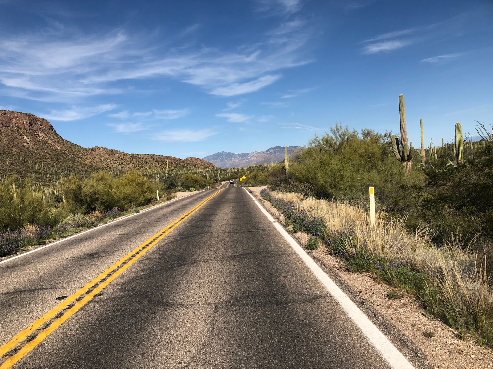
Sunrise near Carefree AZ, about 90 minutes into the ride
A dozen or so riders lined up for the 2018 version of the Scorpion 600km brevet. In addition to the 600, several other ride options were on offer, so unlike last year, there was quite the crowd of randonneurs milling about the Red Roof Inn at 4:30 in the morning!
My companion for the next two days
After completing the registration paperwork and downing the first of many Starbucks's Frappuccinos, it was time for a rider brief from RUSA RBA Mike Sturgill and to get this one underway.


Mike Sturgill gives directions to start
The start included a couple or tricky turns through the adjacent shopping center, but soon we were rolling along, quite quickly, with the three powerful engines from the Calgary Express (Steve, Steve, and Paul) leading the way. My turn at the front came about 12 miles into the ride and while we were motoring along at a brisk pace, it was nice to be in a large strong group. Drifting back after my pull, it seemed like my rear tire may have been getting soft. Wishfully thinking it might be a ripple in the pavement, but after another rider drifted back after her pull, it was clear the tire was soft. The group stopped at the light on Scottsdale Road, and a quick squeeze of the tire confirmed my fear, a flat only 15 miles into the ride!

I pulled out of the pace-line into a well-lit shopping center to make the repair, as the group continued up toward Carefree and first control. After a quick stop of only 6 minutes or so, the repair was complete and it was back on the road, but that fast train was nowhere in sight!
Spectacular sunrise
The ride continues to tilt uphill toward the first control in Carefree. While somewhat concerned that that 50% of my spare tubes (1 of 2) was used only 15 miles into the ride, it was a relief to dial back the pace, enjoy the fantastic sunrise, take a few photos, and catch up on some calories riding solo!
The Boulders on the approach to Carefree
Rolling into the Carefree control, Mike Sturgill was there and said "At least I beat one rider to the first control!" He had to start the other shorter distance events that were running at the same time. Brian was just rolling out as I came in and the fast train was long gone! Double bonus: Not needing get a receipt since Mike signed my brevet card, and another Frappuccino out of Mike's cooler! Switching from clear (night glasses) to sunglasses and downing the creamy, caffeinated, sugary delight, it was a quick 3.5 minute control stop and back out on the road.

The route descends to Cave Creek, and connects with the Carefree highway. Approaching I-17, Brian came into view, but he decided to stop at the last water stop until Wickenburg, since my bottles were nearly full, I pressed onward. 

Continuing westward, with a slight tailwind, traffic was heavier than last year's event, especially near Lake Pleasant. Its a long pull but soon the traffic on US 60 to Wickenburg came into sight. With an ample shoulder that is actually ride-able, it was a welcome relief from the narrow Carefree Highway (AZ 74) with is nearly unridable shoulders. Heavy northbound traffic provided a welcome draft and offset some of the crosswind for the 10 or so miles to the next control in Wickenburg.

77 miles in, and 10 minutes at the Wickenburg control provided another Frappuccino, turkey sandwich, and chance to reload the water bottles before rolling out for the next pull to Congress and the start of Yarnell hill. Exiting US60, AZ89 heads due north and has been resurfaced since last year, a welcome relief from last year's bumpfest.
Yarnell hill in the distance
Yarnell hill starts a few miles outside of Congress. Its about 6 miles of steady climbing on an average grade of 6%. The new State Park in honor of the fallen Grant Mountain Hotshots (19 Granite Mountain Hotshots lost their lives fighting the Yarnell Hill Fire in 2013), is a about 2/3rd's of the way up the climb. A 2.85 mile hike leads from the highway to an observation deck that overlooks the place where they made their last stand when shifting winds pushed the fire into their position. Putting that on the list of places to visit for a time when the clock is not running, the climbing continued.

Two other riders from the event, Catherine and Ray came into view, and we started a game of leapfrog that would go on for the balance of the day. Reaching the top of the hill, with steady winds from the south, it seemed like it took no time and little effort on the descent into Peeples valley. About 100 miles into the ride, but not an official control, the Mountainaire Convenience store with a shaded patio and seats makes this a perfect stop between the official controls at Wickenburg and Prescott.
Reload in Peeples Valley
They were serving free Root Beer floats as part of a customer appreciation day, but I declined and loaded up on sugar, salt, and caffeine in more familiar forms!
 
Add more sunscreen!
Its 18 more miles and 2500 feet of climbing to the high point of 6100 feet before the final descent into Prescott. So without a cloud in the sky it was time to lather up with more sunscreen. The lotion and road grime combined to form a mud pack worthy of some high-end day spa!
Climb to Prescott
The climbing is steady past Wilhoit, but once in the mountains, the road twists, turns, rises, and falls until reaching the 6100 elevation marker a few miles outside of Prescott!
High point of the ride
One more roller, and its mostly downhill to the next control in the historic Town Square. At the edge of town the Calgary express was heading up and back after making their control stop in town.
Historic Yavapai County Courthouse
A receipt from any establishment on the square, including Whiskey Row, is the required proof of passage for this control. Skipping the whiskey and pizza joints, I hopped into a burger/ice cream shop, just looking for water, a coke, and a receipt. But the smell of fresh french fries lured me into a full stop for a large order for fries and a Pepsi! The fries took some time to prepare, but I was able to reload the bottles and get the bike ready for the next leg while I waited for the salty potatoes to arrive. I was especially glad I carried a lightweight cable lock on this ride so I could secure my steed to a light post just outside! Unable to finish the fries, but tucking a few into a Ziploc for some pocket food, I pushed out of the square.
 
Outbound
The longer stop, and building headwind made the climb out of town somewhat less enjoyable, but soon reached the "Welcome to Prescott" pullout conveniently located near the top of the climb to finish the fries!
Once at the 'top' it was a series of fast twisting downhills with unpredictable cross winds punctuated with short climbs. Finally reaching Wilhoit, its steady downhill, but with the heavy cross and headwinds, it took extra time to reach the foot of the climb back into Peeples valley.
Ray and Catherine were reloading at the Mountainnaire Convenience store, and after procuring a Frappuccino and a can of Campbells Chicken Noodle soup (about a weeks worth of sodium in one can!), I joined them in the shade of the porch. 
Its a few miles of climbing to Yarnell before the 6 mile E-Ticket descent back to Congress. Happily there was no traffic on the descent allowing full use of the road for some tricky corners with random crosswinds!
New pavement between Congress and Wickenburg
Rolling through Congress it was again onto fresh pavement and a chance to switch to clear glasses and put on the lights and reflective gear! As the sun set, the light of Wickenburg came into view and after a short control stop it was back onto US 60 for the long run to Sun City and the last control before the sleep stop.

Ray and Catherine were there when I arrived, and after getting a receipt I pushed out quickly. Its about 15 miles to the Red Roof Inn, and of course, they caught me as we made the last few turns to the stop at about 11:30pm.

Wishing I had taken up Mike on his offer to put some dinner food in my room, I checked in, stored the bike and hopped in the car to the nearby Dennys. Food was good, but service was slow, and minutes if not an hour of sleep was wasted on my Grand Slam Breakfast!

I was in the sack at 1 am, and planned to get up at around 5 or 6. Waking up at 5, I grabbed some breakfast treats Mike had left for me at the front desk, and pushed out into the pre-dawn darkness.

Great addition to the Day 2 route
Day 2 starts in the city but soon was on the new Dove Valley road, new and lightly traveled, this road was a great change to the route. Eventually this valley will become developed but on this morning it was a great place to be for the sunrise!

The next control is on Dynamite Road, at the top of 9 Mile Hill. However, it could have been named 9 Mile Downhill for the decent to Rio Verde! After that welcome descent, about 10 miles of classic rollers lead to the next control at Fountain Hills. Rolling into the Chevron station, who else, but Ray was there finishing his stop!

Verde River from the Beeline Highway Bridge
We left together but soon Ray was up the Beeline Highway at a faster pace, he took a break at the Bush Highway turnoff, but I rolled through wanting to get started on the descent to Saguaro Lake and the Salt River.
More new pavement on Bush Highway
Over the past several years, sections of the Bush Highway have been repaved and/or slightly widened. One of the last sections to be completed is the run from Salt River Recreation to the climb up King Kong (Power Road). On the Saguaro 200 earlier in the season it was still under construction and quite rough. With 325 miles in the saddle so far on this brevet, any smooth pavement was welcome relief!

Feeling the sun/heat, radiating from the new pavement, it was time to find some shade and again lather up with another sunscreen mud pack! A small tree at the Salt River Recreation entrance gate was a perfect place for a stop. Ray flashed by while I enjoyed the shade!

Rolling into the Subway (control point), Ray had just arrived so we enjoyed our lunch together. Chips (salt), Coke (sugar/caffine), and a 6" Turkey (protein/carbs), covered most the important food groups. I was ready to get this one done and pushed out after a quick stop.
Strong winds in Fountain Hills
Last climb, Shea Boulevard at Fountain Hills
The route continues through Mesa, back to the Beeline Highway and up to Fountain Hills. Heat, wind, and a few more climbs were the order of the afternoon. Exiting Shea Boulevard after the Fountain Hills descent, its 25 miles of city/residential streets to get back to the start/finish at the Red Roof Inn at I-17. The route is probably the best way across town, using residential routes with bike paths to avoid the heavy traffic on the main roads in Scottsdale and north Phoenix, However, with all the turns and traffic stops, it was hard to get momentum going again. That said, this is still the best possible route across town avoiding major roads and traffic.

One more stop for water with about 8 miles to go and this one was finally in the books 34 hours and 13 minutes after our early start on Saturday morning!

Next up, the Blue Ridge to Bay 1200!

In the books!

Steve Atkins

Ride with GPS data