Showing posts with label around the bend. Show all posts

Saturday, April 22, 2023

2023 Desert 600km Brevet

Sunrise over the Salt River
Pre-Ride Report

Mike Sturgill added the Desert 600km Brevet to the calendar at the end of April for a last chance Arizona 600 before it gets too hot. With my Just North of the Border fail a few weeks ago, it was nice to be able to check the 600 box and not leave town. Only a few riders have signed up so far, but Brian McGuire was game and we did the pre-ride together to check the course for the main event. Here is our story.
Brian; predawn in the Gila Community
Heat and wind are in the forecast so we decide to push out a bit early and start at 0400 Saturday morning. Traffic is light and soon we are at the first information control in Laveen Village. The normal route turns west here and continues on quiet roads through the Gila River Indian Community. The only problem was that route uses 91st Avenue to cross the normally dry Salt River. We were lucky to realize this before the ride and adjusted the route to use the bridged crossing at 51st Ave. The river is still flowing, 91st avenue is closed so the 51st Ave. bridged crossing will be used this weekend.
Do we really need to stop at every bridge?
We stopped at the 51st Ave. bridge for a photo of the Salt River at sunrise (cover photo) and would continue to stop for pictures at each crossing during the ride!

Actually, the 51st Ave. route was first used when Tom Baker designed the inspiration for the Desert 600; the Around the Bend 400 several years ago! The roads were good, just more traffic and stops than the run through the Gila community.
Gila River in Avondale

Hence the reroute !
We made our first stop at the Circle K in Avondale near Phoenix International Raceway. We had good timing, as their computers went down just was we completed our purchases and they had to close the store for 30 minutes to ‘reboot.’
Palo Verdes outside Estrella 
We rolled past the quiet raceway and through the planned community of Estrella. We pressed on to the next control in Buckeye for another Circle K snack and bottle reload. The Sheep Camp restaurant next store has great reviews, and as I stood outside consuming a breakfast muffin from the Circle K a number of folks commented that the Sheep Camp had great food. We were both concerned about the building heat in the forecast, and while a sit-down breakfast would have been great, we needed to press on and we did.
Flat in Palo Verde
Just a few miles past Buckeye, I noticed Brian's rear tire looked soft and flatting. He checked it and it was. Luckily there was some nice shade by the Palo Verde school and he replaced the tube. Uh-oh, the replacement went flat too!

I noticed he had brand new Vittoria tubes. I have had several where the removable valve was not fully tightened at the factory and leaked. We tightened the value and refilled the tube and were good to go for the rest of the ride.

Important safety tip: Check/tighten the removable valves on new Vittoria tubes!
Gillespie Dam/Gila River
Brian was noticeably faster on the fully inflated tube and soon we were at Gillespie Dam. Normally dry, but with lots of water flowing today. An excavator was working replacing a portion of the earthen dam. The old concrete dam breached years ago and has not been repaired.
Lunch Break at McDonalds

The western most point of the route
We rolled into Gila Bend and had lunch at the McDonalds. We both were feeling good and commented how unusual it was to have our stomachs fully intact this far into a ride.

We both purchased an extra water bottle for the long run to the next control in Maricopa. There would be no services for the next 43 miles, much of it uphill! Winds were predicted to be on our tail, but our fast pace had us at the base of the climb before the winds shifted. So with building heat, and swirling winds we made our way up the 15 mile, albeit shallow, climb to the Sonoran National Monument. 

The heat and wind took its toll. I deployed my spare water bottle about 10 miles outside of Maricopa and limped into the Circle K. Tried some Mountain Dew and chips for sugar and salt, topped off the bottles and pushed out to Casa Grande.

Brian at Maricopa
Brian was feeling strong and would lead the way to Casa Grande with yours truly barley hanging on in the heat. We rolled in to Casa Grande and stopped again at a Circle K. I downed my first can of Campbell’s Chicken Noodle soup (loaded with Salt), another chocolate milk, and we reloaded the bottles and pushed on.
Brian leads the way to Florence
The temperatures were starting to drop as we rolled into Florence about 6 pm. We decided to mix it up with dinner at Sonic. I was still feeling the effects of the heat, but was able to get down a Corn Dog kids meal, Coke and some ice cream. Plus seating in the picnic area was nice, although Brian’s meal took a while to get delivered. Good thing for me, I was starting to recover from the heat.
Sunset near Florence
We had 56 miles to our overnight stop to go. We rolled out with Brian in the lead and headed into the farmland.  The temperatures continued to drop, and heading west there is a slight downgrade. Somewhere between Florence and Queen Creek, our roles reversed with me taking more lead pulls and Brian taking advantage of my wheel.

We rolled through the main control in Chandler and headed out on the 200km loop. About 5 miles in, we took a detour to my house for the overnight stop. Debby made some navy bean soup and cornbread and also had potato salad and ice cream waiting for us (She was in bed!). Both of us had trouble downing a decent solid meal, but we stuffed in what we could and hit the sack about midnight. We both downed a couple of Ensure drinks, they were cold and seemed to hit the spot. We decided to set out for the 200 at 5 am, so we set the alarms for 0420 and tried to get some sleep.

Still feeling sour, I woke up and had my normal brevet breakfast (granola, yogurt, blueberries) and a couple of Ensures. Brian had a worse night but was raring to go when we rolled out a few minutes after 5. It’s a familiar route through Tempe to ASU and another Salt River Crossing. Again our roles reversed, with Brian doing most of the work.

Tempe Town Lake/Salt River
We stopped at the Tempe Town Lake bridge for a photo. The lake is ‘flowing’ as evidenced by the muddy color, and the water rushing out of the spillways further west. The route continues north through Scottsdale on 68th Street to Jackrabbit. Turn right and go about a mile, and its bike paths nearly to Shea boulevard.
Bike path in Scottsdale
It took us about 2 hours to cover the 25 miles to Aztec Park and an adjacent Circle K. A good place to stop, restrooms at the park, and a table outside the Circle K. I was starting to feel better and power was coming back, and we picked up the pace. We both enjoyed Circle K breakfast sandwiches warmed in a microwave. There was a sign on the microwave indicating that the warming of fish is not allowed! We put the fish back in our pockets and continued on!
Construction on Pima Road
There was about a mile of construction on Pima road at Pinnacle Peak road. The bike lane was gone. We decided to ride on the hard pack gravel (straight ahead from the photo above). It was fine, and better than mixing it up with the traffic. Only a mile or so, and we were back on the road.

Brittlebush outside Fountain Hills 
We made the climb around Pinnacle Peak and the yummy 9 mile descent to Rio Verde. Temperatures were still good. The breakfast sandwich was doing the trick and I was feeling strong and we made good time in spite of some headwinds. At this point, at least they were still cool.

Best lunch ever!
We had a nice tailwind from Rio Verde and if you timed the power right, you could crest the rollers with just a soft pedal! Our next stop would be the Circle K control at Shea, .2 miles after the turn from Saguaro Blvd (there is one there too!). It has shaded tables, is less busy, and best of all it had fresh hot dogs! At least they seemed fresh! I bought a back-up water bottle, since last time I rode this route I ran out of water on the Usery Pass climb.

Verde River
Another photo stop at the Verde river before the 6 mile climb to Bush Highway on the Beeline. Plenty of flowers along the way. Brian mentioned wild horses were grazing just off the highway. I didn’t notice them, and wondered why a number of cars had stopped on the shoulder of the highway! Now I know!
Weavers Needle from Bush/Beeline Highways

Salt River
From the Bush/Beeline Highway intersection, it’s a fun plunge down to Saguaro lake. Traffic was not too bad. We did notice the long line of boats waiting to use the boat launch! The Butcher Jones camping and day use area was also full! Of course we stopped at Blue Point for another photo of the Salt River.

We made our way up the Usery Pass climb and decided to stop at the Usery Mountain Park visitor center. There is no fee to enter, and shade and restrooms are available.

We topped off and headed for our last stop at a QT store at Baseline and Lindsey. With the heat, we wanted one last stop and chance for ice cream before hitting the Western Canal trail and the last miles of the ride. 

We entered the bike trail off Lindsey and about a mile later we were in the heart of downtown Gilbert. Many places to stop and eat and drink. But we were ready to get out of the heat and continued on.
Brian on the new bike bridge

There is a new bike bridge over an active rail line that sure beats dismounting and scrambling across! Brian gave it two thumbs up and we continued into what seemed like a convection oven for the next 9 miles. Hot heavy winds on the nose…no thanks!

At least the last few miles were in a crosswind as we put this one in the books at 34 hours and 45 minutes. It was great to team up with Brian on the ride, it seemed like at least one of us was feeling good throughout the ride and could get the other through!

There is still time (midnight April 26, 2023) to register for the main event, go to Azbrevet.com!

Steve Atkins

Click here for GPS data


Sunday, March 10, 2019

2019 Around the Bend 400km Brevet

Ride Report
March 2, 2019
Tom Baker gives the rider brief
Flat, fast, and with a tailwind! What could be better than that? The 2019 version of the Around the Bend 400km Brevet lived up to all that, and with an average temperature of 65F, you could hardly ask for more in a 'winter' brevet!
25 Randos at the start
Tom Baker designed this route and would be the Trail Boss for the day's festivities. This is the 8th edition of this ride on the Arizona Brevet calendar, and like the last several years would be run in the counter-clockwise direction. The start finish location was moved a few miles east (from Sun Lakes to Chandler) to the Fry's shopping center at Riggs and McQueen Roads. More services and a better split of some of the urban riding on Riggs Road made this a great change.
Traffic stop at Riggs and Maricopa Roads
A few traffic lights along Riggs through Chandler, but at 6am, the traffic was light and soon we were zipping along at a reasonable but fast pace through agricultural portion of the Gila Indian Reservation. About half the peloton, stacked back up together at the traffic signal at Maricopa road. When it turned green, it was back to brisk pace as the Estrella Mountains were slowly illuminated by the rising sun.
The pace line working through the west valley
Riggs turns into 51st Avenue as the route passes through Komakte, exiting the reservation, and entering the City of Phoenix before turning west toward Buckeye. The group, benefiting from a gentle tailwind, continued to course along at 22+ MPH!
Tom checks us in at the first control in Buckeye
The RUSA Rules for Riders point out that brevets are not competitive events. In fact, results are to be listed in alphabetical order, not the order of finish. They are, however timed events with the opening and closing times of the intermediate and finishing controls determined by a maximum (about 19 MPH) and minimum speed (about 9 MPH). Riders must stay within these time frames to successfully complete the brevet.

Nine of us rolled into the first control in Buckeye exactly at the control opening time of 0851! Tom Baker was there to check us in, sign our brevet cards, and provide supplies and snacks for the next leg to Gila Bend. Riders rolled out one or two at a time, but soon another pace line of 7 or so riders formed for the run to Gila Bend.
David and Mike after some work at the front!

Paceline on old US 80


The route continues west and then south, and with a quartering tailwind, the group was easily holding 20-24 MPH through mostly farm land. With the exception of just a few rollers near the Gillespie Dam, its pancake flat, and most of the road surface is in great shape! Just outside of Gila Bend, with 100 miles behind us, elapsed time was still under 5 hours! Credit to favorable winds and a large group of riders working together at a consistent pace!
Lunch Control in Gila Bend
Just outside of Gila Bend, we turn right onto Watermelon road. A slight, but much improved route variation for 2019. We catch a large farm vehicle moving at about 13 mph and 'motor-pace' behind it for a while, then we swing clear and pow, suddenly the wind is on the nose and quite strong. We continue on for a couple of miles, not minding the wind, since we will soon turn south and then east to the control and another 40 miles to Maricopa, with the wind on the tail!

Rolling into the control at 1111, a mere six minutes after it opened, Tom Baker had staked out the tables at the Gila Bend Chevron/Food Mart and set out an assortment of snacks, sandwich wraps, and drinks! More riders rolled in (the Stephen Kinney group had suffered a mechanical outside of Buckeye) and a bunch were ready to go after only 12 minutes!

Stephen took the lead with his group and we headed out with a nice tail wind. Its a straight shot for 40 miles to the next town of Maricopa. The first 19 miles is a steady 'climb' on an incredibly consistent .8% grade. Reaching the summit its another 20 miles of slight downgrade to town. With 150 miles to go, the pace was a little hot for yours truly, and it was time to drop off and settle into a comfortable pace.
On the big 'climb' of the day
About half-way up, other refugees from the front group came into view and soon we were again a group of about 5 working together. Clouds and a light rain were welcome relief as we cleared the 'summit' and still with a reasonable tailwind the speed picked back up and we were really moving.

On long straight roads, sometimes the mind plays tricks on a rider. Seeing a mailbox ahead in the distance, the mind says there is rider on the side of the road, only to find it is actually a mailbox! This time however, the mailbox became bigger and as we got closer, then then it turned into three Canadian riders!

We slowed down to make sure they were OK and had everything they needed for the repair and continued eastward. Of course well before we reach town, they are back on the train. As they rotate through the pace quickens just outside of town and the group splits again!

With the next control in Stanfield only 19 miles away, and with a full bottle, there is no reason to stop and we head south out of town and through the Ak-Chin Indian Reservation. Passing the Harrah's casino, a couple of riders come into view. Its Roger Peskett and Bob Fisher working together. It takes some time, but just a few miles before the next turn we are a group of three. Continuing at the same pace, Bob hops on and we roll into the control in Mansfield together. With diminishing winds and numbers, no need to worry about arriving early, the control opened 90 minutes ago!

Bob Fisher at the Stanfield control
With 82 miles still to go, and building winds out of the northeast (our direction to the next control in Florence), we take a 20 minute break to refill both bottles and chow down a turkey sandwich, Frappachino, and some chips. Bob is ready to go we head out as a group of two working together through Casa Grande and Coolidge to the next control in Florence.
Mansfield Road near Florence
Superstition Mountains on the horizon
Passing more smelly feed lots that we cared for, we finally roll into Florence and stop at the information control at the Circle K on Main Street. Its bustling on an early Saturday evening. It seemed every third customer was wearing an Arizona Department of Corrections uniform! Lots of folks were interested in our ride, and one nice couple shouted out a blessing from their pickup for safety as we continued our journey!

Florence Control
As we roll out, Mike Sturgill rides up, and we ride together for a short trip to the McDonalds where he makes his dinner stop!
Sunset on the Pinal Mountains to the east
We continue out of town, passing several more corrections facilities heading north as the sun illuminates the Pinal Mountains to the east.
Sunset on Arizona Farms Road
Soon we turn onto Arizona Farms Road and literally ride into the sunset! After a quick stop at Attaway road to put on the reflective gear, its Bob in the lead with yours truly hanging on his wheel for the last run to the finishing control in Chandler.

We rolled in at 1859 (7:59pm) to put this one in the books at 13 hours 59 minutes.

Another great Arizona Brevet! Thanks Mike and Tom!!!

Next up, join us for the Patagonia 600!

Steve Atkins

Click here for GPS data


Monday, March 5, 2018

2018 Around the Bend 400km Brevet

March 2018
Ride Report

Riders assemble at the start
17 riders were on the start list for this one, and with two riders checking out the course earlier in the week, that made for a small group setting out from Sun Lakes AZ Basha's parking lot! Tom Baker would be the Trail Boss with pre-rider Roger Peskett helping out at the lunch control in Gila Bend. The forecast called for a perfect winter day in AZ in the mid-70's with light, potentially favorable, winds during the day.
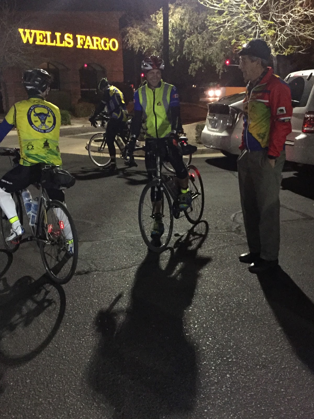
Tom Baker provides the pre-ride brief
We were all checked in and with a short a pre-ride brief, Tom Baker says, "well its 6 a.m., you guys should get going!" And we were off.

We rolled out in the predawn darkness with temperatures in the low 40's, but just a few miles in we riding through irrigated fields on the Gila Indian reservation. What started as a reasonable warm-up pace became a race for warmth as the temperatures continued to drop (the Garmin recorded a low of 30 in this section) and the pace continued to climb. The course continued through wide-open desert on Beltline road until reaching Laveen with more agricultural sections interrupted by random housing developments until we reached the next control in Buckeye Arizona.
At the first information control in Buckeye
The first control was an information control (answer a question on the brevet card), but since Tom Baker was already there, and there was a taco food truck across the street, the peloton rolled over and refilled bottles and soon we were back on our westward journey toward Palo Verde.
Straight, flat, and with a tailwind
The winds had been quite favorable, but began to shift from the east to south causing some cross-wind. Just past Palo Verde and before the rollers leading to Gillespie dam, the pace was too hot for me and leaders disappeared into the distance!
Gillespie Dam Bridge
Gillespie Dam marks the spot where the road turns south toward Gila Bend, and the winds were right on the nose and would swirl from the west or south for the remainder of the day.
Just add water!

The route follows Old US 80. The highway was resurfaced in recent years, has relatively light traffic, and wide-open views. The views are mostly agricultural as we are following the path of the Gila River, but a few solar farms, one planned community (including gate and entrance with no visible homes), and the Arizona Shrimp Farm add some variety and distraction from the headwind!


Solar farm: Less water, more power!
Just a mile before Gila Bend, the route heads due west on a secondary road that included about 500 meters of hard packed gravel. No flats here, thank you, and with a few more turns, it was back on the pavement and the lunch control at Gila Bend.

Tom Baker and Roger Peskett were overseeing a great lunch spread in the shade and on the picnic tables at the convenience store. Time to strip off a layer, lather up the sunscreen, reload the bottles and grab some calories.

Pushing back out on the road, the route heads up through the Sonoran Desert National Monument. The road parallels the Santa Fe rail line on a steady 1-2% grade for about 20 miles. The wind was favorable, especially when the freight trains rolled by (about every 30-45 minutes or so). Finally reaching the top, a slight downgrade carries you to Maricopa.
On the Climb toward Maricopa
The shoulder disappears but with the tail wind it was easy hold 20+ mph on this section. Several groups of motorcycles passed by, some giving more room than others! Glancing in the rear-view, it looked like another group, so preparing for the next burst of Harley noise, it was surprising to hear the familiar "ding-ding" of a bike bell. It was Paul and Jennifer Danhaus on their tandem taking full advantage of the wind and downgrade, blowing by at 25+ mph. They were gone before I even thought of jumping on board that train!

Rolling into Maricopa, it was time to reload the bottles and get some food. Paul Foley pulled out just as I arrived at the Circle K to pick up some water and a Frappuccino. Not an official control, but at about 150 miles, a good place for a break.

The route heads south, and the friendly quartering tailwind alternated to a quartering headwind for the next 15 miles to the informational control at Stanfield. The route is flat, straight, and once outside of Maricopa, there is one Indian Casino and lots of agriculture all the way to Stanfield.

Information control in Stanfield
The control at Stanfield was another informational control so no receipt was necessary. Paul Foley was there and suggested we ride together. He had some extra water, so I topped off the bottles and we headed right back out targeting our next stop in Coolidge.

It was great to have some company and share some stories as we made our way through Casa Grande. This was Paul's first time on this course, so with him taking most of the pulls, and me providing the local route knowledge we kept rolling.

Coolidge is less then 10 miles from the Florence control, but with empty bottles we stopped for a quick top-off and were back on the road for the quick run to Florence.
Paul Foley on the Adamsville road to Florence
The sun was setting as we hit Adamsville road, just outside of Florence, featuring contrasting views of the Superstition Mountains in the distance, old Florence, and the Arizona State Prison!
Sunset from our 'table' at Chez Circle K
The Florence Circle K was our planned dinner stop. I was craving a hot dog, and even though they were out of buns, I still procured the tubular delight, protein style, with some chips washed down with a Mountain Dew. As we were getting ready to head out, Paul and Jennifer Danhaus rolled in on their tandem. They had taken a long break at the Starbucks in Maricopa!
Paul Danhaus and Paul Foley get reflective
We used the break time to don the reflective gear, arm and leg warmers, and set out for the final run through Queen Creek to Sun Lakes. While a little warm at first, as we headed back into the rapidly cooling desert, and then the even cooler farms of Queen Creek, it was the right call.

Back into the urban sprawl for the last 12 miles on Riggs road, we hit about half of the traffic lights, but with the slight downgrade, and little or no wind we made great time to the final control at the Sun Lakes Basha's grocery store.

We arrived 14 minutes after 9 pm, putting this one in the books at 15 hours; 14 minutes. With no volunteers in sight, we congratulated each other on getting this one done. It is always great to have some company for the night riding and companionship to keep up the forward momentum. Thanks Paul!

After grabbing a receipt at the closest store, this one was officially in the books!

Next up is the Scorpion 600!

Steve Atkins

Click here for GPS data


Sunday, March 26, 2017

Around the Bend 400km Brevet

Ride Report
March 2017

The third installment of the 2017 AZ Brevet series featured the return of Around the Bend 400km, with a twist, or rather a reversal. Its the same Tom Baker route run the past several years, but to change it up, the start was moved to Sun Lakes (from Casa Grande) and the direction reversed. We would head west toward Buckeye and Goodyear, then south to Gila Bend. From there, Maricopa, Casa Grande, Florence, Queen Creek, and finally back to Sun Lakes.

15 or so riders arrived at the start, and after an informal rider brief; Tom Baker says, "OK its 6 am, you guys can get started" and before a photo could be taken, we were off. 5 riders and a Tandem formed a fast group and that bolted westbound on Riggs road.
Fast movers on Riggs/51st Ave
The group fell into a fast pace, but with calm winds and a pancake flat course we maintained a 21+ mph pace. Paul and Jennifer on a tandem would get gapped at traffic lights, but for the most part we stayed together to the informational control in Goodyear.

Tom was there with water, snacks, and signed our control cards. With the temperatures rising, we stowed the layers and reflective gear and rolled out toward old US 80.
Lush farmland in the Gila River basin
Rollers just before Gillespie Dam

Gillespie Dam Bridge
After a couple of short rollers we crossed the 'Gila' at the Gillespie Dam Bridge. More pancake flat riding on mostly recently repaved roads meant our pace stayed well above 20 mph!
100 miles under 5 hours!
Just a few miles from the control, the route leaves US 80 and takes a back road loop on a rough patch of pavement. Paul flatted along here and Mike and I continued to the control stop. We arrived before Carlton, and a little later the Fast Canadians arrived after two flat repairs!
Gila Bend Control with Carlton
Figuring that the group would catch me on the climb to Maricopa, I set out early to ride at a easier pace and to investigate the unusual noise coming from my rear derailleur. After stopping to check it on the edge of town it was clear that the chain was installed incorrectly (my fault) and was rubbing on a stop in the cage. Not wanting to waste time, the repair would have to wait until next control in Maricopa. The plan, to either find a bike shop or make the repair on my own (it would require 'breaking the chain,' reinstalling the chain, and connecting with a fast-link).

Mike caught me outside of town and just after we crested the climb 20 miles later the Fast Canadians flashed by (they had suffered another flat!). We hopped on that train, but after a pull at the front, it was clear my time with this group was over. Dropping back and rolling into Maricopa I would find the group at a Circle K.

No bike shops in town, but the good news was the necessary parts and tools were in my repair kit. After procuring some food (chicken soup and chips) the repair was easy and quick in between bites! The group was ready to leave and offered to wait, but not wanting to maintain their pace and I bid them farewell.

15 minutes later the chain was repaired and I was on my way. (Editor's note: After the ride Mike Cox of Curbside Cyclery showed me how to make this repair without breaking the chain. Simply remove the lower pulley, twist the cage, and reroute the chain, about a 3 min repair!)Winds were light and road conditions were good. After checking in at the control in Stanfield, the route rolls along familiar roads through Casa Grande to Coolidge. With the sun starting to set, hot dog and lemonade cravings set in, all items that can be procured at the Circle K in Coolidge!
Dinner in Coolidge!
Just a short break at Chez Circle K, and after getting the reflective gear on, it was on to the next control in Florence. Another Circle K, another Starbucks Frappiccino, and it was off into the night for the final run through Queen Creek and the finish in Sun Lakes.

Tom Baker was there at the finish and checked me in. I finished in 14 hours and 43 minutes, 10 minutes faster than my previous best 400 km time. Special thanks to Stephen, Paul, Steve, and Mike for dragging me along for the first 200km!

Steve Atkins

Click here for GPS data