Showing posts with label rouleur week. Show all posts

Friday, February 6, 2026

2026 McDowell Meandering 150km Preride

Preride Report

February 2026

Sunrise over the McDowell Mountains
This is my second preride this week, and today we tackle the McDowell Meandering 150km Rouleur. The actual event will be a week from Sunday (February 15, 2026) and I will be helping Brian McGuire at the control location in Fountain Hills. There are over 30 riders registered, and registration is open through Sunday so there is still time to sign up!

The ride heads north and east through the Desert Ridge area of North Phoenix. There was some Friday morning rush hour traffic on busy roads, then into quiet neighborhoods, high end retail, and the Five Star JW Marriott Desert Ridge Resort. Probably too early for a spa treatment, so I pressed on.
Only a few balloons today
Approaching the Princess Resort
Phoenix Open Traffic Control
A number of the roads were closed around the Princess Resort and the TPC Golf course for the Phoenix Open PGA event this weekend. Luckily the officers allowed me to pass through, and it was actually nice riding on closed roads. Later in the day the route would return through here and again there was no problem. All this will be long gone next week, so no worries.
Central Arizona Project Canal
The route crossed the canal, and no, the route is not on this gravel path, I just stopped here for a picture and to check out the canal path.
Bike path climb to Fountain Hills 
Instead of fighting traffic on Shea Boulevard to reach Fountain Hills, there is a bike route that heads up residential streets and through a gated community to reach a bike path for the final climb into Fountain Hills. It’s a bit steep in the gated community (8%) but eases off as you reach the bike path. The gates look closed, but there is an offset opening that allows bikes through!
Fountain Hills Park
Brian will have a sag stop set up at the park, if you are lucky the fountain may be on!  
Park restroom information
The restrooms I stopped at were clean and had a filtered water dispenser. I was about to leave when I noticed this information panel that describes where Fountain Hills gets its drinking water (CAP Canal), and how every drop is recycled and used for irrigation and the lake and fountain.
Roadwork is done!
When I rode through here (about a mile outside Rio Verde) earlier this week, debris was piled up on the shoulder. It has been cleared off and the shoulder was clear and free of debris!
Road Closed on Rio Verde Road
Near the top of Nine Mile Hill, traffic started to pile up. Ahead the road was closed but the officer allowed me to ride through.
About another mile another officer directed me onto this jeep trail that paralleled the main road. He said an accident was blocking the whole road.  
Overturned concrete truck
About 1/2 mile of gravel riding brought me to the scene. They were rigging the truck when I rolled through.
Lucky the gravel track was there, there was no way to get around this mess otherwise!
Hikers headed to Tom’s Thumb
The route continues up, but just before the summit the route heads toward Tom’s Thumb trailhead. Mike Sturgill will have a staffed control here with refreshments.
There were great restrooms (no water though) and trails that head in the McDowell Mountains preserve. The rock faces in the distance are the Sven Slab rock climbing area. Debby and I spent many days rock climbing there many years ago!
Some minor construction at the Mayo Clinic
The route heads back from the trail head and returns through Scottsdale to North Phoenix. If the roads look familiar, they are, some of them were on the outbound route.
Bike path along the freeway
The final few miles include an older bike path along the AZ 51 freeway. A bit rough in spots but much better than being in traffic. It has climbs about a mile apart for bridge crossings of major streets.
The bike path dumps you out right on Union Hills Road, and it’s only 1/2 a mile to the finish at the coffee shop.

Another great route. I’m looking forward to riding with the 30+ folks that have signed up for the AZ Rouleur Week!

Join us; azrandos.com has all the information !


Steve Atkins


Wednesday, February 4, 2026

2026 Lower Salt 200km Rouleur Week Preride

Preride report

February 2026


New route! Jog along Jomax
Next week (February 11-16, 2026) Arizona Randonneurs will be hosting a series of Rouleur rides (100km, 125km, 150km, 200km), and a 120km Dart Team event. Yours truly will be helping at controls for the 150km and 200km events. As a volunteer, the RUSA rules allow you to preride the course up to two weeks before the event. Here is my report.

I loaded the route in my Garmin GPS and set out from the start at 32nd and Union Hills a few minutes before 0700. More morning traffic that I expected, but soon I was on Pima Road and headed toward Pinnacle Peak. Mike Sturgill, Regional Brevet Administrator for Arizona, designed all the routes. While many use familiar roads used on other brevets, he found some cool new sections. The first was turning right on Jomax from Pima and heading up a ‘dead end’ street. Alas it goes through and was a delightfully quiet and scenic route on a barely paved, but smooth road. A nice detour before rejoining the regular route on Dynamite road.
Shoulder clearing on Nine Mile Hill
It was cool and my bottles were still full so I didn’t stop at the Shell station at the summit before Nine Mile Hill. Heading down the long (yes, nine miles) descent some fire crews were clearing underbrush along the roadway. The shoulder is paved for the entire stretch, but here I had to briefly cut into the traffic lane to avoid the crew and wood chippers. I doubt they will be working on Saturday the 14th!
More Shoulder work leaving Rio Verde
The route continues through Rio Verde and on the opposite side of of the road, a road scraper was clearing the underbrush along the roadway, but depositing it on the shoulder. Hopefully it will be cleared before we use that side of the road for McDowell Meandering 150km on Sunday the 15th. Spoiler alert, on that one you get to ride UP nine mile hill!
Breakfast at Circle K
You will be treated to a sag stop at a fantastic park in Fountain Hills on the event day to refill your bottles and get a snack. I went a few miles further to the Circle K on Shea near the Beeline Highway. It has tables and shade out front. Luckily one of the tables was open so I took a breakfast break here. 
Photo bombers have been here awhile 
At first I didn’t realize the couple at the next table had suffered a fate common to this area; sudden dehydration.
Verde River outside Fountain Hills
Back on the road, a nice view of the Verde River looking south from the Beeline Highway.
Weevers Needle from Beeline Highway
The highest point of the ride is the junction of the Bush and Beeline Highways. On a clear day you can see the Superstition Mountains!
Calfee at rest
The route follows the Bush Highway ( a few miles without a shoulder ) to Saguaro Lake and the Lower Salt River Recreation Area. The shoulders here are wide and paved and the views are fantastic. You'll turn left and head up Usery Pass. Soon after the summit, the route will take you to the Usery Park Visitor Center about .1 of a mile from Usery Pass Road. On the event day, volunteers (yours truly) will be there with water, snacks, and lunch. The center also has convenient restrooms. 
Power Road construction 
The route continues south before turning right on McDowell road to form a loop back to Bush Highway and head back to the Beeline. There was some construction on Power Road, but I was able to ride in the barriers. Yes that is our event day, Mike has already checked with the Mesa Marathon organizers and and by the time we reach this part of the ride, the runners should be long gone!
Salt River just above Granite Reef Dam

Four Peaks from Bush Highway

Salt River below Saguaro Lake

Saguaro Lake from Bush Highway 
Just a sampling of the views along the Salt River!
Fountain Hills!
When I rode through Fountain Hills in the morning, the fountain was at rest!
Now you see it …

… now you don’t
Lots of food options in Fountain Hills at the corner of Palisades and Fountain Hills Boulevard. I decided to try Filibertos Mexican. In the Safeway center, it was fast and delicious. 
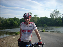
Preride done!
One more climb out of Fountain Hills then its a great selection of mostly low traffic streets through Scottsdale and Phoenix to the finish.

There is still time to sign up for this great week of rides, check out AZrandos.com and come join us!


Steve Atkins