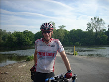
The training plan called for two 9-hour training rides on Saturday and Sunday. I selected the Mining Country 130 (this version of the Mining Country is an out and back from Superior to Globe via Winkelman) for Saturday and figured I would ride to Bartlett Lake on Sunday for another 150. I put the word out to the AZRandon and San Tan group lists looking for riding partners and only Marty Liddell was foolish enough to join the fun on Saturday.
Mining Country - Saturday
We left the house at 4 am and were on the bikes heading toward Winkelman at 5am. Its all uphill to the back side of the End-of-the-World climb, but soon we were bombing down the 14% + grade toward the Ray mine and Kelvin. There the road becomes a very pleasant roller all the way to Winkelman. We rolled into the Circle K and reloaded our bottles about 7 am in very cool weather. The next leg is a 25 mile climb to a pass named El Capitan about 11 miles outside of Globe. We each bought extra water bottles and headed out.
Marty in Winkelman
The route joins AZ77 and the car and boat traffic picked up noticeably, so did the grade. About 5 miles from the top, at the 50 mile point of our ride I gave the keys to Marty who turned around and headed back toward Superior (he was only looking for a 100 mile ride today). The grade lessened and soon I was at the top of El Capitan!
Summit of El Cap!
Looking northeast from the summit
The weather changed dramatically when I crossed the pass with the cross-winds and temperature picking up dramatically. The 11 miles passed quickly and I stopped to reload at a Circle K on the edge of town. I chatted with some motorcyclists from San Diego and soon was on my way back to Winkelman. The winds continued to build and unlike this mornings cool breeze felt more like a blast out of an oven! I reached El Cap and started my descent hoping this weather change was only on the east side of the divide. Unfortunately, the winds continued to build slowing my descent and as the elevation dropped the temperature increased dramatically.
I rolled back into Winkelman hot and frustrated from the wind, but hoping that as I made the harpin turn back toward Superior the wind would be a helper (or at least netural). With the temperature now over 90, I reloaded my bottles, and dumped the first half gallon of cold water over head and down my back to cool off and enjoy some evaporative cooling.
The run from Winkelman to Kearny/Kelvin is normally a pleasant rolling climb through an area with several active open pit copper mines. Today it was a long slog into a hot dry wind. I normally don't stop at Kearney, but today I did to reload my bottles with ice, and dump another half gallon of cold water for the last long climb of the day.
The wind continued to build and felt like it was gusting to 25-30+ miles per hour! The last two miles of the climb to the End-of-the-World has a 10% grade road sign. Marty's Garmin computer indicated 14%! The wind was so strong, and I was so cooked, that on the steepest section I had to dismount about half-way up and walk to stay upright. Even walking, my heart rate continued to increase. After a quarter mile, the road turned slightly and the wind became a cross so I remounted and rode to the top. I stopped at the top and found some shade in a road cut and took a little break to try and recover. Finishing the last of my water (including my spare bottle!) I set off for the last 5-6 miles of downhill riding to Superior.
I rolled into Superior and went straight to the Circle K and bought water, ice, peanuts, and a couple of Mountain Dews. Outside the store I topped off my bottles with the Dew and dumped a gallon of cold water over my head and back. I rolled back to the rest area dripping wet, found some shade to cool off in, and waited for Marty.
Cooling it with a Dew at the Superior rest area
Marty arrived shortly and we packed up the Suburban to head back to Phoenix. With the wind and heat conditions, my 9 hour planned ride had stretched to an 11 hour Epic!
Pinnacle Peak - Sunday
After Saturday's extended adventure, I modified my plan for Sunday to cover 7 hours of riding. I would ride the route to Carefree, but turnaround at Pinnacle Peak. I set the alarm for 4 am and was on the bike at 4:30 heading out into a calm cool morning. Rolling out of the house, I was not totally recovered from yesterdays adventure and had that familiar Day 2 feeling! Winds were forecast again today to build throughout the day out of the southwest, so that with this route I knew I would have an additional 'training aid' on the return.
At the base of 9-Mile hill
I reached the Circle K in Fountain Hills as the sun came up and rolled through town to the golf/retirement community of Rio Verde. I was about 1/2 way up 9-mile hill before the winds picked up. They were coming directly from the south, and were still cool so it was only a cross-wind was not really a bother.
Breakfast!
I rolled into the Shell station, bought a power breakfast (hot dog and Doubleshot) and turned the ride back toward the river and home. The 9 mile descent was fast and fun, however as the cross winds increased I came grim realization that when I reached the bottom and turned toward home, it would be about 40 miles of headwind all the way home.
It was, but being mid-morning the temperature was still cool. I rolled into the house about 11:30 am, covering 100 miles in about 7 hours.
With this two-day training block done, I looked forward to an easy recovery ride on Memorial Day!
About a week ago, Chuck Royalty sent out a post to the San Tan Racing Team. He and Josh Brown (Tandem teammates that recently finished second overall at the South Mountain Time Trial) were planning an epic journey. Ride to the End of Pavement (EOP) then continue 22 miles on the unpaved Apache Trail down Fish Creek Hill, past Apache Lake to Roosevelt Lake. Then rejoin the pavement, head north to Punkin Center, returning on AZ 87 - 175 miles. The plan was to start at 4 am and return between 1-2 pm. Seemed like a fast pace to me, but I needed an endurance ride so I sent a note to Chuck saying I was in.
I met Chuck at 4 am and we picked up Josh and continued to Lindsay road where Marty was going to meet us to ride to the EOP. Unfortunately Marty had a double pinch flats on the way and told us to go on ahead. We reached the Apache Trail before 6 am and stopped at the Canyon Lake Marina, encountering very little boat traffic. The gate to the water fountain was closed, so we refilled our water bottles at a hose bib and we were off.
On the climb to Tortilla Flats and the EOP, it was clear to me that Chuck and Josh could easily complete this ride by 1-2 pm. I was well into my red zone just trying to keep up! I told Chuck that he and Josh didn't need to wait for me at the top of the hills. Chuck said nonsense, "all for one, one for all!"
Josh Brown
Chuck Royalty
Chuck and Josh about to descend Fish Creek Hill
Luckily, there was no traffic on Fish Creek Hill, a very steep mostly single lane dirt road. The steep canyon was still very green and very cool. When we reached the bottom, Fish Creek was still flowing and the canyon was very lush. I thought it was a cool descent, a little tricky on a road bike without suspension but not too bad. Once we reached the bottom however, the washboards started and with our road tires, it was sometimes quite a challenge to keep from sinking into the soft portions of the road.
About half-way down Fish Creek Hill
The Apache Trail is a twisting, bumpy, up and down affair all the way to Roosevelt Lake, with a few long climbs and descents. Generally, I would watch Chuck and Josh ride away on the uphills, and I could make up some time on the descents. After we reached the Apache Lake Marina turnoff there was a steep climb and sharp descent. I picked up a little too much speed and blew out my rear tire on a particularly rocky section of the road. I replaced the tube and was back on the bike in about 10 minutes. Josh had backtracked to check on me.
We rode to Chuck and set off together again. I dropped a water bottle (vibrated out of the cage on an especially rough section of washboards!) and stopped to get it. When I caught Chuck, he was dusting himself off from a spill he took on a soft set of washboards hidden an a shadow on a steep descent. Luckily no real damage (to Chuck or his bike) was done and we were on our way.
A couple of miles from Roosevelt Lake, the boat traffic (and dust) really picked up. Finally, we turned a corner and Roosevelt Dam came into full view, and even better, the dirt gave way to pavement. It is quite a climb around the dam, but when you reach the top, there is a great view of the Lake and highway bridge.
The Bridge at Roosevelt Dam
We checked our water and figured we had enough so we headed north toward Tonto Basin. We had a little tail wind and made good time to the Tonto Basin Market where we reloaded our bottles and headed toward the 87. It is a gentle climb out of the basin to the 87. Along the way, a motorist stopped and offered me water and Gatorade. I had just refilled so I declined, but it was a very nice offer.
When I reached the 87, Josh and Chuck were waiting in the shade. We set off for the hilly, hot, and dry section of the ride. The Arizona Department of Transportation has made a great improvement on the shoulder of 87 between Sunflower and the Four Peaks Road turnoff. There was still construction cones in place, but the shoulder was wide and smooth. A great improvement over the old narrow tarmac that it replaced. About halfway up the final climb I came upon two bike tourists fixing a flat. Not needing any help, I decided to continue on. Josh and Chuck had backtracked to check on the tourists and said the top was in sight.
We reached the top together and I tucked in as Josh and Chuck traded pulls along the Beeline Highway with me hanging on for dear life! Between the Saguaro Lake cutoff and Ft. McDowell, another San Tan Teammate, Durrant Williams saw us as he was returning from a camping trip. He pulled over ahead and gave us several ice cold water bottles from his cooler, a very timely stop, as we were all low or out of water!
Reloaded, we didn't need to stop in Fountain Hills and continued down the Beeline. About a mile before Gilbert road (only 15 miles from home) Josh flatted. He repaired the tire, but blewout again just as he remounted his bike.
This time the flat was caused by a rim failure! About 4-5 inches of his rear rim split right along the lip that holds the bead of the tire. No way to repair, so Chuck called his wife to rescue Josh and Chuck and I continued on to complete the ride. As bad as that mechanical was, we were lucky that it happened so close to home, and just as we were starting out (not on the 40 mph descents we had just completed 30 minutes before!).
We rolled in 13.5 hours after we started, covering 175 miles, and climbing about 8000 feet. It was quite a ride and adventure. I am glad I took Chuck up on his invitation for this adventure and appreciate especially he and Josh waiting and regrouping so we could finish (almost) together. I am quite sure that had they not waited for yours truly along the way, they would have finished this ride in 9-10 hours!
Five riders assembled in Chino Valley Arizona for the Inaugural Route 66 300k Brevet organized by Susan Plonsky. Jim and Robin Pettett provided outstanding rolling neutral support during the day, providing welcome encouragement on this very windy day in northern Arizona. The route is an out and back along some wide open sections of Northern Arizona along Historic Route 66 connecting Chino Valley, Ash Fork, Seligman, and Peach Springs. Elevations are 4000 - 5700 feet on the wide open Kaibab Plateau.
Lonnie "Epic" Wolff (above) and Bob Owen formed the Utah contingent with Paul Layton, Pete Dusharm and yours truly representing the East Valley. We rolled out of the new, but noisy, Days Inn in Chino Valley Arizona at 6 am. Winds were predicted to be strong and gusty all day and we started with a gentle early morning tailwind.
Susan Plonsky, RUSA RBA Extraordinaire
The route to the first checkpoint in Ash Fork was easy to navigate (R out of parking lot on Highway 89N, go 36 miles, turn left into checkpoint)! In fact the route was easy to follow all day. Leaving Ash Fork, we joined the I-40 for a five mile run to Crookton Road. The next 17 miles were probably the best in terms of light traffic and smooth pavement. Leaving the I-40 we climbed to 5700 feet, then descended slightly into Seligman and the next control at the Roadkill Cafe.
As was the case all day, Jim and Robin were there when we arrived to sign our brevet cards and provide food, water and support. We decided that we would stop for a proper lunch on the return trip.
As we left Seligman, the wind really picked up and would be a huge cross-wind for the remainder of the day. Here is a little video summary:
Returning to Seligman we decided to stop at the Roadkill Cafe. It was full of tourists, many from Europe, on day trips from Las Vegas. Service was slow, so it was at least an hour before we got back on the road. Rolling through town, we stopped to check out Elvis and Marilyn!
Discussing the cross wind with Elvis
Marilyn liked my shades!
Our cross wind became a slight tailwind as we made our way back to Ash Fork. Just as we started the day, all five of us were together at the checkpoint with Jim and Robin providing their last support. All the riding on the rough road shoulders took its toll. Bob's fender bolt vibrated off outbound from Seligman (repaired with a zip-tie) and he suffered a flat just outside Ash Fork on the return. With all the junk we rode through all day, we were surprised we didn't have more flats.
Pete and Paul at the Ash Fork control
However, the climb out of Ash Fork shattered the group and for the run back to Chino Valley we again became a group of three, in a tight echelon tucked into the rough debris laden shoulder of 89N fighting the cross-wind! We stopped in Paulson as the sun set to check our lights and add a layer of clothing for the final pull into Chino Valley. With the Days Inn on the far side of town it felt like we would never get there.
As we rolled in Susan, Jim, and Robin cheered us into the finish. After a quick shower (Thanks Lonnie) I was on the road heading back to the Phoenix. I arrived at the end of the Easter Vigil mass at St. Tim's , just in time to take Debby, Michael, and Saskia to Denny's for a late night breakfast. Quite a full day!
36 riders assembled at the Round Trip Bike Shop in Casa Grande Arizona for this years Tombstone 600 brevet. This is the fourth and last required ACP sanctioned brevet to qualify for the 17th Paris-Brest-Paris 1200 Randonnee. This event is held every 4 years. I rode the PBP in 2007( ride report ) and while it was an epic experience, I have been planning to return for the 2011 edition.
Here is a little video preview of the ride:
Kurt Smith at the start
Many of the usual suspects were at the start for this year's 600. Kurt Smith, a fellow member of the San Tan/Paragon Racing Team joined me on a RUSA permanent ride last year and chose the Tombstone 600 as his first official brevet.
Yours truly all smiles before the fun begins
We were soon rocketing offwith lights blazing into the desert darkness. A good size pace line formed and we worked well together. About 35 miles into the ride, between Picacho Peak and Marana, one of my tail lights vibrated off my saddle bag. A couple of the riders said, 'hey Steve your light fell off!" I had a spare but this early in the ride I did not want to risk night riding without a back-up so I pulled out of the pace line and doubled back to find it. By the time I had found it and put it away, the pace line was way up the road. I thought about trying to chase them down, but decided to settle into my own pace. I figured I would catch them at the checkpoint in Marana.
Kurt and the group at the Circle K in Marana
As I rolled into the Circle K at about 0730, the group was there reloading bottles, buying supplies, and getting their brevet cards stamped by the cashier at the store. I quickly stripped off some layers, reloaded my bottles and left the checkpoint with Kurt, and several other riders. A few riders had already left and the big group split into several smaller groups. Temperatures were cool and winds were light and we made great time through Saguaro National Park and the Tucson Mountain Park.
Finally needing sunblock at the Drexel Circle K in Tucson
The next official checkpoint is 60 miles awayat Green Valley, too far without a water stop, so our little group (Kurt Smith, Roger Peskett, and Joey Korkames) stopped at the Circle K at Mission and Drexel roads in Tucson. This is a good stop, just over half-way to the next control, and the last stop before heading up the dreaded Mission Road past the San Xavier Mission to the Duval Mine Road. Kurt was enjoying his sandwich and not ready to go, so we pulled out after a very quick bottle reload and sunscreen applications.
Dreaded, because Mission is famous for broken pavement and heavy head and cross winds. The pavement is much improved (thanks to Indian Gaming) and today the winds were very light so the ride to the mine area was very enjoyable.
As we crossed Helmet Peak Road, we encountered waves of racers from the opposite direction participating in the Tucson Bike Classic. If was very exciting to see the waves of racers, and somewhat sketchy when we passed through the feed zone and parking area (no one was really expecting traffic from the direction we were coming!).
Checkpoint in Green Valley
When we rolled into the Chevron in Green Valley, a few randonneurs were already there, and Kurt rolled up just a few minutes after we arrived. He made this stop quick so Kurt, Roger, Joey, and I rolled out a few minutes after the lead group had left while others were arriving.
We headed north into a building cross-wind so that by the time we turned right on Sahuarita highway we had a nice tail wind. It made the trip to the market at Houghton road go by very quickly. As a recurring theme for the remainder of the day, we rolled in, just as the lead riders were heading out. I picked up some extra water at this stop since the next available water is in Sonoita, only 30 miles away, but most of it climbing. I ended up refilling one of my water bottles near the top of the climb, so we were able to roll through Sonoita and head straight to the checkpoint Elgin.
Susan serving lunch at the Elgin Dance Hall
With a huge tailwind, Joey and I rolled into the checkpoint at about 3:30. Susan had some tomato soup and sandwiches prepared. I had some soup, grabbed an Ensure out of my drop bag, changed into a dry kit, and was out the door with Kurt, Roger, and Joey. The crosswind was huge as we headed north 5 miles to SR82. Once we turned right, it was a direct tailwind and we made great time to the checkpoint in Tombstone.
Feeling much better that I looked here at Tombstone!
With the sun starting to set and knowing how quickly the temperature drops, I put on a few layers and soon our group was heading back, now our friendly tailwind was in a strong headwind. But we added Russ and Dick to our group and worked well together, and happily the wind seemed to die down as sun dropped below the horizon. I dropped off the group at the top of the hill that leads into Elgin to put on some extra layers. The club was only 5 miles away at the bottom of a hill, but it is always very cold. I am glad I layered up, including my balaclava, because this year was no exception. I rolled into a very cold and somewhat deserted Elgin at 8:20 pm.
Dinner in Elgin
My plan was to take a 4 hour break: Eat, clean-up, reload the bike supplies, nap for 3 hours, dress and go.Susan had a big pot of pasta ready so, I chowed down while I readied my bottles and supplies for the night assault that would begin about midnight. I was in the sack by 9:15, but didn't really fall asleep until 10:30, which seemed only seconds before Mike Allen gave me my midnight wake-up call. After some coffee, an Ensure, and a little oatmeal, Kurt, Joey and I were out the door (Roger decided to forgo the nap and left several hours earlier).
Ready to leave Elgin at 12:45 am!
We were ready to go at 12:45, a little longer than my plan, but still a relatively efficient stop. As advertised, it was extremely cold, but the winds were light, the moon was full, and it was a spectacular night. We climbed up to Sonoita to SR 83. We passed the Border Patrol checkpoint a couple of miles before the top of the hill that leads back down to Tucson. This checkpoint sits in a draw and is extremely cold. Luckily the agents were not looking for a long conversation, and we were out of there in no time.
Soon we were bombing down the big hill, and with the increased speeds, the wind chill added to our general discomfort. We stopped at the secret water stop at Sahuarita Highway to top off bottles and were off toward the next warm spot 19 miles away, a convenience store at the I-19 interchange. We burst in shaking and headed straight for the coffee pot. The cashier was counting down his till, and said it would be a few minutes before we could pay for the coffee. That was fine with us, we were ready to spend a few minutes to thaw out. While we were lounging on the floor, Keith Jensen walked in, also shaking from the cold.
Joey enjoying some hot brew
We left together but soon Kurt and Keith were hammering up Helmet Peak road trying to warm up. Joey and I settled into a more even pace and watched as their tail lights disappeared in the distance.
We stopped again at the official control at Drexel and Mission to find Kurt and Keith enjoying some breakfast. Feeling hungry for solids, I had a chocolate milk and a can of Beanie Weenie, just the ticket at 5:45 in the morning after riding most of the night! Soon Joey and I were riding through the Tucson and Saguaro National Parks heading down the hill to Marana. As the sun came up, so did the wind, from the Southeast!
Flying the Navy Colors!
When we left the Circle K in Marana the wind was almost a perfect tailwind. Joey and I settled into a steady pace averaging 20-23 miles an hour. Normally I would stop in Eloy (15 miles from the finish) for water, but since we were there in an hour and a half, we both had plenty of water for the final 15 miles and pushed on through without stopping. We arrived at the finish at 10:30 am, just under 2 hours after we left Marana, very good for a 44 mile segment!
We noted the time and loaded the bikes back in our trucks and headed over to the Comfort Inn. Susan had rented a room so riders could clean up and rest while they waited for the drop bags to be returned from Elgin. The bags were not back yet, so I chilled in the room for a little while, then headed over to Chipotle for a burrito bowl, then back to the motel. The drop bags arrived, and I headed back home, just in time for a Corona High School Band Booster Board meeting!
5 Arizona Randonneurs pre-rode this year's Arivaca 400 on Saturday February 12, 2011. Volunteer pre-riders check the course and are available to assist our brevet organizer Susan Plonsky on the actual day of the event. The pre-riders are subject to all the RUSA rules and time limits, but can lessen the load on the organizer and allow them to also participate in the event. Enjoy the video composite of the ride at the bottom of this blog entry.
The Arivaca 400 always seems to be a note-worthy ride, and this year's entry is no exception! Although Mike Sturgill and I think Susan should rename this route the Headwind 400!
Mike Sturgill, Jim Pettett, and Ben Andrews at the start
It was a cold start when we left the Albertson's parking lot at 5 am and became even colder outside of town. Our little group of 5 formed a nice pace line and we stayed together through Eloy. As the frontage road tilted up at Picacho Peak our group split into to two groups with Mike and I riding into the sunrise and encouraging the sun to hurry up and clear the horizon.
Mike and I arrived at the first checkpoint, the Marana Circle K just before 8 am. We reloaded our bottles, picked up some food and were preparing to leave as Jim, Alan, and Ben arrived. Even though the sun was up, we wisely left ALL of our layers on. Generally, the temperature dips even further around the Marana Airport, and this year was no exception. We noted a thin layer of ice on the irrigation puddles as we made our way up Sanders road.
The temperatures increased as we climbed Sandario road. As we crested the top of the hill at the Saguaro National Park Visitor center, we were greeted with a strong headwind that would be our nemesis for the rest of the day!
We continued to the next checkpoint at the Circle K on the Ajo Highway, reloaded, and were back on the road before 10am. The wind continued to pick up and turned into a nasty cross headwind as we made our way up Mission Road. There were many motorcyclists and a few bike riders out. One particularly large group of riders on super bikes buzzed by us with one rider shouting for us to get off the road! As a former motorcyclist that faced the same issue that we cyclists face (that is, being invisible to cars); I am always amazed at the animosity that many motorcyclists have toward cyclists.
We continued through the Helmet Peak area and descended Continental road for the right turn (at the first traffic circle, that I missed on a previous 400!) and arrived the next control at the Shell Station in Green Valley at about noon.
Mike relaxing of the Patio at the Shell Station in Green Valley
We took a short break here and removed a few more layers and started adding sunscreen! We both decided that we needed a refund on the Weather.com and WeatherUnderground wind forecasts as we continued to battle strong head and cross-winds. Both websites predicted light winds out of the north, northeast all day.
Think they serve a veggie plate here?
We made the right turn at Cow Palace and headed west toward Arivaca. Our fist sight was a Border Patrol 'tour bus' being loaded with patrons for the return trip to Sonora! As we headed down the road past the Border Patrol checkpoint, many emergency vehicles were racing westward. As we neared the base of the climb just east of Arivaca, Sheriff's deputies and Border Patrol vehicles had blocked the road. Ahead a life flight helicopter was being loaded with what was left of a motorcyclist that lost control of his bike. The deputy noted that 'the gentleman must be in bad shape if they have the helicopter here.'
Mike and I noted that this was the same group of motorcyclists that buzzed us on Mission Road a few hours earlier! I hate to see anyone in this situation, but this is the second time on a long ride when one these inconsiderate and unsafe riders on a superbike has buzzed me or my group on a ride, only to find them getting airlifted on a life flight to a trauma center later in the ride!
Arivaca Road closed for a life flight
The helicopter lifted off and we were soon relaxed at the next checkpoint in Arivaca. We arrived about 2:40. This is about the half-way point of the ride and we had a little lunch and shoved off wondering what the winds would hold for us as we pushed to the next services at Robles Junction!
Sitting in the shade at the Arivaca Mercantile Store
Of course, NOW that we had to head north for 110 miles to the finish, the winds caught up with the forecast and we had headwinds for the long stretch to Robles Junction. Generally I suffer along this segment of the ride and today was no exception. I think it is the mental challenge of the realization that you are barely half-way complete and there are headwinds to look forward to all the way back. We arrived at Robles Junction about 6:30. I had been using my Sustained Energy/Shot Blocks on the bike supplemented with Starbucks Frappuchinos, chocolate milk, and potato chips at the checkpoints. I tried a turkey sandwich at Arivaca that didn't work. On to plan B, so I bought a can of Campbells Chicken Veggie soup and chased it with a Frappuchino. The soup is loaded with sodium, calories, and since the veggies have been 'marinating' in the soup since they left the factory, easy to digest.
Soon my legs were back and we were powering up the incline to the visitor center at Saguaro National Park. The wind seemed to die down in this segment, however, when we crested the hill, they were back for the duration. We rolled through Painted Rocks. Some local yelled at us about getting our bikes off the road. I thought; bad mojo dude, the last guy that gave us grief had a bud on a life flight to Tucson Medical Center!
Good news: only 45 miles to go!
The bad news; headwind and the mind numbing brain damage that is the run from Marana to Casa Grande. We were able to hold a pace between 16-18 miles per hour, so we got it done in under 3 hours. That included a very quick stop in Eloy, only 13 miles from the finish, for one last Starbucks Double Shot!
We rolled into the Albertson's parking lot at 11:30 pm, 18.5 hours after we started. About 5 minutes after we arrived, I was shaking from the cold, so I loaded the bike, thanked Mike for a great ride, cranked up the heater, and headed home. We were both thankful that we didn't have to face this one alone, and that this year's 400 is behind us!
Before I get to the ride report, Susan Plonsky our regional brevet administrator made a few changes to this years route. I have only one word: BRAVO!
She eliminated the spur past the Marana batch plant and the pothole laden Airport road to Silverbell near the I-10 in Tucson. Instead, she added Twin Peaks Road, a new divided boulevard with bike lanes through 'new' Marana all the way to Silverbell for the approach to Gates Pass. To make up for the loss of mileage here, she added a few miles in Casa Grande at the start, again all on great road surfaces! Thanks Susan!
OK now for the ride report: Over 40 riders lined up for yesterday's Arizona Randonneurs 300 Brevet. The Round Trip Bike Shop in Casa Grande opened early to host the start of this brevet and offer last minute cycling needs, rest room, and most importantly a warm place to wait for the ride to begin!
Reflective bikes and Randonneurs at the start
I arrived in plenty of time to set up and check in. After nearly forgetting my brevet card in the rest room at the bike shop we were ready to start.
Balaclava in place; stop shivering for a clear picture!
Susan had a number of volunteers working the event today so she was able to ride with the group, so that meant no 'brevetmobile' leadout. So as we roll out of the bike shop I turn on my computer. No speed or heart
rate data is registering. I check the speed sensor and my strap and restart the computer. Nothing. As we rounded the first turn, I noticed the front wheel quick-release is on the wrong side. I pull out of the pace line, flip the wheel and rejoin the group that was caught (luckily for me) at a red light. With the sensor magnet on the correct side, I had speed and distance data, but still no heart rate.
The monitor strap needs a little moisture between it and skin to work. Since it was under several layers of clothing, I figured I would deal with it later. A group of ten or so riders formed at the front led by Stephen Kenny and his merry group of fast Canadians from Alberta. We settled into a nice pace as we dropped into agricultural area just outside of Coolidge AZ. As we descended past the Community College the temperature continued to drop. Later in the day, Dick Wiss mentioned his Garmin computer registered a very cold 24 degrees in this section of the ride!
Soon we were on the Pinal Parkway heading toward the sun and the first checkpoint at the Tom Mix roadside memorial. The group worked well together in a single file pace line and our spirits lifted with the increasing temperatures! We were in and out the checkpoint within ten minutes, our group of ten still intact. Now that I was warm and sweating my heart rate monitor was working fine! As the grade and pace increased, I let the group go and settled into my own pace and enjoyed the very lovely morning. I recorded the following video just as I reached the "summit" at about the 63 mile mark:
I rolled through Oro Valley and stopped at the Circle K on Tangerine to refill my bottles, down a Starbucks Frappachino (Caffeine and sugar, yummy), peel off a few layers and add sunscreen. Back on Tangerine, I turned left on Twin Peaks Road for the descent to I-10 and Silverbell road. It is a new road that leads to a new overpass at I-10 and is a huge route improvement!
I caught Dick Wiss at a stoplight on Silverbell and we rode together to the control at Kinny Road. Here we were greeted by volunteers at the checkpoint offering sandwiches and Cokes.
Volunteers seeking shade!
Soon Dick and I were rolling out of the checkpoint heading north toward the finish. As we cleared the Desert Museum we were greeted with a stout headwind that stayed with us until we made the final turn westward only a few miles from the finish. We also came upon the local rider often spotted in the area known as The Wolf.
We worked together to the Circle K in Marana and as we headed up the dreaded I-10 frontage road I started to suffer, and Dick did most of the work dragging us along and keeping the conversation going. When we pulled off at Picacho School Road I told Dick to go ahead and I backed it off a little further. I limped into Eloy and stopped at the Circle K there for one last reload of water bottles. I needed a jolt, so I pounded down a Starbucks Doubleshot.
As I headed up toward the information control, the Doubleshot did its magic and I was able to generate some good power and speed for the last 20 miles of the ride.
Its a secret!
I rolled into the Round Trip Bike Shop just before 6 pm for a time of 11 hours and 55 minutes. I visited with Russ, Dick, and the checkpoint volunteers for a few minutes then headed back to Tempe, happy that this one was behind me.
The Southern Arizona Randonneurs 2011 brevet season started with a very well attended 200km brevet on January 8, 2011. Over 60 riders, a new record, set out from the Round Trip Bike shop in Casa Grande at 7:30am heading out for the first of two legs to this 200km brevet. I arrived and checked in with plenty of time and was very excited to see such a great turnout, lots of new riders and many of the 'usual suspects!'
The group rolled out without Susan's brevet-mobile 'lead out' since a number of riders had not yet checked in at departure time. We settled into a nice controlled pace as we headed out of town. By the time we reached the I-10 overpass, a group of about 20+ riders had formed at the front and we worked together making great time to the first checkpoint at the ruins, only minutes after it opened at 9am.
Last year I was amazed by the speed of the check-in and ended up being left behind. This year I bolted to the restroom first to reload my water, then get my card stamped, and then get back on the bike. Even then, about 6 riders were already gone. I set out and tacked onto a group that caught me and by the time we turned onto Martin road, the group had reformed with about 12 riders. We worked together and were back at the bike shop just after 10am.
When we arrived I went right to my Suburban and reloaded food and got rid of one layer and my booties. I checked in at the bike shop and was back on the road with two other riders. We rode together out of town and I dropped off when the pace picked up. Soon the large group caught me and I tacked on. I stayed with them as we entered the reservation and took a few pulls at the front. Once we hit the rollers, I decided the pace was a little too hot and dropped off. A tandem and one rider from the Canadian team had the same idea and we formed our own little group and worked well together to the turnaround on Indian 15.
Susan Plonsky at the Lunch Turn-around
After a Coke and a wrap I was back on my way towards Casa Grande. The tandem team and I shared the work much of the way through the reservation. They decided to take a break and I continued on alone. They caught me again just as we left the reservation, but flatted soon thereafter. They had everything they needed for the repair, so I rode the in rest of the way solo.
I arrived back at the shop a little after 2pm, (6 hrs 40 min). I was very happy with my time and had a great day on the bike. The weather was cool and sunny, the winds were light, and it was a great start to the 2011 brevet season. I am already looking forward to the Saguaro National Monument 300km brevet in just three weeks!