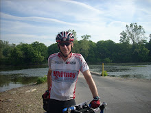
Yes,
its that time of year again…The 31th Annual Whitney Classic Bike
Ride, Summit Adventure’s main fundraising event,
will take place on September 29th-30th .The Whitney is an
adventurous 135-mile bike ride that starts at 3:00 p.m. at Badwater,
Death Valley, California (282 ft. below
sea level), continues through the night and finishes the next morning at the
portals at Mt. Whitney (8365 feet above sea
level). The ride includes three major climbs of 17 miles, 13 miles and 13
miles, two of which by Tour de France classifications are considered “Out of
Category” which to you and me means “really, really steep.” Total elevation
gain for the ride is 15,300 feet.
This is my 13th Whitney!
What, are you nuts? Yes, nuts and addicted to this awesome ride. I love to
ride, I love Summit Adventure, and I love this event. Nothing matches the
awesome course, camaraderie of the participants, and incredible support from the
Summit Staff and volunteers. Many of you have been loyal supporters of Summit all these years. I
cannot thank you enough!
This year I was able to convince 4 other riders
(Michael Atkins, Ryan Snow, Daniel
Tansill, and Carlton van Leuven) to ride uphill, in the heat, and through the
night to join me for this suffer fest! All are experienced riders, but none
have ridden the Whitney Classic as a solo rider. This year will all ride solo for the ‘Full
Whitney’ Audax Style (together as a group). This will be my 7th
Whitney solo effort!
In the past twelve years, through your generous support, we have contributed over $125,000 to Summit Adventure! Thank
you! Here’s where you come in: I have
set a goal to raise $10,000 for this
year’s Whitney. Course income provides
for only 45 percent of the Summit
budget. The rest comes through fund raising events such as the Whitney Classic.
I served as a member of the Summit Board of Directors and know how critical a
successful Whitney is to the financial health of the ministry. Debby, Mark,
Michael and I have all participated on Summit
courses over the years and have been deeply impacted by this great ministry! We
all love Summit.
That’s why I ride!
Please
join my support team and send in your donation today!
(Donate online by clicking
here and indicate ‘Steve Atkins
WC’ in the donor comment box).
Please
pray with me for a safe, successful event. If you have any
questions, or would like to just catch up, please call me at 602-549-5331 or at
home at 480-775-1682. I would love to hear from you. Thank you and God bless!
For years, explorers have searched the globe for The End of the World (EOW). Apparently they did not look along Arizona Highway 177 about 8 miles south of Superior Arizona! Why has its location eluded explorers for so long? Perhaps is it because of its location? The EOW is located at the very TOP of a hill with a 10 percent grade.
The EOW sits at the northern edge of an area known as the Copper Basin. Its steep slopes are known to many cyclists that have ridden the Mining County Century and is one of my favorite training areas!
KEOP (End of Pavement, Kelvin AZ)
With the Whitney Classic only two weeks away, Michael, Carlton and I decided to 'do laps' from the EOW to the end of the pavement on the Kelvin-Florence highway. Our route headed down and south along AZ 177 for 8 miles to the Ray Mine Road, then about 1.5 miles past Riverside AZ to the Gila River, then a short and VERY Steep half mile to the end of the pavement outside Kelvin AZ (KEOP)
Its 10 miles from the EOW (3,600 ft) to the KEOP (1800 ft). With the elevation change and a few intermediate climbs mixed in, one round trip is 20 miles with about 2,200 feet of climbing (according to Mike and Carlton's Garmin GPS computers). With a number of sections of 10%+ grades it is also a great location to check out the climbing set-ups on our bikes.
Carlton and Michael at the EOW Safety Pullout
Carlton picked us up at about 5 am, and after a close call at the Jack-in-the-Box drive through (Oh yeah, the bikes are on the roof rack!) we had our breakfast and were on our way to the EOW. We reached the Safety Pullout at the EOW, unloaded our bikes, and were on the route before 6:45 am.
We were surprised that the temperature was still in the sixties! Mike put on his arm warmers and soon we were descending the steep drop. Hang on, within a few seconds you find yourself speeding down the hill at 45+ mph for 2 miles on a grade of more than 10%. After a short climb, the descent continues six miles past the ASARCO Ray copper mine. We turn right on the Ray Mine Road and roll past Riverside AZ, and the Wilson Trailer Park. The road becomes rough on the approach to the single lane bridge over the Gila River. Crossing the bridge the road tilts way up 14%+ for a few hundred meters then levels off until you reach the end of the pavement. We noted a small fox on the side of the road that had an unfortunate rendezvous with a pick-up truck! We agreed later that there seemed to be an inordinate amount of road-kill this morning! On each successive lap there was less and less of our little friend, as the vultures enjoyed their morning meal!
Near the KEOP looking into the Copper Basin
We made out way back over the river and to the AZ 177 for the 8 mile climb back to the EOW. This morning a strong wind continued to build from the south, so we had a little wind assist on the climb past the Ray Mine. In fact on the last lap, ascending the false flat that overlooks the mine was faster than we were descending.
The last two miles are a very steep 10% grade with sections that reach 12%. Not as sustained as sections of the Portal Road on the Whitney, but steep enough to make sure our climbing setups are dialed in. After the first lap, Michael decided he could use the extra gears, so swapped out his road wheel with a back-up wheel with a 12-34 MTB cog installed. Mike likes to climb at a high cadence and that wheel combined with his compact crank (34/50) allowed him to really spin up the steep grades. Our plan is to start on our road setups and keep our climbing wheels in reserve for the long steep climbs of the Whitney Portal!
This is the last lap, right? Mike with the Ray Mine in the distance.
Each lap took about a little less than an hour and a half, we reloaded our bottles at Carlton's van after laps 1 and 2. Our objective was to ride about 5 hours and when we reached the van on lap 3, the elapsed time on my computer was 4:55. With our time objective met, and the temperatures already over 90 degrees we decided to call it a day. We packed the bikes, toweled off and headed back into town. We decided to stop for lunch, why not continue our the day like we started, so we pulled into the Jack in the Box near Gold Canyon (not the drive through thank you!).
While we waited for our order, a mechanic driving an Empire Machinery truck, came up to us and asked if were the three cyclists he had seen earlier this morning on the climbs by the mine!
They could have easily done another lap!
We headed home after a very successful morning to continue our weekend. The Whitney Classic Fundraiser is just two weeks away. Our last event specific training ride will be this Wednesday night. We will put on the lights and reflective gear and ride Carlton's Beeline/Saguaro Lake/Usery Pass 100k populare route. We will start at 8 PM and should complete the ride ride a little after midnight to simulate the heat and darkness that we will encounter during most of the Whitney!
If you have joined our support team, thank you very much!!!
If you would like to support us, click here to read more about the ride or simply click here to go right to Summit Adventures Donation page (enter S.Atkins WC in the donor comment box).
With the Whitney Classic only a few weeks away, Michael and I have been dialing up the distance and climbing. Last week we worked in an 85 mile ride from Mormon Lake to the AZ Snow Bowl from the St. Timothy's Father/Son camp out with our Whitney teammate, Daniel Tansill. This week, we put the High Country 200km Brevet on the training plan. Another Whitney teammate, Carlton van Leuven had signed up so we were looking forward to riding with him and getting some distance and climbing in.
We headed up to Show Low Friday afternoon and checked into our room near the start and drove through town looking for a spot for the pre-ride meal. We stopped into the Elements Bistro (tiny cafe that started dinner service on Friday/Saturday nights only a few weeks ago). We had the place to ourselves. They did not have any PKU friendly items on the menu, but Michael, our waitress, and the chef combined the vegetable of the day (zucchini and squash) with the special (spaghetti and meatballs) to make stir fry veggies over pasta with marinara sauce! It was great.
The Ride
We were up at 5, packed, coffee'd and at the starting line at 5:30. The ground and roads were very wet from some heavy overnight rain. It was cool at the start so we pulled on the arm warmers for the start.
All smiles at the start
Paul Layton, today's Trail Boss, pre-rode the course on Friday and was doused with heavy rain. He noted in the pre-ride briefing that historically on this ride, if the pre-ride is dry then the event is usually wet. Since he was hammered with rain, our day should be dry. We packed our rain jackets anyway, but his prediction was correct and our rain jackets stayed stowed all day.
Paul Layton - Trail Boss
Some of the usual suspects, Roger Peskett and Russ Cummings, were at the start and at precisely 6 am, we were off. We soon formed the lead group with Roger, Russ, and Kevin Arps.
The Lead Group, Kevin, Roger, Russ, Carlton
Just outside Show Low after a pull a the front
About 45 minutes into the ride, Carlton flatted (small rock from the wet
roads) and the group went on while Michael and I helped Carlton change
his tire. The middle group of riders went by while we were stopped, but we were soon back on the road.
After Carton's flat
After Carlton's flat we rode as a three man group. The first checkpoint was the small store in Vernon. Since the store was closed, our ever-present Trail Boss was there to sign our cards and refill our bottles. The middle group was checking in and left a few minutes after we arrived. The riding was spectacular with lots of rollers and sweeping views. We caught the middle group somewhere in this section when they pulled off at the top of a roller to peel off a layer. With the sun up, it was starting to get a little warm. We made great time to the twin cities of Springerville/Eager. We stopped at the Eager Circle K to reload our bottles as Kevin rolled in. We left together to climb the hill outside of Eager. It was a steady climb of about 8 miles. It was very warm on the climb. As we neared the top, a group of very enthusiatic young women leaned out of the window of their car as they passed shouting "Venga, Venga Venga!"
Paul and Mike at the Top of the Big Hill
Paul set up a SAG stop at the top of the hill on the road outside the scenic view. We reloaded our bottles, had a quick snack and were back on the road. Our Italian fans had stopped as well and shouted additional words of encouragement. We shouted back Buon Giorno! and were on our way.
Most of the climbing is behind us!
With the climbing behind us we were treated to more sweeping views on a grassy plateau at 9000+ feet elevation. The only drawback to this section were the very annoying, rough, and wide frost cracks on the road. It was about 5 miles of punishing road surface (AZ 261), but with little traffic and great views, we could endure the pounding. Soon we turned on AZ 273 toward Big Lake and the road improved considerably. As we approached the turn off to the Big Lake check point, we waved to Russ and Roger, already on their way back to Show Low.
Mike on the rough section
AZ 261
The checkpoint is the general store at Big Lake. It had more camping and fishing tackle than food, but we found some Campbell's soup (cream of mushroom for Mike and Carlton, I dined on a can of cream of chicken) in pop top cans that made a very tasty lunch. At about 300 calories per can, loaded with sodium, and served at room temperature they were consistency of pudding. A perfect brevet lunch!
Kevin rolled up as we savored our meal. We took a somewhat leisurely time with lunch and Kevin left just before we decided to get going.
Lunch at the General Store
Big Lake AZ
A great day at Big Lake
The road surface on AZ 273 was great; a good shoulder with light traffic. As we left Big Lake we cheered approaching riders as they made their way to the checkpoint. The next 16 miles from Big Lake back to AZ 260 were very nice, the wind picked up but the scenery was great as we passed the trail heads to Mount Baldy and rode past the Sunrise Ski Resort. Once on the 260 our quartering headwind became a tail wind and we started the long descent back to Show Low (2500 feet over 38 miles). We rolled through McNary and decided to make one last stop at the Hon-Dah convenience store just outside Pinetop. With our bottles filled and a quick snack we pointed our steeds toward Show Low and covered the last 17 miles in less than an hour in somewhat heavy Saturday afternoon traffic.
Paul Layton was at the finish when we rolled in 8 hours and 38 minutes after we started. Thanks again to Paul, he was ever-present to support the riders and pre-rode the course alone on Friday to support the randonneurs and be the Trail Boss on Saturday. He took care of our paperwork and we packed up. Carlton had an extra O'Doulles for Michael so we toasted our success in the parking lot, cleaned up and headed for home.
We all agreed that this was a fantastic route, in perfect weather, with great friends!
With Michael's high school graduation, house painting, and floor refinishing behind us, this weekend looked like a great chance to get away for a long ride. The Arizona Randonnuers had a combined 300km/600km event starting in Flagstaff and featuring a tour of the Grand Canyon. With the requisite honey-do chores completed, I signed up for the 300km event. So on Friday after attending a high school graduation party, I loaded up the Mini and headed north to the Flagstaff and the Woodlands Mall Motel 6!
Arriving about 10 pm I checked my Blackberry and saw a post to the AZRandon group from Carlton. After he unpacked and set up his bike at the Motel, he noticed two large rim cracks. He sent out a post hoping someone brought along a spare wheel. Luckily Dan Fallon had not yet left home from Prescott and brought along a spare and Carlton fitted it with his cog set early Saturday morning before we started.
It was a relatively small turnout of riders (12) for both events. The 300km event generally followed the same course for first loop of the 600km so both groups started together. We formed into a nice pace line of about 6 riders and were soon at the first control in Valle AZ. Other than an uncomfortably close pass by some knot-head in a pickup truck (with mountain bike in the back!) traffic was light and the weather was perfect.
Calton reloads the gear on his ride in Valle
Our group had split on the descent onto the Kaibab Plateau but we reformed at the control in Valley and worked well together all the way to the park. Lots of folks were heading into the park so we took a place in a lane. Dick had a Golden Eagle pass (usually good for 4 riders), but the park ranger let us all through on Dick's card, saving each of us the $12 bicycle entrance fee!
Dick using is Jedi magic..."These aren't the riders you are looking for...Move along!'
Perfect morning ride!
Carlton and I were the only two members of the group on the 300km. The 600km route continued to Hermit's Rest, our course took us to the Marketplace Store for the next control. We purchased some food and enjoyed an early lunch in the shade of the store. We couldn't help noticing the increasing heat and wind.
Enjoying the last of the cool weather.
We left the Marketplace and headed east along the Rim Road to the next control at Desert View. The Rim Road is not as heavily traveled as the road from the main entrance, has a good road surface, lots of rollers (relatively short climbs and descents) and has great views of the Canyon. But after 24 miles of increasing heat and cross winds it was starting to take its toll on me. When we rolled into the control at Valley View, Carlton made some derailleur adjustments and we enjoyed the first Popsicle's of the day.
Watchtower at Valley View
The East park entrance is just a few miles from Valley View and soon we were on the long hot descent into the town of Cameron on the Navajo reservation. Leaving the pines behind, soon we were on the high desert of the Navajo Reservation. With the Painted Desert just barely visible in the distance, we fought nasty cross winds with an occasional tail wind all the way to Cameron. At just over 4200 feet above sea level, we had dropped 2500 feet out of the tall pines at the South Rim over the last 50 miles. Turning right into a hot fierce cross/head wind, we had 53 miles to regain 3000 feet of elevation before dropping into Flagstaff and the finish line.
There are few services along this stretch of road, and with the Anasazi Inn 'only 8' miles up the road, we passed on refilling in Cameron and headed south. The winds were incredibly strong in this section, mostly cross winds that tried to push us back into traffic. With a narrow shoulder and heavy traffic we both bore the brunt of it and started the grind up Grey Mountain. Pulling into the Anasazi Inn, I think my arms and shoulders were more fatigued that my legs from fighting the cross-wind.
Shade and shelter from the wind at the Anasazi Inn/Store
While we were reloading our bottles and enjoying a Popsicle, a motorcycle rider asked us if the winds were as bad for us as they were for him, and he was heading north! We pushed out back into the wind. Along this section the shoulder widened, and I was able to tuck in alongside of Carlton as he dragged me along somewhat sheltered from the wind. We stopped at the only other store before reaching Flagstaff and just before the cutoff to the Watapaki National Monument. It also had benches, shade and shelter from the wind so we grabbed more water and Popsicles! The real climbing started here so when we left I told Carlton to climb at his own pace and not worry about hauling me up the hill. I settled into a steady pace and concentrated on drinking and eating to try and recover. With the gain in elevation it seemed a little cooler and the scrub pines provided some wind break.
We reached to the top and started the descent back into Flagstaff. The first services were available at a Chevron Station 13 miles from the finish. I pulled in starting to feel better with the dropping temperatures and found Carlton sitting by his bike. He looked up and said " I feel as bad as you looked back there!" We reloaded our bottles, I downed a Frappachino and recommended Chocolate Milk to Carlton. With the sun nearing the horizon we pointed our steeds toward the finish and rolled in to the Motel 6 at 7:55 pm.
It had taken over 5 hours to cover the last 43 miles!
Ryan Guzy was this event's trail boss and he had an awesome spread prepared at room 249! Soup, pasta, and I daresay a craft beer or two. We enjoyed a meal, regaled in tales about the day, and packed up. Just as I was leaving 4 riders on the 600km event rolled in for their half-way check in and meal.
I bid them good luck and headed down the hill toward home. A beautiful full moon was up and part of me wished I was out there with them on the 600, but I must say another part had had enough and was happy to be on my way home!!
Thanks to Ryan and Susan for organizing a great event, and Carlton for putting up with me on another long ride.
or How I spent Good Friday with 3 great Mormon Guys!
Ride Report
6-7 April 2012
What the heck is a Fleche? It is a 24-hour team Randonneuring event held on or around Easter weekend. No rest stop may be longer than 2 hours. Allowable start
times are from noon Thursday through 10 AM on Saturday. A minimum of 360 km must be covered during the
event. Multiple teams start from various locations and all finish at one location the same time. One additional 'feature' of the event is that the teams must be at a penultimate checkpoint on their route 2 hours and 20 kilometers from the finish. This rule helps to synchronize the finish of the various teams. This was the first year a Fleche was held in Arizona. Two teams formed; one riding from the Grand Canyon to Tempe (Extreme Picnic Society); and the second, consisting mostly of Mormons (Mormon Batalion), riding a loop that started at the finish location (The Boulders Restaurant/Bar).
Curt, Paul, Steve, and Carlton at the start
On the 400k Brevet, Carlton mentioned that he was putting together a team of Mormon guys for the Fleche, and still had an open slot or two and would were open to Hindus, Protestants, and even Catholics joining the team. I told Carlton I was in. Carlton and Paul designed a team Jersey based on the flag carried by the Mormon Batalion in 1847. (In case you are wondering about the spelling of the team name, it is based on this flag carried by the BATAlion).
I knew this was going to be tough brevet since I would be responsible for all the team coffee and beer consumption during the event. At the start, I was given the unofficial moniker of 'designated drinker' and we were on our way!
Interesting Roadside artwork in North Scottsdale
Our route took us north through Scottsdale toward Pinnacle Peak. We made great time and decided to take a rest stop at the Pinnacle Peak Grocery Store. Since we were riding only 360 kilometers with a 24 hour time limit, and we were riding at a good pace, we ended up needing to take longer and more frequent breaks to prevent us from getting too far ahead of schedule. It made for a nice pace and long breaks that were conducive to more 'human' food along the way.
Our route took us down 9 mile hill, through Rio Verde, to the first official checkpoint at the Denny's in Fountain Hills. Since it was Good Friday, I ordered Clam Chowder
and fries. Carlton and Curt ordered the same, not realizing they were doing their part for interdenominational harmony! I used the Rusa.org time calculator so we knew when the
checkpoints would 'close' so we didn't get too far ahead of schedule. We
had plenty of time, refilled our water bottles and headed out the Beeline highway toward Saguaro Lake and Bush Highway.
Paul on Bush Highway near Saguaro Lake
Curt powering up Bush Highway
Paul and Carlton enjoying the fresh pavement on Usery Pass
Paul put together the route for the team and lives in the area. He guided us to the Usery Park visitor center with a water fountain to refill our bottles. It made for a very pleasant stop and gave me a chance to start adding layers as the sun was starting to set and the temperature was beginning to drop. We were able to continue all the way to Gold Canyon and the next official checkpoint without having to stop again...that is for water.
Carlton and Curt at Usery Park
Our route took us to the US-60 outside of Apache Junction. The sun had set and we had our lights and reflective gear on. At this point the route is a divided four-lane road with wide shoulders. Unfortunately; it had lots of uneven pavement (recently resurfaced), tons of debris that included a dead owl (most likely hit in mid air by a passing vehicle) that seemed to stare us down, and something sharp that punctured my front tire just a mile before the checkpoint in Gold Canyon.
We stopped at the Red Sage restaurant for dinner and we enjoyed more of Clam Chowder. Much better than the Denny's version. It was a fun local restaurant nestled in the heart of a retirement community. I don't know the average age of our team, but I certainly wouldn't call us young. But it was a crack-up when one of many curious patrons said it was nice to see such a 'clean-cut group of young men' out on a bike ride!
We rolled through Florence AZ (well lit by the various houses of Correction) and noting that we were again an hour ahead of schedule rolled into a Burger King. We were fortunate that the manager let us in the dining room (we arrived at 10:05 and it closed at 10:00 but she said we could stay inside until the drive-though closed at 11:00). Curt made a bike repair and we all enjoyed a snack.
Curt enjoying an ice cream after his bike repair
A mini-PBP scene; eating, sleeping, and chilling in reflective gear
Next stop; Casa Grande and where else for the next checkpoint: Denny's! We arrived with nearly two hours to spare, so we enjoyed another meal and ending up snoozing in the booth until the Drunk Rush started to fill the restaurant at 0230! Carlton's cousin is a member of the police department and was able to stop by visit with the team as we were paying the bill. Ready to go, I grabbed my bike and noted my front tire was flat again! Paul headed up the road while I put in my last spare tube, and Carlton's cousin headed out, with great haste, to respond to a burglary call!
Getting a little drowsy in Denny's - Casa Grande
By now traffic was very light, but it was becoming more than a little cold. I thought I had brought way too much gear, but by the time we left Casa Grande I was wearing every thing I had brought along and was still chilled. We even stopped at the Walmart so Carlton could buy beanie cap, no they don't stock winter wear this time of year, so he went on without one. It was especially cold around the irrigated fields that surround Maricopa.
We rolled into the next checkpoint (Circle K) in Maricopa shivering! I went right to the coffee pot and hot dog grill (now about 5:00 am and Easter Saturday) and enjoyed a hot brevet breakfast. We all plopped down around the soda fountain and enjoyed a break on the floor. Its always fun to see the reaction of folks walking and seeing Randonnuers sprawled out on the floor of a convenience store!
"A table for four please, oh no tables, the floor will be fine thank you!"
Since Carton's house was just a mile or two off the route and very near the 22 hour checkpoint, he offered several couches and the floor of his home theater for a rest stop. That was a good thing, since the temperature really dropped when we left Maricopa (just before dawn) and we were quite chilled. Again a little more than an hour ahead of schedule, we were able to stretch out and grab a snooze for about an hour before checking in at the 22 hour checkpoint (an Arby's) and getting a receipt for proof of passage.
We rolled through Chandler and Tempe to the finish line at The Boulder's Restaurant and Bar. We arrived at a little after 10:00 am and the other Fleche team rolled into the parking lot just minutes after we arrived.
The Boulders is very bike friendly and even has an indoor bike rack. Our waiter gave us all date/time stamped receipts so we could officially end the ride (10:25) and begin the celebration. Friends and family from both teams joined the fun, food and festivities. We shared stories from ride and had a great time.
Doing my duty for the BATAlion with Joey and Ryan from the Extreme Picnickers
It was a great ride with awesome teammates! Normally at the end of a Brevet every one files in at different times. With the Fleche format, all the participants arrive at about the same time and that made the finish (always a relief) very enjoyable indeed.
Paul Layton writes a great blog and he has his side of the story here.