Tuesday, March 16, 2021

2021 Arivaca 400km Brevet

Ride Report

March 6, 2021

Sunset on E. Sahuarita Road

A bakers dozen of randonneurs turned out for the 2021 editions of the Arivaca 400 and 300 brevets. Still in COVID protocols, this would be a 'no touch' brevet with electronic sign ups and ride verification. Frankly, we think the new protocols simplify the process and make it easier on the riders and organizers. Hopefully the new rules will stick when we get back to 'normal.'

Our hard-working Regional Brevet Administrator Mike Sturgill pre-rode the 400 earlier in the week, and was back to ride the 300 with Canadian hard-man Stephen Kinney. The 300 follows the same route for the first 100 miles to Amado, so both groups would start together.

Mike Sturgill gives the pre-ride brief

Since the ride starts at 0600 we decide to book a room near the start in Marana for the night before, and night of since we expected to finish around midnight. The cheapest alternative was the Super 8 and it was anything but 'Super.'

Winds were predicted to be heavy in the early part of the ride (15-25 mph gusting to 35-40), and mostly unfavorable cross-winds. Leaving the hotel for the ride across the street to the start, the flags were already standing straight out!

Mike provided the rider brief, we turned on lights and GPS units and were off at 0600. The route snakes through the north end of the Saguaro National Park through Picture Rocks pass. Mostly heavy cross-winds until we reach the top for the run down to Picture Rocks. The wind is on our tail, we are rolling at 35 mph, and its totally calm.

New pavement on Sandario Road!

Lights blazing!

We quickly reach Picture Rocks and turn south, and are treated to a micro abrasion treatment from the desert sands flying in the 30 mph cross-wind. At least Sandario road was recently repaved! Its 15 miles to the next turn so it was quite a slog to AZ86. We are in a group of 6, but there is little relief from the cross-wind!

Baboquivari Peak in the distance

Turning right on AZ86, its slightly downhill with a tailwind for some relief for the next 6 miles to Three Points. Those miles flash by, and we turn south again for more cross-wind for the next 32 miles on AZ286. 

We pass the Border Patrol checkpoint with the group. Its unmanned, after the ride we find out that many of the agents have been called to the border crossings in the large towns along the border. Its 3 hours into the ride, and with at least 15 hours to go we decide the pace of this group it just too fast. We drop off the back with about 15 miles to go to the control in Arivaca and dial the pace back about 25%!

Traffic is light and we are able to enjoy the wide open views including Baboquivari Peak and Wilderness area. We are also riding through a nature preserve that is usually teeming with 'Birders,' not so this year, another COVID impact.

The fans really turned out in Arivaca!

Turing onto Arivaca road, the wind is back on the nose, but it is much lighter than earlier. The road surface is rough and consists of patch on patch on patch. Including some brand new 'patches' that consisted of loose piles of asphalt tossed (not compacted) into holes just a few days earlier. The fresh tar was quite a mess, sticking to tires, frames, and legs!

The road surface didn't bother the cows grazing on the roadside just outside of Arivaca, and they seem only slightly curious as we ride by!

Stephen Kinney enjoys his lunch

We roll into Arivaca to find the A team just finishing their lunch. We go inside to grab some food and drinks, and they are gone by the time we finish our selection and get through the checkout. We plunk down on the sidewalk for our lunch and bottle refill. Arivaca is hopping with tourists and artisans, and the smell of the killer weed (now legal in AZ) was definitely in the air!

We finished up just as another group of riders rolled in. The legs are starting to stiffen, so we make the decision to push out alone for the run to Amado and the I-19.

Longhorn Grill in Amado

The road surface is much improved, and after a few miles of climbing, it is a spectacular ride with rollers that generally descend to Amado. Its wide open with great views, and not a cloud in the sky. We pass another Border Patrol checkpoint. The lone agent waves us through and we continue to the most photographed sight in Amado, the Longhorn Grill. Its open, but we have many hours ahead, so take the obligatory photo and continue on!

The route follows the I-19, mostly on the frontage road toward Nogales and only a short section of 1.5 miles is on the highway shoulder.
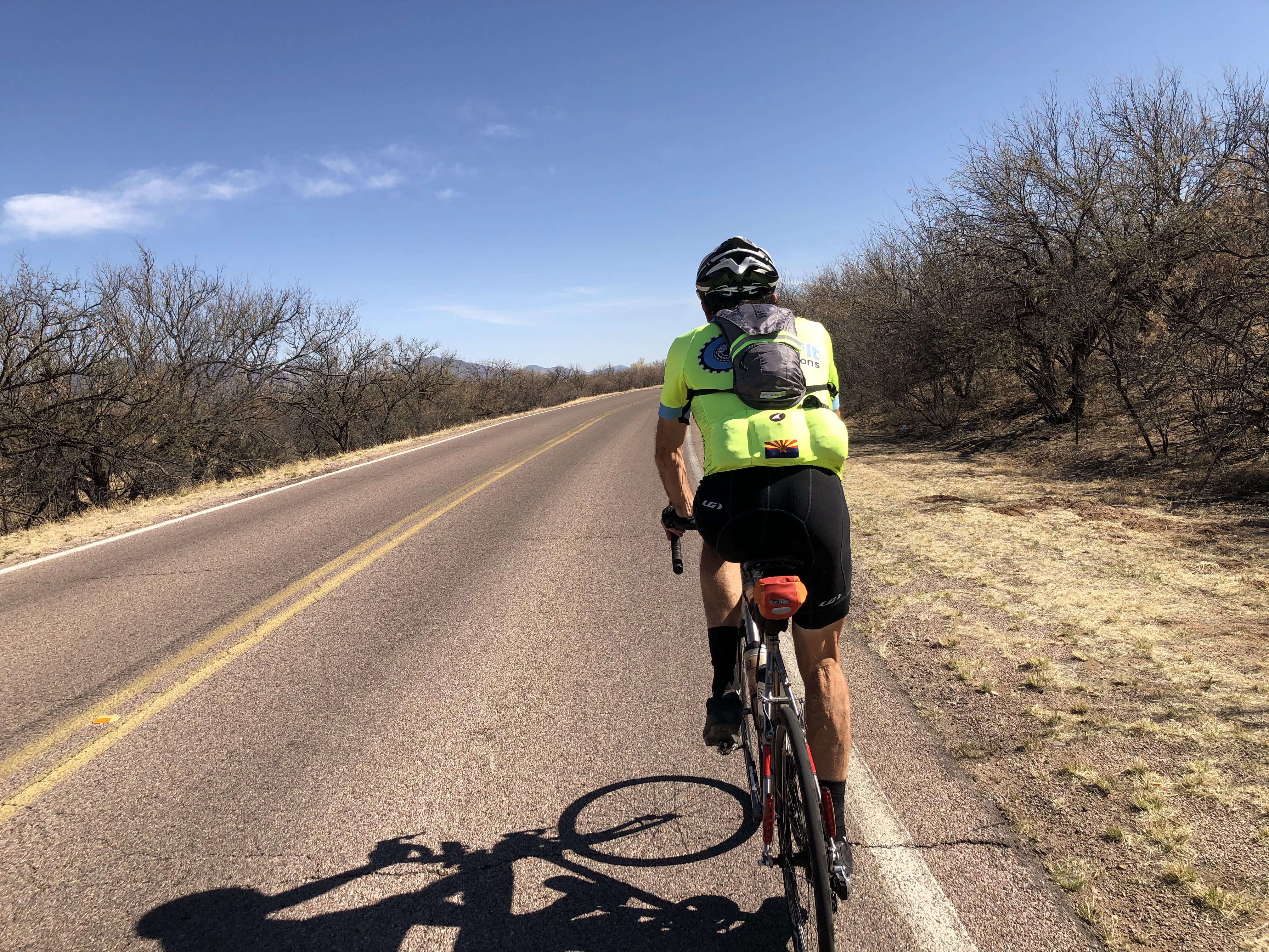
Roger Peskett leads out on River Road
Between Tubac and Rio Rico, we spot Roger Peskett up the road. We are riding the same pace, but dial it up a bit and catch him just outside Rio Rico. We stop at the convenience store to refuel and reload supplies before heading out. The route heads northeast toward Patagonia and the next control in Sonoita. But first some sharp rollers on Pendelton Road, then easy pedaling on River Road before joining AZ82 to start the climbs to Patagonia and Sonoita.
Ward Ranch near Patagonia

Shrines at the Ward Ranch pullout

We pass the Nogales International Airport and the legs are feeling the effects of the morning effort, and we drop off the pace as Roger continues up the road. We take a break at the Ward Ranch Historic Monument pullout before continuing through Patagonia.

High desert grasslands near Sonoita
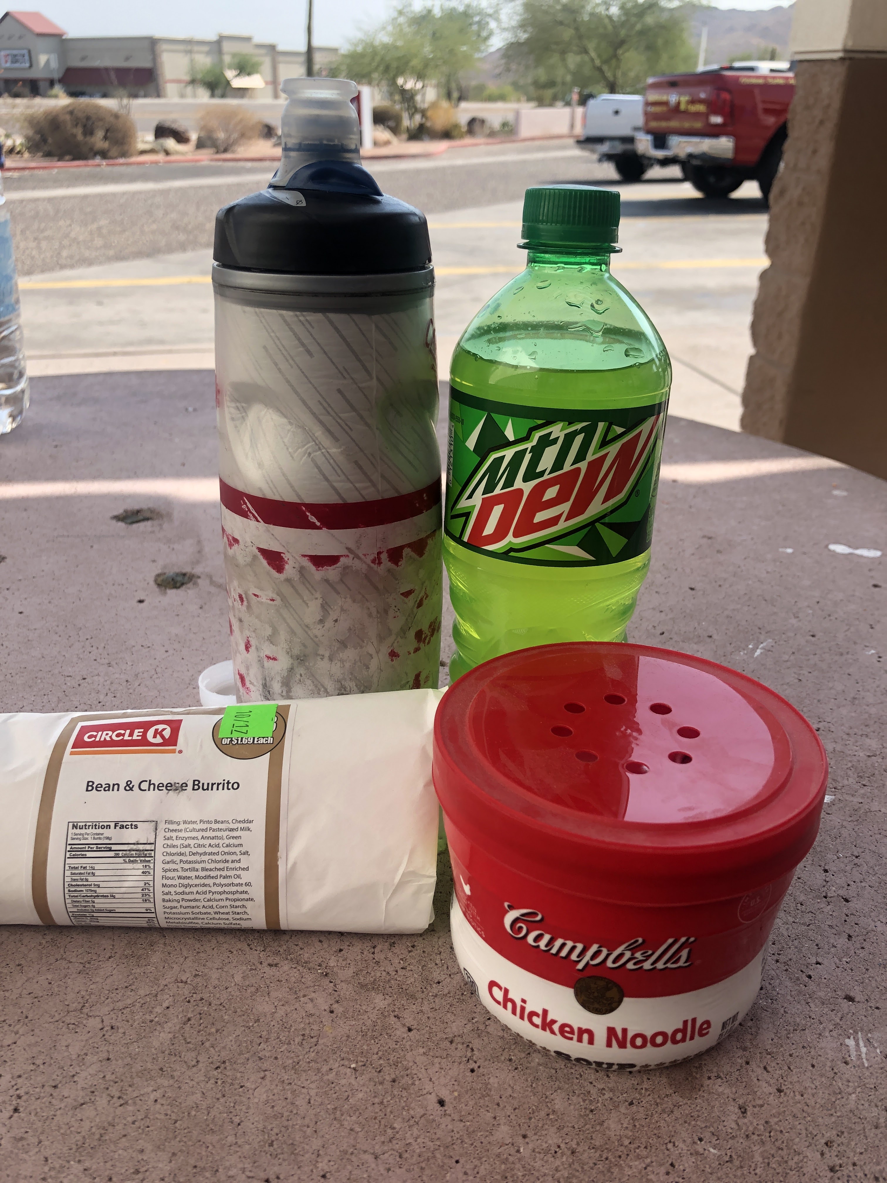
We are still on pace for a midnight finish and should make Sonoita and the descent toward Tucson before it gets dark. Nearing Sonoita, Catherine Dickson powers by with two other riders. We pick up the pace and try to tack on, but no dice! We'll see them again rolling out of Sonoita, as we settle in for a canned soup dinner on the Sonoita Dollar Store sidewalk!
New pavement on Sahuarita Road!

We push out of Sonoita at 1715 with plenty of sunshine. We pass another Border Patrol checkpoint, this one abandoned too, indicating only 2.6 miles to the summit.  We hit the summit and start the 12 mile descent. The sun has set, but there is still plenty of light, and we head down dodging the rumble strips before the sharp turns. By the time we reach Sahuarita Road, we are relying on the lights to see, and enjoy a glowing western sky for the 20 mile run to Sahuarita and the next control. 

More fresh pavement, and with a slight tailwind, we make great time and pull into the McDonald's for dinner. Two cheeseburger meal (one for the pocket) and a McFlurry and we push out for the last long climb up Helmet Peak road. Traffic is light, but we are riding back into the desert and with no moon, its totally dark and hard to measure progress on the 6.5 mile climb. Finally we see the stop sign near the top and climb to the summit at the Helmet Peak fire station. We stop to put on the knee warmers and roll on only a few hundred meters before stopping again. The temperature is 55, but with wet kit and wind chill, its quite cold. We put on the rain jacket under the reflective vest to cut the wind, it does the trick and we enjoy more smooth roads through dark desert with the lights of Tucson in the distance.

Reaching the lower elevations and heat island of the city, it warms to 63. We stop at a Circle K for another snack and keep the coat on expecting the temperature to drop as we enter the Tucson Mountain and Saguaro National parks. The temperature drops again as we hit the rough roads through the Tucson park. Turning into the Saguaro National park the road surface is fresh and the nighttime views are stunning. We try to take a few photos, but not enough light for my iPhone 8 to pick anything up. Time for an upgrade? A slight tailwind helps as we continue north and down Sandario road. We roll through Picture Rocks, and a few miles of old pavement, before we turning east and south on Twin Peaks road, over Rattlesnake Pass, and the finish.

We roll into the finish at the Marana Starbucks 38 minutes into Sunday morning and are happy to put this one in the books! More canned soup and an ice cream from a nearby convenience store before a shower and crawling into bed at the 'Super' 8, and this day is done.

Steve Atkins

Click here for GPS data

Thursday, February 4, 2021

2021 Vulture Mine 300km Brevet

February 2021

Pre-Ride Report

Sunrise on Cave Creek Road

This report is for the pre-ride of the main event to be held this Saturday, Feburary 6, 2021. Mike Sturgill will be the trail boss and I joined him for his pre-ride to check out the course.

Morning traffic on Cave Creek Road

We pushed out from Mike's house (just around the corner from the King Coffee Roastery) at 0700 and headed into the morning rush hour traffic on Cave Creek Road. We were treated to an awesome sunrise! Traffic thinned as we continued north, and turning onto Sonoran Desert Drive, we had the road mostly to ourselves. 

Several hot air balloons were launching and were quite the sight in the morning dawn. This area of the valley is not yet developed and is a great place to ride. We connect to the Carefree Highway (Gordon Lightfoot wrote a song about it!) and continue westward. Just before the I-17, and the last chance for food/water for the next 40 miles, the road becomes extremely rough for a hundred meters or so. We joked that if anything was going to come loose on the bikes, it would be now. Luckily nothing did!

We are good on water and so continue on AZ-74 past Lake Pleasant and onto the 25 mile run to the US60. Passing Lake Pleasant, we wondered what river fed into it. I guessed (incorrectly) the Hassayampa River (it runs through Wickenburg). Near the end of the ride Mike will guess again, and confirm after the ride that the Agua Fria river feeds Lake Pleasant.

Mike leading the way on AZ 74


Light traffic on AZ74
Such are the pressing issues that need to be sorted out on a brevet! The road surface was good, however the shoulder became rough in a few spots so we rode the fog line when necessary. We make the turn on US 60 (wide and smooth shoulder) and soon are at the first control in Wickenburg. We make a quick stop to refill the bottles and strip off a layer and are back on the road.

Passing through Historic Wickenburg

Vuture Mine Road
Its a few rollers to  the 'summit' of the ride near Vulture Mountain. There is no paved shoulder, but very little traffic on this stretch of open road. The gravel shoulder has been recently regraded, so if you happened to drift off the pavement it may not be as catastrophic as my ride on this brevet in 2016 (click here for that ride report)!
Vulture City Ghost Town

Nearing the end on the 20 mile run on Vulture Mine Road

Its a long gentle descent on Vulture Mine Road, winds were light as we were able to hold speeds of 20-23 mph most of the way. The road jogs right on Indian School road toward Tonopah, before heading south again.

Nearing Wintersburg; Palo Verde Nuclear Station in the distance

Wintersburg Mercantile

Taking a break in the shade

We roll into the Wintersburg Mercantile at 104 miles into the ride. We grab sandwiches and take a short lunch break in the shade.

Fields in Palo Verde

Back on the road its past the many coops that house the Hickman Egg Farms. The wind was right on the nose, which was OK, since those coops emit a really foul stench!

Connecting with Old US 80, we are back in wide open farm country. Cattle feed lots and dairies alternate with alfalfa fields providing many aromatic contrasts! We turn north and cross I-10 again and  begin the steady climb toward Surprise on the Sun Valley Parkway. 

The first third of the 20 miles is on fresh pavement with a wide shoulder. Neither of us commented on our good fortune, for fear of jinxing it! Later it reverted to older pavement with some frost heaves, but not too bad. With four lanes and light traffic it was just fine.

As Vulture Peak again came into view, the route finally turns east and we stop at the Canyon Springs  Store. We both needed a sugar and caffeine break and found just the ticket inside! Add some chips and we were ready for the last 40 miles of the route.

Oh yeah, this will dew!

More excellent pavement on the descent into Sun City, then its a tour de Retirement Community as we travel through the various iterations of Sun City. Tidy yards, golf courses, and tricked out golf carts dominate the landscape as we continue eastward into Phoenix.

On the Agua Fria Bridge on Happy Valley Parkway

Its again rush hour, but the roads are good with bike lanes, just the normal need to watch folks turning right without checking the bike lane as we make our way through town. We spot a few hot air balloons in the distance as we cross the Agua Fria Bridge on Happy Valley Parkway. Mike wonders if its the Agua Fria that feeds Lake Pleasant. After the ride, he confirmed it in an e-mail:

I just learned something about our valley rivers. It's the Agua Fria that sources Lake Pleasant. It continues to flow south and dumps into the Gila down by PIR. I also saw that the Salt dumps into the Gila right where we cross it when we ride by PIR on AtB 400k. The Gila, then, flows all the way to the Colorado in Yuma. The Salt River is formed by the confluence of the White & Black Rivers in the White Mountains. The Verde also flows into the Salt down by the Bush Hwy. The Verde River starts all the way up in Prescott Valley near Paulden. Sycamore Creek flows into the Verde just north of Clarkdale.

Major lakes formed by our rivers:
    - Lake Pleasant: Agua Fria
    - Roosevelt, Apache, Canyon & Saguaro Lakes: Salt River
    - Horseshoe & Bartlett Lakes: Gila River

Back to the ride...We roll into Mike's neighborhood just as the sun set to put this one in the books at just over 11 hours. Good day on the bike with great company, thanks Mike!

Steve Atkins

Click here for GPS Data


Sunday, January 3, 2021

2021 Saguaro Lake 200km Brevet

Ride Report

January 2021

Salt River below Saguaro Lake

Mike Sturgill gives the rider brief, at a distance!

A dozen or so randonnuers gathered in Fountain Hills Arizona at the Safeway parking lot before dawn on 2 Jan 2021 to welcome in the new year, and a new brevet season. As has been the tradition of late, multiple distances were on offer (100 and 200 kilometers). Since the route is the same for the first 100 km we all rolled out together at 0730!

Because of road construction on Fountain Hills Boulevard, discovered in the pre-ride, the route was adjusted to avoid that construction, and with it the notorious rollers to Shea. Instead it was a gentle descent into the increasingly cold air as we neared the Verde river. Along the way, a few riders mentioned that the steep rollers would have at least given us a chance to warm up!

Mike riding into the dawn on Bush Highway

Finally reaching the Verde river (and a temperature of 28F) the road tilts up, and with the steady incline and occasional patches of sunshine we finally begin to warm up. Mike and yours truly, took the front in double paceline fashion and started the climb. A few miles into the climb, we realize we are off the front and on our own! It was our haste to warm up, and in deep conversation about various tax impacts of retirement, Social Security, and ACA strategies, that separated us from the group!
At the top of Usery Pass

Still distracted by our nerdy old guy conversation, suddenly we are at the Bush Highway turnoff for the downhill run to the Salt River. Traffic is light and soon we are up and over the Usery Pass climb. In past rides, a staffed control would greet the riders at the top of the pass. Alas, this is a COVID "touchless" brevet, no support, so we roll over the pass at speed taking a photo for 'proof of passage!'

Along the Bush Highway

Approaching the King Kong descent

We roll down the backside of Usery and back to Power Road/Bush Highway to begin our journey back to Fountain Hills. Still very cool, and with both bottles still nearly full, we decide to press on without stopping for refills.

Back on the Beeline, we enjoy the gentle downgrade at speed and find ourselves back at the start. 'Normally' the brevet entry would include a 6" Subway Sandwich at the half-way point, but with COVID.... you get the picture.

Mike pre-rode the 200 last week and had other plans for the afternoon, so we said our goodbyes. After reloading the water bottles, grabbing some food, and stripping off a layer of clothing, its back out of the Safeway, riding solo for the second half of the 200.

The route climbs Palisades Boulevard and takes a bike easement through the hills and a gated community to connect to East Via Linda and Scottsdale without having to risk riding on Shea Boulevard, very nice!

Not a Care in the world!
Its a long gentle climb up to Carefree Arizona, and the second control for the 200k! Its a popular bike route and there are many riders out on the road. Still somewhat cloudy, and cool, the temperature actually dropped as we gain 1250 feet over 16 miles!
A bit cloudy to read the sun dial!
No need to reload at the control, so squeeze off a picture and keep rolling. We do decide to check the time at the Carefree sun dial, but with the a cloud obscuring the sun, we have to rely on the Timex!
Oops!

Apparently our kind was not welcome at the sun dial!

The start of Nine-Mile Descent
Back on Pima, its a gentle downgrade as we head toward Dynamite Road. We wave at other riders on their way to Carefree before taking a left and a short climb before the big payoff of the day, the Nine-Mile Hill! Payoff, because its 9 miles of downhill, and at 20-35mph, it goes by fast!

At the bottom, its 12 miles of easy rollers back to the finish through Rio Verde and the McDowell Mountain Park.

A bit cold at the start, but warmed by reconnecting with fellow randonnuers, and rewarded with great company and weather throughout the day. It was a great way to start the new year. 

Next up, the Bartlett Lake 100/200, come join us, check out the details at https://azbrevet.com/

Steve Atkins

Click here for GPS data


Tuesday, October 20, 2020

2020 Desert 600km Pre-Ride


Crossing the Verde River on Day 2

Ride Report 

October 2020

The Kitt Peak 600 was scheduled to go in March of 2020, but fell victim to COVID when the Kitt Peak road and observatory was closed. Also shortly thereafter, RUSA (Randonneurs USA) cancelled all events as the pandemic caused lock-downs across the country. In September, RUSA reopened events up to 300km and in October gave approval for events up to 600km.

Great news for those of us wanting to complete the full brevet series (200, 300, 400, and 600km) for 2020! Working with our regional Brevet Administrator, Mike Sturgill, we knit together a route that combined the Around the Bend 400 and a new 200 that started near 24 hour services and affordable hotels. Early drafts used the title Desert 600 and it stuck. Like the Kitt Peak series, we plan to offer routes of 100, 200, 300, 400 and 600 on October 24/25. 

REGISTRATION IS OPEN AT WWW.AZBREVET.COM

Volunteers can pre-ride the course to check the route and be able to support the riders on the event day and still get credit for the event.  I will be supporting the event, this is my pre-ride report.

 Day 1

Circle K control in Chandler at the start

Weather was predicted to be unseasonably hot (highs in the low 100s) so we pushed out at 4 am. Temperatures were cool and the dogs were still asleep passing through Komatke/St. Johns on the Gila River Indian Reservation. The route uses St. Johns road to avoid the heavy traffic on 51st Avenue and Laveen. Skirting the edge of town, mostly through farms and dairies (that are slowing giving way to new home developments), we find ourselves at Phoenix International Raceway.

PIR at dawn

Flag shop and museum near PIR

Its all quiet at the raceway and we press on westward toward and through Estrella. Back into the farm country, the route follows farm roads to the next control in Buckeye Arizona.

Circle K Control in Buckeye
Cool temps and a pre-dawn start mean that the water bottles were finally needing a refill, so we make our first stop at the control in Buckeye, 57 miles into the ride. The route continues through main street Buckeye then back to the farms and dairies as we head toward Gila Bend.
Trump country!
The route continues past AZ85 and takes a slightly less direct, but infinitely more enjoyable route on Old US80 to Gila Bend. We stop in Arlington and note a Trump display using an old limo!
Deer enjoying breakfast near Gillespie Dam

Gillespie Dam Bridge

What is left of the dam in the distance!
 

A few short steep rollers and soon we are bombing down a short hill to the Gillespie Dam bridge. The Dam is in disrepair, but the scenic pullout provides a great spot to take a break and enjoy a snack.

Solar farm

Gila River Power Station
The next 25 miles are through farms and power stations. The road surface is excellent, and with only light local traffic. Several solar farms interrupt the agricultural farms, and soon the Gila River Power Station comes into view (reminds me of the Rebel Power Station in The Empire Strikes Back). The combined cycle (natural gas) power station is on the edge of town and is a joint venture of the Salt River Project and Tucson Electric Power.
100 miles done, welcome to Gila Bend

The next control is the Chevron Mini Mart (formally Texaco). It had a great covered picnic area with adjacent restrooms that was perfect for a stop in years past. Alas, the curios for sale have overrun the picnic area and the restrooms were moved inside. No worries, there are better tables to the west of the store in the shade, even with some wildlife!

 A Road Runner enjoys the shade too!

Picnic area at the Gila Bend control
Another quick snack and bottle reload and we are back on the road for the first long climb of the day. Its more of a long false flat, but with increasing grade, temperatures (over 90), and headwind, it took much longer to clear this section of the route than I expected.

    (Post-ride comment: Should have grabbed an extra water bottle for the pocket here)

Sonoran Desert National Monument

Mobile Elementary School

Finally clearing the pass, its another 8 miles to Mobile (School and fire/police substation). Normally we would fly by Mobile, but with the heat and headwind, I have consumed most of my water. Instead of trying to 'ration' the puddle in the bottom of my bottle for another 12 miles (about an hour), I decide to pull into the school. Its in session, the fence is open, and luckily there is a hose bib on the loading dock where I refill. (The school and fire/police substation are both fenced, if the school had been closed the fence would have prevented access to the hose bib) After a few minutes sitting in the shade of a nearby tree, its back on the road.
Full stop at Subway
With the heat nearing 100 and still building headwind, it takes more than an hour to cover 12 miles, including another shade break just outside of Maricopa!

The heat has blown-up my stomach, so we decide to take a long break at the Subway in Maricopa. Spending 90 minutes there, it was good to reload the stomach with real food and let the core temperature drop back to normal!

Back on the road, its still 100, but with the sun a little lower in the sky, we settle into an easy  digestion pace as we make our way toward Casa Grande. This is a new variation to the ATB400, going direct to Casa Grande instead of through Mansfield AZ. The first half of the run toward Casa Grande is on newer roads with reasonable shoulders. About half-way, the pavement reverts to rough two-lane highway with little or no shoulder. The lanes are wide enough and most of the motorists respect the 3 ft rule.

Its 25 miles to Casa Grande and we arrive about 90 minutes later, a reasonable pace given the conditions. A light snack and water refill at the control in Casa Grande and its onto Coolidge. The sun sets and its back to lights and reflective gear. Arriving in Coolidge in the dark, its not an official control, but a good place to stop and ice the bottles.

Its a short run to Florence from Coolidge and we decide to take another long break for dinner at the Florence McDonalds. Still suffering from a weak stomach, I figure it would be good to cool off and have a good meal for the final 50 miles to the overnight control.

D'oh; the McDonalds dining room is closed! I decide to eat at the tables outside, but it took what seemed like forever for the food to come out, and when it did, no dice. The stomach was not having it. The Drive-Thru was packed, hence the long wait, and while a McFlurry sounded good, I tossed the dinner in the garbage and headed across the street to the Speedway convenience store. A chocolate milk and ice cream sandwich did the trick and I was back in business!

After missing the turn at Bella Vista in San Tan Valley at mile 215(making a u turn to recover), its finally onto Riggs road and one last stop before the overnight. Pulling into a Circle K, I spot some Chicken Noodle soup on the shelf and grab another chocolate milk. The sodium content of the soup is off the charts, and based on the salt stains covering my kit, I figure I need it! It works and while they were sold out of real chocolate milk, the Yoohoo 'chocolate beverage' was tasty and calorie rich!

Salt and Sugar in Queen Creek
I rolled into the overnight control about 12:30 am. Conveniently located about a mile off-route, it was great to pull into my house for the overnight! Plugging the lights into the charger, feeding the dog, and yours truly, its time to hit the 'douches' and grab a few hours of sleep!

Day 2

Sunrise on Tempe Town Lake

The alarm is set for 05:30 and I wake up at a little after 5. Reload the bike, feed the dog, and head back out for the final 200km of the ride. The route follows familiar roads (my old route to the office in Scottsdale) through Tempe and Scottsdale. Some construction to be careful of along Mill Ave, they are adding embedded light rails in the street, but soon we are on the Mill Avenue Bridge enjoying the sunrise!

Canal path in Scottsdale

Bike route through a golf course

The route continues over the bridge then up College/68th street to Jack Rabbit. There the route connects to a canal path and continues on bike trails up Pima toward North Scottsdale. Its a great alternative that avoids some heavy traffic areas.

Stay on Pima Path at mile 275.4!

Only one tricky route cue at mile 275.4. Continue straight, but it looks like you should turn right, don't go under the freeway bridge! A half-mile later, a right turn leaves the path and its back on roads.

A park and Circle K at 100th Street and Thompson Peak Parkway provide a convenient reload about 30 miles into the day. The route continues north to Pima Road and then east on Dynamite toward Pinnacle Peak. There is an information control (Shell Station) at Alma School road, but the bottles are still full so its onto and down 9 mile hill to Rio Verde.

The Fountain!
Brunch at the Circle K Control

We enjoy the only tail-wind of the day on the run through Rio Verde and Fountain Hills. Plenty of rollers and great views make this section go by quickly. We hit the control on Shea near the Beeline Highway for brunch and a water refill. 

    (Post-ride comment: Should have grabbed an extra water bottle for the pocket here too!)

Beeline Highway

The breeze is building on the nose as we head up the Beeline. Our pace slows from the heat that is starting to build and the fatigue from the accumulated miles (320 miles).

Salt River at the Blue Point Bridge

By the time we reach the Salt River at the Blue Point Bridge, the temperature is 98+ and I seriously consider stopping and jumping in the river to cool off! Pressing on, without a swim, we turn onto Usery Pass road and start the climb. I realize there is only about a half-bottle of water left for the climb. That is manageable, but not optimal.

Just then a motorist pulls up beside me holding up a water bottle, and asks if I need anything. What an angel! I nod 'yes' and he pulls off and refills my bottles with some cold water! He and his daughter were out enjoying the river area, and said "you didn't look so good so we decided to check"!

Turns out he used to ride century events 'back in the day' and was thinking about getting back into cycling shape. I told him about our brevet and www.azbrevet.com! I said thanks again and enjoyed the cold water on the climb! What a blessing!

Usery Mountain Park Entrance

Park Visitor Center about .3 miles off route
Clearing the pass, its an easy decision to stop at the Usery Mountain Park Visitor Center to take a break in the shade and refill the bottles. There is no ice, but the water fountains are refrigerated so it is nice and cold! From here its about 35 miles to the finish. Most of that will be city miles after exiting the park. Its still hot and the wind/breeze is on the nose nearly all the way in. One more stop at a Circle K at Baseline and Lindsay for water and an ice cream bar, about half-way to the finish.

I roll into the finish just before 4 p.m. to put this one in the books at 35 hours and 58 minutes!

Registration for the Desert 600, 400, 300, 200, and 100 is open until midnight October 21, 2020, go to http://www.azbrevet.com/ to check it out.


Steve Atkins

Click here for GPS Track