Ride Report
June 2018
Prologue
2019 will be a Paris-Brest-Paris year, and pre-registration groups are determined by the longest brevet completed in 2018. The longer the ride completed, the earlier you can pre-register. The longest includes any brevet greater than 1000 kilometers, so after a few trips to the RUSA website, up pops a new brevet sponsored by the DC Randonneurs, the Blue Ridge to Bay 1200. The route included some cool destinations from the Shenendoah 1200 (Gettysburg and Antietam National Battlefields) a run through the Washington DC mall, and two passes through Annapolis and the US Naval Academy. Count me in!
 |
| Both bags arrived at IAD (Dulles) |
The event starts at the Best Western Inn in Leesburg VA, just a $35 Uber ride from Dulles Airport. Not thinking about potential bag problems, the flight was booked the day before the ride, arriving at 3:30 pm. Happily both bags arrived without any hitch, so no travel cushion was necessary and it was off to the hotel.
The first order of business was to assemble the Calfee, check in for the event, and head out for a shakedown ride. After a quick stop at a nearby bike shop for some CO2 cartridges (forbidden by the TSA) for quick flat repairs, it was onto the Western and Old Dominion Trail. A converted rail line that would be the first 28 miles of the BRB route!
 |
| BBQ at the turnaround |
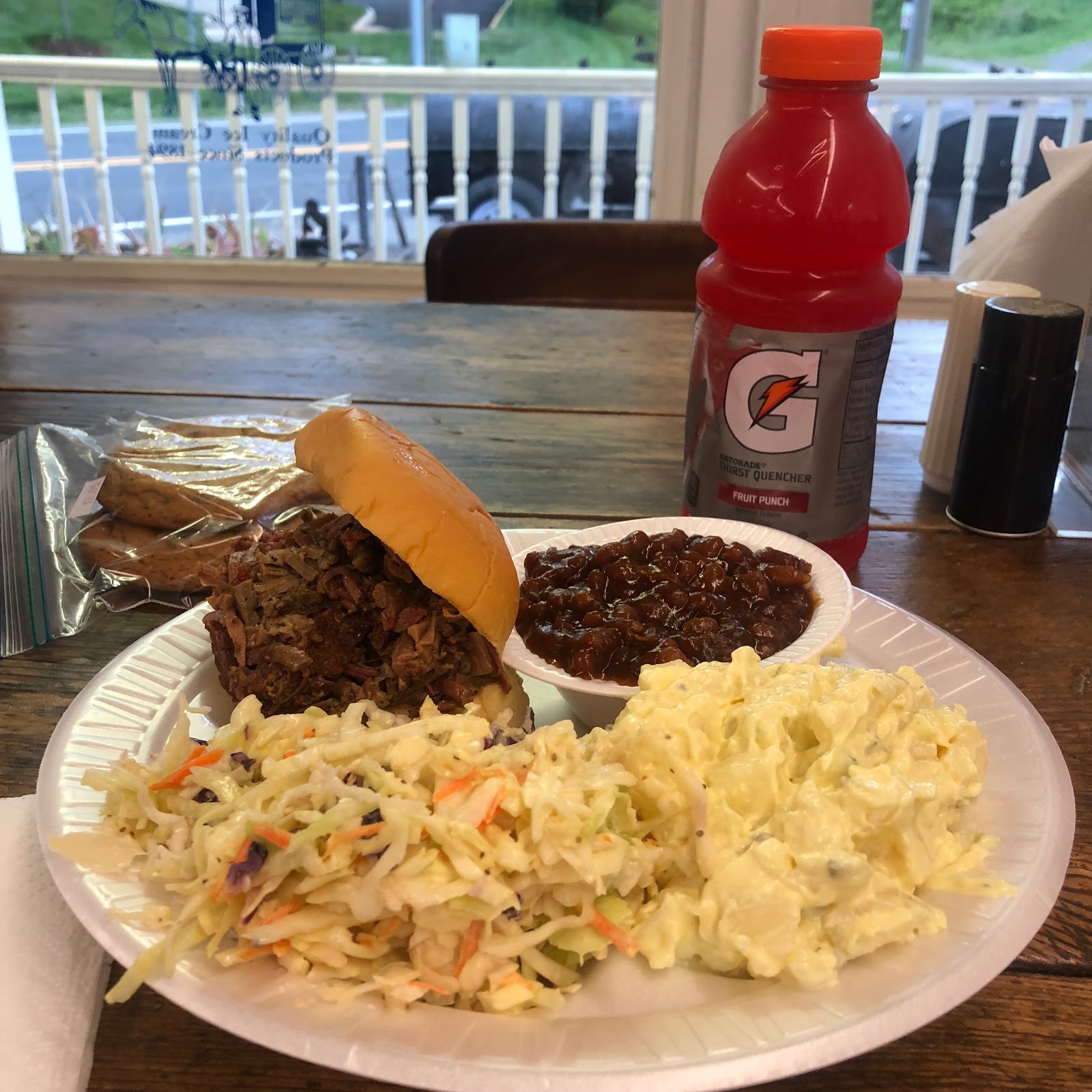
After about 30 minutes, it was time to turn the bike around and head back, feeling hungry, it was a joy to see Carolina BBQ, right on the trail, and just before closing time.
 |
| This will work! |
Oh baby, that was a great meal! Time to head back to the hotel, and as a double test, it started to rain so it was also a checkout ride for the rain gear and fenders, all of which worked fine. Arriving back at the hotel, all that was left to do was repack the drop bag and get some sleep before the 0430 check-in and 0500 start!
Day 1 - Leesburg to Sheperdstown 230 miles/9100 feet elevation gain
Monuments, suburbs, and battle fields
 |
| Checkin and breakfast |
The original plan was to give the organizer two drop bags, one each for the Shepherdstown and BWI (Baltimore Washington Airport) overnight controls. However, to make it simpler for the riders it was determined that one bag would be moved to each control. Having brought two small drop bags, it was a tight squeeze, but everything fit into one and it was deposited in the heap in the hotel lobby.
 |
| Drop bags |
 |
| My companion for the next 4 days |
|
 |
| Nick Bull gives the pre-ride brief |
Nick Bull, Regional Brevet Administrator for the Capital Region MD provided the rules for the ride. The most important item was to avoid the 'huge crater' in the hotel driveway on the way out!
 |
| Ready to go! |
 |
| And we are off! |
|
A volunteer stood in the crater with reflective gear and a flashlight, and all riders successfully negotiated the first obstacle of the day!The local club would do an outstanding job supporting the ride with nearly as many volunteers as riders throughout the event. Many of these photos were provided by Bill Beck who was ever-present in rain and shine!
 |
| On the W&OD trail |
|
A fast group formed and for 38 miles to the DC mall, this was my view. Well paved bike trails with occasional stop signs for cross streets was on order for the first 2+ hours of the ride. The pack thinned as the pace quickened until there were about 8 riders in the group.
 |
| Jefferson Memorial |
 |
| Washington Memorial |
 |
| With the fast movers at the first control |
Bill Beck was on hand to record our arrival and take some photos at the first informational control at the Washington Monument. An "information control" does not have an open/close time, but rather has a question that can be answered from looking around that particular spot. The answer is recorded on the brevet card as proof of passage, and you are on your way. Taking time for a few pictures and stopping at several memorials, the group disappeared into the urban tangle of Georgetown.
 |
| WWII Memorial |
 |
| Not many tourists |
 |
| The only flat portion of the route! |
The route follows the Rock Creek park and several bike paths until depositing us in to Bethesda MD. After countless turns through back streets and neighborhoods we finally broke into the Maryland countryside.
 |
| Fantastic, we are finally in farmland! |
 |
| Great View |
Stopping to admire the view and take a photo, it is suddenly clear from the cue sheet that I missed a turn for the out-and-back control in Olny MD.
 |
| Can't believe I missed that control! |
No choice other that turn the Calfee back around and backtrack the course to the missed turn and head to the control. Soon after turning around, the fast movers flashed by. Finally back on course and to the control in Olny MD, with 8 'bonus' miles added to the ride! Later Stephen Kinney would note that "you looked none to happy" on your way back to the control!
Happily a Dunkin Doughnuts was the first establishment in Olny, a quick bottle reload and breakfast sandwich later, it was back on the road. More miles of fantastic Maryland farmland, then into Pennsylvania and the next control in Littlestown PA. Another reload at the Sheetz convenience store and it was back on the road to the Gettysburg National Battlefield.
 |
| Big guns near the Minnesota Monument |
 |
| Many lives lost here |
No time to linger here, with more than 100 miles to the overnight control in West Virginia, the route continued through Pennsylvania and back into Maryland. Passing the Antietam National Battlefield well past sundown, I rolled into the control at 11:35pm. After checking in, cleaning up, and eating a fine meal of rice, soup, and lasagna, it was sack time with a wake-up call of 3:30am for what was billed as the 'hardest day' of the event. Did I mention the volunteers had an ample supply of beer at the overnight controls!
Day 2 - Shepherdstown to Blue Ridge Parkway to Shepherdstown 188 miles/9800 feet elevation gain
Wildlife, National Parks, heat and rain!
 |
| Must...have...coffee |
The route travels 50 miles to Front Royal on well paved roads with non-stop rollers. From there a loop up to Hogback Overlook on the Blue Ridge Parkway, down and over Edith Gap, back to Front Royal, and finally an encore of the non-stop rollers 50 miles back to the control in Shepherdstown.
 |
| Sunrise on the road to Front Royal |
Leaving the control at 0415 in light rain, the town was still asleep so it was surprising to stop for a passing train at the edge of town. The rain subsided, but the dew point was so high that a heavy fog filled the valley. Several deer emerged from the fog, and crossed dangerously close (so close you could hear the click of hoofs on the pavement), finally with the sunrise, the fog began to clear as traffic increased on the way to Front Royal.
 |
| Shenandoah River |
The first control was a run-down 7-11 in Front Royal. Completing my reload, the fast-movers arrived (electing a much more civilized start time) and would flash by at various points along the Blue Ridge Parkway.
 |
| $15 entry fee buys all the climbing you could want! |
 |
| Many fantastic overlooks |
The route is not a single climb, but rather three climbs followed by fast descents. On the descent before the final climb to Hogback Overlook, a small bear, not hearing my approach, decided to cross the road. It was a close call, but he moved quickly enough to get out of the way, but close enough to be able to see the matted hair on his hind quarters!
 |
| Finally at the top |
A few turns before the Hogback overlook, Paul and Dan passed by and were just sorting out the informational control question that was required at this checkpoint. Nick Bull and Bill Beck arrived shortly thereafter with cold water, snacks, and an opportunity for some photos!
 |
| Paul and Your Humble Correspondent |
 |
| View from Hogback Overlook |
 |
| Group shot with Nick Bull |
With the temperature rising, it was a welcome descent from Hogback to the next control just outside the National Park in Luray Virginia. More of a rolling descent with a few short climbs, but with drop in elevation, the temperatures continued to climb into the 90's. The Luray control was a 7-11, but across the street was a Burger King and several of the group from Hogback were already there, so hungry for some solid food, and a place to cool off, it was a perfect spot for a lunch break.
Back on the road the route crosses a valley then climbs another ridge line before dropping into Fort Valley for the run back to Front Royal. Just in case the 50 miles of rollers and 3800 feet of climbing along the Blue Ridge Parkway was not enough to drain the glycogen from the muscles, the short 2.5 mile climb to Edith Gap with grades up to 12% did the trick!
The next control was the Valley Country Store and there were several riders spread out on the bench in the shade. Dan purchased a bag of ice and several of us availed ourselves to ice down water bottles and various body parts!
Here I would leave my brevet card on that cool bench in the shade. Luckily my roommate Greg found it and presented it to me while I was in full panic mode feverishly searching my bike/pockets for it before the Front Royal control! Thanks again Greg!
 |
| Passage Creek in Fort Valley |
Route back to Front Royal followed Passage Creek and was generally downhill, however, it would be regularly interrupted by short punchy climbs as the creek meandered back and forth and the highway would climb the intermediate drainage back to the creek. The next control was another 7-11, albeit updated and upgraded from the morning version, and several randonneurs were there reloading and sorting out the control's information question.
The forecast was for rain and thunderstorms in the evening and the building clouds were set to confirm the accuracy of that forecast. The temperatures continued to drop as the clouds built. That combined with a fresh sugar and caffeine push from the last two controls seem to breath life back into the legs. As the storms continued to build from behind, tailwinds picked up and it felt like surfing the leading edge of the storm. That lasted 20 miles before the storm caught up just outside of Berryville.
With the rain picking up dramatically, there was a school bus stop shack on the side of the road, seemingly a perfect place to jump into and change. Rolling up, no go, it was overgrown with vines and potentially poison ivy. With no shelter, I simply plopped down on the driveway of a farm house and put on the rain gear. Finishing up, a big brown Labrador walks up and starts licking my face. Happy that my new found friend was not aggressive I stood to mount up. Just then a bolt of lightning hits danger close (how close? the flash and sound were simultaneous). Looking down my new friend is cowering between my legs.
With the rain coming down in buckets, and Berryville just a mile or so up the road, I mount up and start pedaling, with my new friend following along. Another flash-bang and he headed back to his farm house and me with renewed emphasis to Berryville. The store was closed, but the pizza joint across the street was open so I hopped in and found a table as a huge puddle formed as the rain water drained off. Ordering a coke and a pizza, and figuring to wait out the storm I bring up a weather map on the phone. Crap! The leading edge of the storm had passed, but another and bigger wave of red indicated a larger cell was on its way. Just them my pizza arrived, but I gave it to a family at the next table and made a run for the overnight control in Shepardstown.
Rolling in at a few minutes after 11pm, the decision was confirmed when heavy rain and lighting broke loose again! Check in, shower, and another repeat of beer, chicken soup, rice, and lasagna before crawling into the sack and calling this day done!
Day 3 - Shepherdstown to Elkridge Heights (BWI Aiport Hampton Inn) 203 miles/7200 feet elevation gain
Fog, heat, rollers and rain!
Taking the longest sleep stop of the ride at just under 7 hours, but still on the road at 5:30, we rolled out into another foggy morning. While not an official control, the War Correspondents Arch in Gathland park was a highly recommended as one the Great Spots on the ride. Bill Beck was there to photograph the riders as we passed.
 |
| Short climb to the Arch |
The Appalachian Trail passes through the park and a large shelter is there for hikers on the trail. A number of them were making breakfast and had their gear spread out in an attempt to dry out. Since we were in a cloud, that certainly was not going to happen! Taking some time off the bike, it was worth it to check out the arch and related information panels at the park.
 |
| Well worth the stop |
 |
| Site of another decisive Civil War Battle |
After victory at Manassas, General Lee split his forces into three columns and marched north. General McClellan successfully pushed the Confederates back, but they held this pass long enough for Lee's forces to regroup and withdraw toward Sharpsburg. The Federals would finally take the pass and pour through in pursuit of the Confederates for the Bloody Battle of Antietam!
 |
| Dropping down from the gap, the clouds cleared |
A steep descent from the park leads to more fantastic Maryland farm countryside, and with the drop in elevation we emerged from the clouds and into the sunshine. The BP convenience store in Lander was a perfect place to stop and reload, then back on the road.
The recent floods in Ellicott City caused a route change that was included in the GPS file, but I packed the outdated cue sheet. Trusting the Garmin, I continued on the route following the GPS track, but started to wonder about whether the Garmin or cue sheet was correct. Just then the ever-present Nick Bull pulled up to check if I needed anything. Why yes, an updated cue sheet would be nice. He topped off my water bottle and it was off to the next control.
 |
| Karin and Tim at an Information Control |
The next information control was to get a phone number from a sign at the intersection of Woodville and Jesse Smith road. Arriving as another group was shoving off, they said there was no sign of the sign described on the brevet card! Tim and Karin rolled up so we took selfies as proof of passage and headed onward.
 |
| Another train stop |
The route continued toward the BWI Airport and Millersville for the next control at a Wawa Convenience store. Finding some shade under a tree behind the store, it was time to reload and contemplate why I wore the lightweight wool jersey. Rain was in the forecast, but after dropping out of the mountains, it was all sunshine and building temperatures!
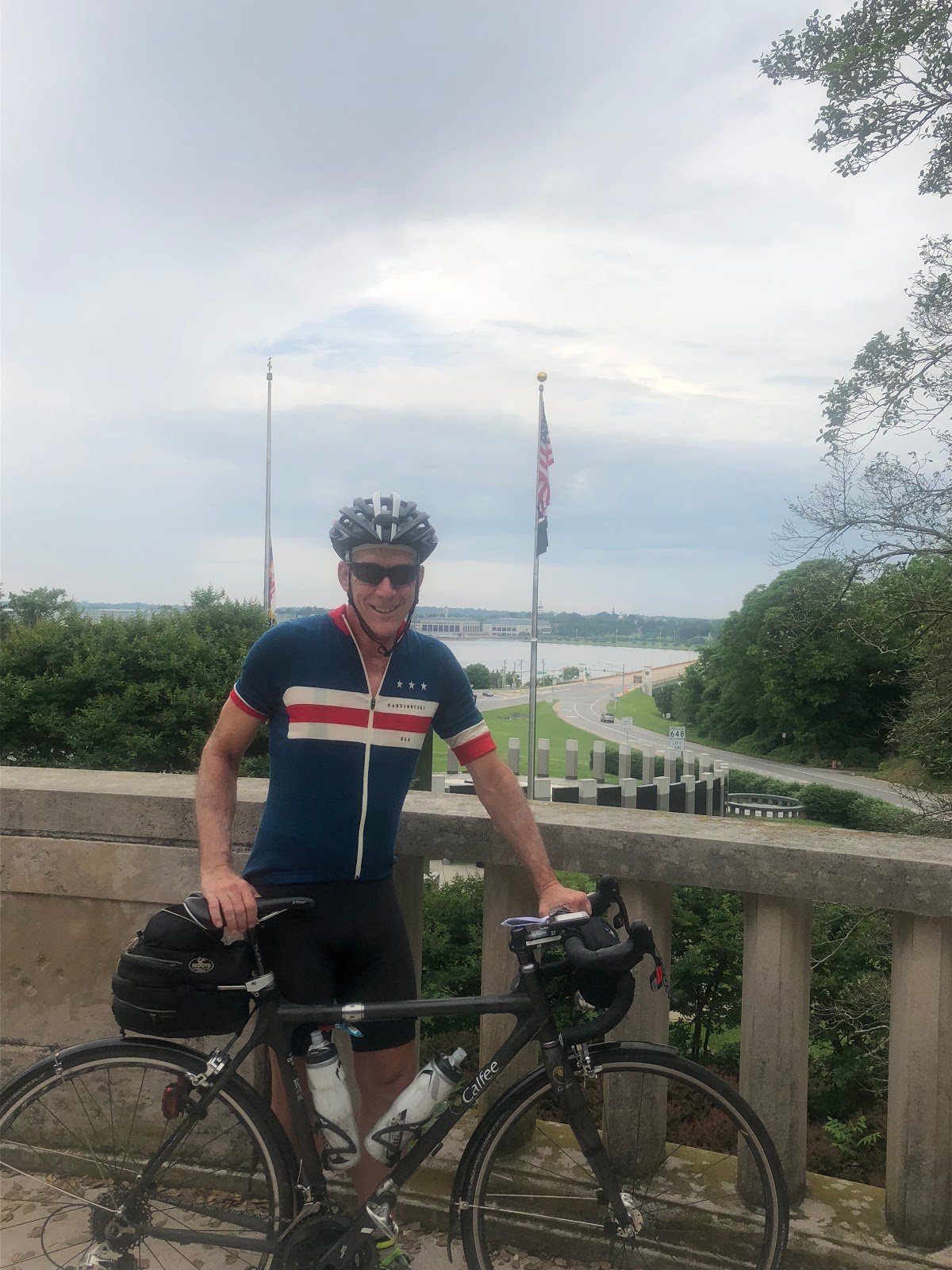
The route continues through the back streets and bike trails of Severna Park and emerges at the historic monument overlooking the US Naval Academy.
 |
| Clouds finally forming over the US Naval Academy |
Stopping here some tourists offered to take a photo before the final push over the Severn River and into Annapolis.
 |
| State House in Annapolis |
The route skirts the edge of the Academy and heads downtown to the State House in Annapolis, then back down to the water near Ego Alley and the marina. It was quite busy, and after considering a stop at our favorite tavern from Mark's Naval Academy days (Middletons), but passed because of the crowds and still having about 100 miles to go!
Leaving town some of the Fast Movers passed in the opposite direction, already completing their loop down to the information control at the Bay Ridge Community on the Chesapeake Bay and heading back. The route heads out of town and over the Spa Creek bridge.
 |
| Information control at Bay Ridge Community |
 |
| Sweet bayside cribs on the Chesapeake |
Seeing a few more riders on their return, the route continues to the Bay Ridge Community (private, with many reminder signs throughout!) and the information control. Finding and recording the number it was a pleasant spin along some very nice homes along the Bay. Back into the urban tangle on the outskirts of Annapolis, and spotting a Subway, it was time for a 6" Turkey sandwich and a dinner break.
Back into Annapolis again, but stopped at the Spa Creek Bridge for a passing sailboat!
 |
| We waited for that boat to pass |
 |
| Another stop! |
No worries though, still riding at a post-meal easy pace, the route continues back through Annapolis, but this time passing the main gate of the Academy.
Leaving Annapolis we head for the hills again past Parole and Crofton then south to Deale for one last loop and look a the bay before heading north and back to BWI. Again the route goes out and back along a two mile section of road, and of course the Fast-Movers are on their way back waving a hearty hello, blazing away, already completing the 40 mile loop!
The rain finally arrived near the turn-around and would continue for the balance of the evening. Hitting the control in Beal and downing a sugar coffee and a hot dog it was back out into the rain and dropping temperatures. Finally comfortable in the wool jersey, the legs recovered and the 64 miles (including two information controls) looked fairly straight forward.
The rain continued, and was coming down so hard at the information control, it was difficult to get the card out of the bag and write down the answer. Thinking it would be easier to take a picture, I tried to photograph the sign, but with wet hands and a wet iPhone I gave up and scribbled the answer and moved on.
A few miles later in another heavy rain, the Garmin froze. After pulling off the road and recycling the power, it finally restarted for navigation, but (operator error) did not record the ride data for the last 18 miles to the overnight control.
The rain eased off at Millersville but came down heavy again on the outskirts of the BWI airport. With a soggy and nearly illegible cue sheet, it was trust the Garmin and follow the purple line to the hotel. The last two miles along steep uphills with "no outlet" warning signs, there was nothing left to do but trust the GPS and put power to the pedals and hope it would end soon!
Emerging from the forest, and after passing every hotel brand known to man, finally the Hampton Inn came into sight, and with a half-dozen sleepy volunteers cheering this lone rider into the proper entrance, the day's ride was finally complete at 1:20am!
Check-in, beer, shower, food, and sleep and this day was finally done.
Day 4 - Elkridge Heights (BWI Aiport Hampton Inn) to Leesburg Virgina 128 miles/3800 feet elevation gain
Rain, rollers, and mental mistakes!
The BWI control would not close until 8:05am, so I set the alarm for 6:00am to target a 7:00am departure to try to get 3-4 hours of sleep. The result of three consecutive days of double century+ riding is general fatigue and a deterioration of physical performance, hence a 200km ride that fully rested may take 7-8 hours to complete will more likely take 9-10 hours. The result of three consecutive days of riding with only 3-4 hours sleep per night (or less) is mental fatigue that results in mental mistakes that can add minutes and hours.
Again waking before the alarm, and before my roommate awoke, I dressed, had breakfast and moved my bike into the hallway to set up and rollout. Here I made several mental mistakes the morning of day 4:
- Thinking the rain has been 'warm' for the whole ride, didn't need to pack my rain booties or warm base layer.
- Thinking it was 'only 200k' I didn't pack my battery recharging adapter or cable. Niether was necessary for the ride, but in that bag was the cable that connected the Garmin to back-up battery, and it was necessary and left behind.
- Somehow I packed only page 1 of the cue sheet that would cover only half the ride.
 |
| First control, Historic Bridge at Savage Mill |
Its only 14 miles to the first information control, and while cloudy, the rain held off until the critical information was obtained and recorded on the brevet card. Rolling out, the wind picked up and the rain started. Getting shelter near an information sign, the rain gear was deployed and it was back on the road. Now heavy raid was being driven by strong winds (luckily mostly a tailwind) and the temperature dropped dramatically into the 50's. With shoes fully soaked, couldn't help wondering why I left the rain booties in the drop bag at the hotel.
 |
| Rolling along before the knee problem |
Keeping the forward momentum going to stay warm, a sharp pain developed in my right knee whenever I got out of the saddle to climb, and with many rollers that was quite often. Normally Advil/Excedrin would be in the 'pill kit' for this eventuality, however, not using either in years and none was packed for this ride (mental mistake made prior to the event). The knee flared up in a rural area and there were no stores in sight. In fact, the first store was at the next control in Damascus, it was impossible to climb out of saddle, greatly slowing progress for almost 30 miles. Rolling into town, I selected the Safeway as a first stop to get Advil and Excedrin and a Chipotle stop for a large lunch while the drugs did their magic.
Checking the cue sheet for the next control, I realized the second page was missing! No worries, I had the iPhone and could track it that way. Noticing the Garmin battery was below 50%, it was time to plug it in for a recharge from the auxiliary. Ugh, no cable. OK no worries there were drug stores and phone stores all over Damascus, certainly one would have the necessary cable, so get some lunch then get started!
The Garmin 810 has an old USB connector that is not used in phones or many current devices, short story, no love at CVS, T-Mobile, Sprint, or several other stops. With 40+ percent of battery left, there was a chance I could make it, but without a cue sheet I would need to rely on the iPhone, and as long as the rain held off, that should not be a problem.
Rolling out of Damascus the heavy rain returned. The CVS in Poolsville was the next control and had a wider selection of cables, but not the one that was needed! With the rain, the iPhone was nearly useless as the wet touch screen was unresponsive.
Next up, rear flat tire. Well, at least one of the CO2 cartridges purchased before the event was put to use! Upon discharge the CO2 will freeze the stem and adapter, not normally a problem, unless your fingers are wet! Ouch, a small patch of skin fused to the cartridge and peeled off my fingertip! It was only a 8 minute stop before getting back on the road, with a little less skin!
Luckily the ever-present Nick Bull passed by between the Adamstown and Lovettsville controls checking on riders. "Do you need anything?" he asked, oh boy, "Yes!"
After getting a second cue sheet AND a Garmin cable, my navigation worries were over and all that was left was 35 miles of riding (the Garmin battery was less than 20% at that time)!
 |
| Just over the Potomac in Virgina, just before the Lovettsville control |
Two controls in quick succession (7-11 in Lovettsville) and the McDonalds in Purcellville provided welcome food breaks before the final 10 miles to the finish in Leesburg.
 |
| Rolling into the finish |
Avoiding the 'crater' in the driveway and arriving to cheers from other riders and volunteers this one was finally in the books at 1956 (7:56pm) for a total elapsed time of 86 hours and 56 minutes!
 |
| Done! |
After checking in and grabbing a beer, I checked into my room to clean up and return to the meeting room for a post-ride feast and to share stories of the ride with other participants and volunteers. We would all jump up when other finishers approached to the hotel to welcome and congratulate them!
 |
| Beer and plenty of food at the finish |
Epilogue
Unable to stay awake, I gathered up the Calfee and bike box, returned to my room and promptly passed out! The Best Western had a surprisingly well stocked hot breakfast buffet and I enjoyed breakfast with some of the other riders.
Retiring to the room, it was time to pack the bike and plug in the computer and check into work and start the slog through hundreds of emails that had piled up in only a few days off. After a noon checkout the BW shuttle delivered me to the airport well in advance of my flight, so burning a day pass, I checked into the United Club to continue my day job!
Arriving back to Phoenix without incident. Tougher than expected, this was a fantastic event, special thanks again to Nick Bull and his team of Capital Randonneurs for making this one happen!
 |
| Sweet BRB pint glass and finisher medal! |
Click here for Ride with GPS Data
Click here for Photo Album